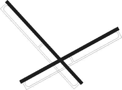
St Inigoes - Webster Nolf
Airport details
| Country | United States of America |
| State | Maryland |
| Region | K6 |
| Airspace | Washington Ctr |
| Municipality | Saint Mary's County |
| Elevation | 20ft (6m) |
| Timezone | GMT -5 |
| Coordinates | 38.14600, -76.42847 |
| Magnetic var | |
| Type | land |
| Available since | X-Plane v10.40 |
| ICAO code | KNUI |
| IATA code | n/a |
| FAA code | NUI |
Communication
| WEBSTER NOLF NAVY WEBSTER Tower | 126.200 |
| WEBSTER NOLF PATUXENT Approach/Departure | 120.050 |
Nearby Points of Interest:
St. Ignatius Roman Catholic Church
-Cross Manor
-Porto Bello
-West St. Mary's Manor
-Woodlawn
-Bard's Field
-Cecil's Mill Historic District
-Spence's Point
-Mulberry Fields
-Wheatland (Callao, Virginia)
-Kinsale Historic District
-Claughton-Wright House
-William B. Tennison
-Mount Pleasant (Hague, Virginia)
-Resurrection Manor
-Tudor Hall
-Abell House
-Bushfield (Mount Holly, Virginia)
-The Academy
-Springfield (Heathsville, Virginia)
-Spring Grove (Mount Holly, Virginia)
-St. Stephen's Church
-Heathsville Historic District
-Preston-on-the-Patuxent
-Oakley (Heathsville, Virginia)
Nearby beacons
| code | identifier | dist | bearing | frequency |
|---|---|---|---|---|
| NHK | NAS PATUXENT RIVER TACAN | 8.1 | 8° | 110.25 |
| NHK | PATUXENT NDB | 8.4 | 10° | 400 |
| PXT | PATUXENT (PATUXENT RIVER) VORTAC | 8.6 | 11° | 117.60 |
| OTT | NOTTINGHAM VORTAC | 36.7 | 331° | 113.70 |
| HCM | HARCUM VORTAC | 43.9 | 202° | 108.80 |
| DAA | DAVEE (FT BELVOIR) NDB | 44.5 | 307° | 223 |
| ADW | ANDREWS (CAMP SPRINGS) VORTAC | 44.7 | 326° | 113.10 |
| SBY | SALISBURY VORTAC | 44.9 | 78° | 111.20 |
| BRV | BROOKE VORTAC | 45 | 282° | 114.50 |
| SWL | SNOW HILL VORTAC | 45.9 | 95° | 112.40 |
| DCA | OXONN (WASHINGTON) NDB | 46.6 | 316° | 332 |
| DCA | WASHINGTON, D.C. VOR/DME | 51.5 | 320° | 111 |
| CCV | CAPE CHARLES VORTAC | 52.1 | 152° | 112.20 |
| GTN | GEORGETOWN (WASH., D.C.) NDB | 57.3 | 318° | 323 |
| RIC | RICHMOND VORTAC | 57.3 | 234° | 114.10 |
| BUH | ANNE ARUNDEL (FT MEADE) NDB | 58.4 | 341° | 260 |
| HPW | HOPEWELL VORTAC | 58.9 | 220° | 112 |
| DOV | DOVER TACAN | 74.4 | 44° | 110 |
Disclaimer
The information on this website is not for real aviation. Use this data with the X-Plane flight simulator only! Data taken with kind consent from X-Plane 12 source code and data files. Content is subject to change without notice.

