Oak Harbor - Whidbey Island Nas
Airport details
| Country | United States of America |
| State | Washington |
| Region | K1 |
| Airspace | Seattle Ctr |
| Municipality | Island County |
| Elevation | 43ft (13m) |
| Timezone | GMT -8 |
| Coordinates | 48.34506, -122.66303 |
| Magnetic var | |
| Type | land |
| Available since | X-Plane v10.40 |
| ICAO code | KNUW |
| IATA code | NUW |
| FAA code | NUW |
Communication
| Whidbey Island NAS ATIS | 134.150 |
| Whidbey Island NAS Clearance DEL (Radar) | 124.150 |
| Whidbey Island NAS Clearance DEL | 135.100 |
| Whidbey Island NAS Ground Control | 121.750 |
| Whidbey Island NAS Tower | 127.900 |
| Whidbey Island NAS Approach/Departure West | 118.200 |
| Whidbey Island NAS Approach/Departure East | 120.700 |
Approach frequencies
| ILS-cat-I | RW14 | 110.1 | 18.00mi |
| 3° GS | RW14 | 110.1 | 18.00mi |
Nearby Points of Interest:
Deception Pass Bridge
-Ebey's Landing National Historical Reserve
-Bethsaida Swedish Evangelical Lutheran Church Parsonage
-Stanwood IOOF Public Hall
-Cama Beach State Park
-Rothschild House
-Capt. Enoch S. Fowler House
-Jefferson County Courthouse
-Fort Flagler State Park
-Methodist Episcopal Church of Port Hadlock
-Moran State Park
-New Dungeness Light
-McAlmond House
-Lairmont Manor
-St. Anne's Roman Catholic Church
-Gamwell House
-Old Main
-Indian Shaker Church
-J. J. Donovan House
-Bellingham National Bank Building
-Manis Mastodon Site
-Flatiron Building
-B. P. O. E. Building
-United States Post Office and Courthouse
-T. G. Richards and Company Store
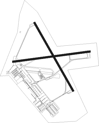
Runway info
Runway 7 / 25  | ||
| length | 2432m (7979ft) | |
| bearing | 88° / 268° | |
| width | 61m (200ft) | |
| surface | concrete | |
| blast zone | 40m (131ft) / 42m (138ft) | |
| Runway 14 / 32 | ||
| length | 2438m (7999ft) | |
| bearing | 145° / 325° | |
| width | 61m (200ft) | |
| surface | concrete | |
| blast zone | 30m (98ft) / 30m (98ft) | |
Nearby beacons
| code | identifier | dist | bearing | frequency |
|---|---|---|---|---|
| NUW | WHIDBEY ISLAND (OAK HARBO TACAN | 0.5 | 7° | 113.80 |
| CVV | PENN COVE VOR/DME | 6.5 | 211° | 117.20 |
| BVS | SKAGIT/BAY VIEW (BURLINGTON) NDB | 12.2 | 63° | 240 |
| FHR | FRIDAY HARBOR NDB | 17.5 | 295° | 284 |
| AW | WATON (ARLINGTON) NDB | 26 | 118° | 382 |
| PAE | PAINE (EVERETT) VOR/DME | 29.8 | 138° | 110.60 |
| NOW | EDIZ HOOK (PORT ANGELES) NDB | 32 | 255° | 338 |
| YJ | VICTORIA NDB | 34.3 | 292° | 200 |
| HUH | WHATCOM VORTAC | 36.2 | 8° | 113 |
| WC | WHITE ROCK NDB | 39.6 | 352° | 332 |
| MB | MILL BAY (VICTORIA) NDB | 39.9 | 290° | 293 |
| YYJ | VICTORIA VOR/DME | 39.9 | 295° | 113.70 |
| AP | ACTIVE PASS NDB | 40.3 | 310° | 378 |
| XX | ABBOTSFORD NDB | 40.8 | 15° | 344 |
| YVR | VANCOUVER VOR/DME | 48 | 326° | 115.90 |
| VR | VANCOUVER NDB | 52.1 | 335° | 266 |
| YPK | PITT MEADOWS VOR | 52.3 | 357° | 112.40 |
| SEA | SEATTLE VORTAC | 56.4 | 159° | 116.80 |
Departure and arrival routes
| Transition altitude | 18000ft |
| Transition level | 18000ft |
| SID end points | distance | outbound heading | |
|---|---|---|---|
| RW25 | |||
| CVV5 | 30mi | 138° | |
Instrument approach procedures
| runway | airway (heading) | route (dist, bearing) |
|---|---|---|
| RW07 | ORCUS (90°) | ORCUS 4400ft OMRAE (7mi, 91°) 2700ft |
| RNAV | OMRAE 2700ft ZATAX (6mi, 88°) 1800ft KNUW (6mi, 91°) 67ft (6668mi, 112°) 1500ft KASEY (6673mi, 291°) 3000ft KASEY (turn) 3000ft | |
| RW14 | SOBEE (147°) | SOBEE 3500ft |
| RW14 | WADPA (26°) | WADPA 3500ft SOBEE (25mi, 359°) 3500ft SOBEE (turn) 3500ft |
| RNAV | SOBEE 3500ft ZONGU (6mi, 144°) 1800ft KNUW (6mi, 150°) 90ft (6668mi, 112°) 420ft FIDPO (6667mi, 291°) WADPA (11mi, 246°) 3500ft WADPA (turn) 6500ft | |
| RW25 | BOCAT (270°) | BOCAT 5400ft HIGET (4mi, 276°) 4300ft PEMRE (4mi, 276°) 3000ft |
| RNAV | PEMRE 3000ft TOTKE (6mi, 268°) 1800ft KNUW (6mi, 266°) 69ft (6668mi, 112°) 447ft TOCUY (6671mi, 291°) NEDOE (7mi, 274°) 3000ft NEDOE (turn) 3000ft | |
| RW32 | NICIT (323°) | NICIT 3500ft UREAL (9mi, 325°) 2700ft |
| RNAV | UREAL 2700ft LATRE (6mi, 325°) 1800ft KNUW (6mi, 319°) 97ft (6668mi, 112°) 1200ft JVOLK (6681mi, 291°) 2000ft JVOLK (turn) 6000ft |
Disclaimer
The information on this website is not for real aviation. Use this data with the X-Plane flight simulator only! Data taken with kind consent from X-Plane 12 source code and data files. Content is subject to change without notice.