Yuma - Yuma Mcas
Airport details
| Country | United States of America |
| State | Arizona |
| Region | K2 |
| Airspace | Los Angeles Ctr |
| Municipality | Yuma |
| Elevation | 211ft (64m) |
| Timezone | GMT -7 |
| Coordinates | 32.65958, -114.60983 |
| Magnetic var | |
| Type | land |
| Available since | X-Plane v10.40 |
| ICAO code | KNYL |
| IATA code | YUM |
| FAA code | NYL |
Communication
| Yuma MCAS ATIS | 118.800 |
| Yuma MCAS Ground Control | 121.900 |
| Yuma MCAS Tower | 119.300 |
| Yuma MCAS Yuma Approach | 124.700 |
| Yuma MCAS Yuma Departure | 125.550 |
Approach frequencies
| ILS-cat-I | RW21R | 108.3 | 18.00mi |
| 3° GS | RW21R | 108.3 | 18.00mi |
Nearby Points of Interest:
St. Paul's Episcopal Church
-Southern Pacific Freight Depot
-United States Post Office–Yuma Main
-Methodist Episcopal Church
-Brown House
-Cactus Press-Plaza Paint Building
-Yuma County Courthouse
-Masonic Temple
-Southern Pacific Railroad Passenger Coach Car-S.P. X7
-McPhaul Suspension Bridge
-Algodones Dunes
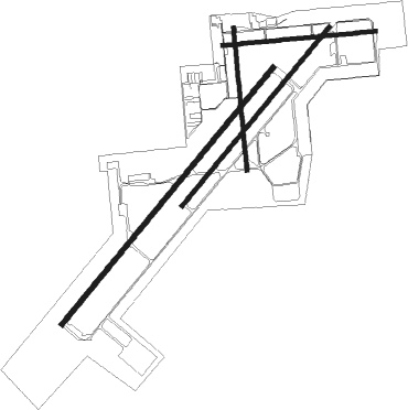
Runway info
Runway 3L / 21R  | ||
| length | 4057m (13310ft) | |
| bearing | 49° / 229° | |
| width | 61m (200ft) | |
| surface | concrete | |
| blast zone | 255m (837ft) / 255m (837ft) | |
| Runway 3R / 21L | ||
| length | 2818m (9245ft) | |
| bearing | 49° / 229° | |
| width | 46m (151ft) | |
| surface | asphalt | |
| blast zone | 255m (837ft) / 255m (837ft) | |
| Runway 17 / 35 | ||
| length | 1746m (5728ft) | |
| bearing | 179° / 359° | |
| width | 46m (151ft) | |
| surface | asphalt | |
| blast zone | 80m (262ft) / 244m (801ft) | |
| Runway 8 / 26 | ||
| length | 1869m (6132ft) | |
| bearing | 89° / 269° | |
| width | 46m (151ft) | |
| surface | asphalt | |
| blast zone | 75m (246ft) / 255m (837ft) | |
Nearby beacons
| code | identifier | dist | bearing | frequency |
|---|---|---|---|---|
| NYL | YUMA TACAN | 0.7 | 196° | 113.70 |
| BZA | BARD (YUMA) VORTAC | 6.5 | 4° | 116.80 |
| MXL | MEXICALI VOR/DME | 31.7 | 267° | 115 |
| IPL | IMPERIAL VORTAC | 45.7 | 276° | 115.90 |
| BLH | BLYTHE VORTAC | 56.7 | 351° | 117.40 |
Departure and arrival routes
| Transition altitude | 18000ft |
| Transition level | 18000ft |
| SID end points | distance | outbound heading | |
|---|---|---|---|
| RW03 (ALL) | |||
| MOHAK5 | 33mi | 80° | |
| CARGO1 | 46mi | 276° | |
| ARGUS5 | 36mi | 278° | |
| HEEDS3 | 21mi | 284° | |
| PICA5 | 57mi | 351° | |
| RW08 | |||
| MOHAK5 | 33mi | 80° | |
| CARGO1 | 46mi | 276° | |
| ARGUS5 | 36mi | 278° | |
| HEEDS3 | 21mi | 284° | |
| PICA5 | 57mi | 351° | |
| RW17 | |||
| MOHAK5 | 33mi | 80° | |
| CARGO1 | 46mi | 276° | |
| ARGUS5 | 36mi | 278° | |
| HEEDS3 | 21mi | 284° | |
| PICA5 | 57mi | 351° | |
| RW21 (ALL) | |||
| MOHAK5 | 33mi | 80° | |
| CARGO1 | 46mi | 276° | |
| ARGUS5 | 36mi | 278° | |
| HEEDS3 | 21mi | 284° | |
| PICA5 | 57mi | 351° | |
| RW26 | |||
| MOHAK5 | 33mi | 80° | |
| CARGO1 | 46mi | 276° | |
| ARGUS5 | 36mi | 278° | |
| HEEDS3 | 21mi | 284° | |
| PICA5 | 57mi | 351° | |
| RW35 | |||
| MOHAK5 | 33mi | 80° | |
| CARGO1 | 46mi | 276° | |
| ARGUS5 | 36mi | 278° | |
| HEEDS3 | 21mi | 284° | |
| PICA5 | 57mi | 351° | |
Instrument approach procedures
| runway | airway (heading) | route (dist, bearing) |
|---|---|---|
| RW03L | CAZZI (175°) | CAZZI 4000ft BZA (9mi, 169°) 4000ft ICATI (14mi, 140°) 4000ft WIGGS (8mi, 224°) 3000ft RUGGS (8mi, 283°) 2000ft |
| RW03L | WIGGS (343°) | WIGGS 3000ft RUGGS (8mi, 283°) 2000ft |
| RNAV | RUGGS 2000ft JUDAP (6mi, 17°) 1200ft KNYL (5mi, 46°) 247ft (6638mi, 106°) 1000ft CAZZI (6635mi, 286°) 4000ft CAZZI (turn) 6000ft | |
| RW17 | CAZZI (175°) | CAZZI 4000ft |
| RNAV | CAZZI 4000ft BZA (9mi, 169°) 2200ft KNYL (7mi, 184°) 236ft (6638mi, 106°) 800ft CAZZI (6635mi, 286°) 4000ft CAZZI (turn) 6000ft | |
| RW21R | CAZZI (175°) | CAZZI 4000ft ROLFY (9mi, 127°) 3000ft |
| RW21R | WARTT (250°) | WARTT 4000ft ROLFY (10mi, 283°) 3000ft |
| RNAV | ROLFY 3000ft DRAXX (6mi, 199°) 1800ft KNYL (5mi, 231°) 246ft (6638mi, 106°) 800ft CAZZI (6635mi, 286°) 4000ft CAZZI (turn) 6000ft |
Disclaimer
The information on this website is not for real aviation. Use this data with the X-Plane flight simulator only! Data taken with kind consent from X-Plane 12 source code and data files. Content is subject to change without notice.