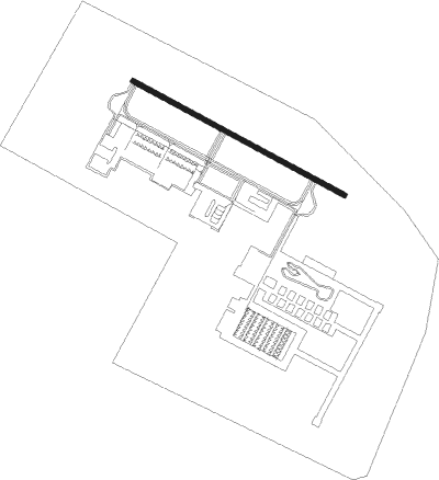
Marina - Marina Muni
Airport details
| Country | United States of America |
| State | California |
| Region | K2 |
| Airspace | Oakland Ctr |
| Municipality | Marina |
| Elevation | 137ft (42m) |
| Timezone | GMT -8 |
| Coordinates | 36.68153, -121.76167 |
| Magnetic var | |
| Type | land |
| Available since | X-Plane v10.40 |
| ICAO code | KOAR |
| IATA code | OAR |
| FAA code | OAR |
Communication
| Marina Muni CTAF/UNICOM | 122.700 |
| Marina Muni NORCAL Approach/Departure | 133.000 |
| Marina Muni NORCAL Approach/Departure | 127.150 |
Nearby Points of Interest:
Peter J. Bontadelli House
-Fort Ord Station Veterinary Hospital
-B. V. Sargent House
-Monterey County Jail
-Monterey County Court House
-Samuel M. Black House
-Elkhorn Slough
-G. T. Marsh and Sons
-Cathedral of San Carlos Borromeo
-Monterey State Historic Park
-Lou Ellen Parmelee House
-Mary C. W. Black Studio House
-Trimmer Hill
-Larkin House
-James W. Finch House
-Frank LaVerne Buck House
-Asilomar Conference Grounds
-Tor House and Hawk Tower
-Whalers Cabin
-Redman Hirahara Farmstead
-Porter-Vallejo Mansion
-Godfrey M. Bockius House
-Rozas House
-California State Route 152
-Castro Adobe
Nearby beacons
| code | identifier | dist | bearing | frequency |
|---|---|---|---|---|
| SNS | SALINAS VORTAC | 7.7 | 96° | 117.30 |
| MR | MUNSO (MONTEREY) NDB | 9.2 | 251° | 385 |
| UAD | CHUALAR (SALINAS) NDB | 17.9 | 124° | 263 |
| BSR | BIG SUR VORTAC | 30.5 | 167° | 114 |
| SJC | SAN JOSE VOR/DME | 42.5 | 345° | 114.10 |
| NUQ | MOFFETT (MOUNTAIN VIEW) TACAN | 47.2 | 338° | 117.60 |
| PXN | PANOCHE VORTAC | 47.3 | 88° | 112.60 |
| OSI | WOODSIDE VOR/DME | 49.4 | 324° | 113.90 |
| HGT | HUNTER LIGGETT NDB | 51.3 | 142° | 209 |
| SFO | SAN FRANCISCO VOR/DME | 63.4 | 327° | 115.80 |
| MOD | MODESTO VOR/DME | 68.6 | 40° | 114.60 |
Instrument approach procedures
| runway | airway (heading) | route (dist, bearing) |
|---|---|---|
| RW11 | MOVER (144°) | MOVER FOMET (6mi, 218°) 2700ft |
| RW11 | PENNI (95°) | PENNI FOMET (8mi, 67°) 2700ft |
| RNAV | FOMET 2700ft AXAME (5mi, 117°) 1800ft KOAR (5mi, 117°) 176ft (6905mi, 107°) 600ft FOMET (6911mi, 287°) 2700ft FOMET (turn) 2700ft | |
| RW29 | HAGRO (297°) | HAGRO COVAR (4mi, 313°) 4000ft |
| RNAV | COVAR 4000ft FOGON (6mi, 287°) 2100ft ICULU (4mi, 297°) 880ft KOAR (2mi, 297°) 181ft (6905mi, 107°) 537ft FOMET (6911mi, 287°) 2700ft FOMET (turn) 2700ft |
Disclaimer
The information on this website is not for real aviation. Use this data with the X-Plane flight simulator only! Data taken with kind consent from X-Plane 12 source code and data files. Content is subject to change without notice.