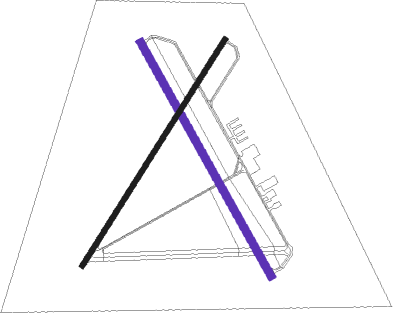
Washington - Warren Fld
Airport details
| Country | United States of America |
| State | North Carolina |
| Region | K7 |
| Airspace | Washington Ctr |
| Municipality | Washington |
| Elevation | 38ft (12m) |
| Timezone | GMT -5 |
| Coordinates | 35.57047, -77.04980 |
| Magnetic var | |
| Type | land |
| Available since | X-Plane v10.40 |
| ICAO code | KOCW |
| IATA code | OCW |
| FAA code | OCW |
Communication
| Warren Fld AWOS 3 | 120.175 |
| Warren Fld CTAF/UNICOM | 122.700 |
Approach frequencies
| LOC | RW05 | 110.9 | 18.00mi |
Nearby Points of Interest:
North Market Street Historic District
-Bowers-Tripp House
-Beaufort County Courthouse
-Bank of Washington, West End Branch
-Trinity Episcopal Church
-Grimesland Plantation
-Goose Creek State Park
-Robert Lee Humber House
-United States Post Office
-Greenville Commercial Historic District
-Pitt County Courthouse
-Jones-Lee House
-James L. Fleming House
-Greenville Tobacco Warehouse Historic District
-Skewarkey Primitive Baptist Church
-Jesse R. Moye House
-Skinnerville-Greenville Heights Historic District
-Dickinson Avenue Historic District
-E. B. Ficklen House
-Williamston Colored School
-Asa Biggs House and Site
-Cox-Ange House
-William H. Long House
-Martin County Courthouse
-First Christian Church
Nearby beacons
| code | identifier | dist | bearing | frequency |
|---|---|---|---|---|
| RNW | CHOCOWINITY NDB | 4.5 | 223° | 388 |
| AQE | ALWOOD (GREENVILLE) NDB | 17.7 | 293° | 230 |
| ISO | KINSTON VORTAC | 27.6 | 249° | 109.60 |
| EWN | NEW BERN VOR/DME | 29.8 | 179° | 113.60 |
| EW | KAFTI (NEW BERN) NDB | 32.9 | 183° | 362 |
| IS | STALS (KINSTON) NDB | 37.3 | 243° | 276 |
| TYI | TAR RIVER (ROCKY MOUNT) VORTAC | 40.1 | 302° | 117.80 |
| NKT | CHERRY POINT TACAN | 41 | 165° | 112.80 |
| GSB | SEYMOUR JOHNSON TACAN | 47.2 | 256° | 116.50 |
| CVI | COFIELD VORTAC | 48.9 | 13° | 114.60 |
| NCA | NEW RIVER TACAN | 55.2 | 204° | 115.40 |
| LLW | WOODVILLE (ELIZABETH CITY) NDB | 55.3 | 47° | 254 |
| OA | ELLAS (JACKSONVILLE) NDB | 58.8 | 219° | 261 |
| ECG | ELIZABETH CITY VOR/DME | 59.2 | 52° | 112.50 |
Instrument approach procedures
| runway | airway (heading) | route (dist, bearing) |
|---|---|---|
| RW05 | EWN (359°) | EWN DECOI (18mi, 348°) 2000ft COULD (5mi, 301°) 2000ft |
| RW05 | ISO (69°) | ISO BROAM (15mi, 71°) 3100ft COULD (5mi, 121°) 2000ft |
| RNAV | COULD 2000ft BROTH (6mi, 42°) 1600ft KOCW (5mi, 44°) 70ft HALAX (12mi, 42°) 2600ft HALAX (turn) | |
| RW23 | HALAX (222°) | HALAX 2600ft |
| RW23 | PUNGO (266°) | PUNGO CAGLU (19mi, 280°) 2600ft HALAX (5mi, 301°) 2600ft |
| RW23 | ZAGGY (137°) | ZAGGY DIBNE (13mi, 95°) 2600ft HALAX (5mi, 121°) 2600ft |
| RNAV | HALAX 2600ft JOROX (6mi, 223°) 1700ft KOCW (5mi, 221°) 77ft SODOY (6mi, 224°) KEKBE (11mi, 321°) HALAX (17mi, 76°) 2600ft HALAX (turn) | |
| RW35 | EWN (359°) | EWN WATGO (18mi, 0°) 2400ft JUMDO (5mi, 69°) 2400ft |
| RW35 | PEARS (205°) | PEARS MERPE (22mi, 165°) 2400ft JUMDO (5mi, 249°) 2400ft |
| RNAV | JUMDO 2400ft ZAMPI (6mi, 331°) 1600ft KOCW (5mi, 329°) 74ft ZIPDA (5mi, 332°) HALAX (10mi, 67°) 2600ft HALAX (turn) |
Disclaimer
The information on this website is not for real aviation. Use this data with the X-Plane flight simulator only! Data taken with kind consent from X-Plane 12 source code and data files. Content is subject to change without notice.

