Osceola - L O Simenstad Muni
Airport details
| Country | United States of America |
| State | Wisconsin |
| Region | K5 |
| Airspace | Minneapolis Ctr |
| Municipality | Osceola |
| Elevation | 900ft (274m) |
| Timezone | GMT -6 |
| Coordinates | 45.30935, -92.69012 |
| Magnetic var | |
| Type | land |
| Available since | X-Plane v10.40 |
| ICAO code | KOEO |
| IATA code | OEO |
| FAA code | OEO |
Communication
| L O Simenstad Muni AWOS 3 | 119.925 |
| L O Simenstad Muni CTAF | 122.900 |
| L O Simenstad Muni MINNEAPOLIS Approach | 121.200 |
| L O Simenstad Muni MINNEAPOLIS Departure | 121.200 |
Nearby Points of Interest:
First Baptist Church
-John Copas House
-Interstate State Park WPA/Rustic Style Historic Resources
-Taylors Falls Public Library
-Thomas Henry Thompson House
-Cushing Land Agency Building
-Hay Lake School
-Johannes Erickson House
-Center City Historic District
-Marine Mill
-Marine on St. Croix
-Moody Barn
-Lamar Community Center
-Croixsyde
-Arcola Mills
-Wild River State Park
-First English Lutheran Church
-New Richmond West Side Historic District
-Erick J. Thompson House
-William J. Bernd House
-New Richmond News Building
-Dr. Frank W. Epley Office
-Polk County Courthouse
-Marcus Sears Bell Farm
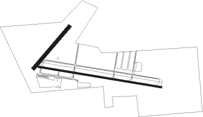
Runway info
Runway 10 / 28  | ||
| length | 1528m (5013ft) | |
| bearing | 100° / 280° | |
| width | 23m (75ft) | |
| surface | asphalt | |
| Runway 04 / 22 | ||
| length | 669m (2195ft) | |
| bearing | 55° / 235° | |
| width | 46m (150ft) | |
| surface | grass | |
Nearby beacons
| code | identifier | dist | bearing | frequency |
|---|---|---|---|---|
| ROS | RUSH CITY NDB | 25.7 | 326° | 282 |
| GEP | GOPHER (MINNEAPOLIS) VORTAC | 30.5 | 257° | 117.30 |
| RZN | DME | 33.4 | 32° | 109.40 |
| BXR | BIG DOCTOR (SIREN) NDB | 33.6 | 32° | 203 |
| MSP | MINNEAPOLIS VOR/DME | 33.9 | 233° | 115.30 |
| RP | WICKR (RICE LAKE) NDB | 37.4 | 89° | 221 |
| PNM | PRINCETON NDB | 41.5 | 286° | 368 |
| RG | REGUE (RED WING) NDB | 42.7 | 177° | 274 |
| FCM | FLYING CLOUD (MINNEAPOLIS VOR/DME | 43.1 | 237° | 117.70 |
| FGT | FARMINGTON VORTAC | 45.7 | 216° | 115.70 |
Departure and arrival routes
| Transition altitude | 18000ft |
| Transition level | 18000ft |
| STAR starting points | distance | inbound heading | |
|---|---|---|---|
| ALL | |||
| TWOLF3 | 127.1 | 23° | |
| AGUDE5 | 16.6 | 301° | |
Instrument approach procedures
| runway | airway (heading) | route (dist, bearing) |
|---|---|---|
| RW10 | WESUS (100°) | WESUS 3000ft |
| RNAV | WESUS 3000ft ZAVGO (7mi, 100°) 2600ft YUGUP (3mi, 100°) 1760ft KOEO (3mi, 99°) 919ft (5519mi, 116°) 1134ft ECLEY (5507mi, 296°) 3000ft ECLEY (turn) | |
| RW28 | ECLEY (280°) | ECLEY 3000ft |
| RNAV | ECLEY 3000ft RICNO (7mi, 280°) 2600ft NAYIY (3mi, 280°) 1760ft KOEO (3mi, 280°) 943ft (5519mi, 116°) 1106ft WESUS (5531mi, 296°) 3000ft WESUS (turn) |
Holding patterns
| STAR name | hold at | type | turn | heading* | altitude | leg | speed limit |
|---|---|---|---|---|---|---|---|
| AGUDE5 | BEERI | VHF | right | 127 (307)° | 1.0min timed | ICAO rules | |
| TWOLF3 | TWOLF | VHF | left | 178 (358)° | < 17999ft | 1.0min timed | ICAO rules |
| *) magnetic outbound (inbound) holding course | |||||||
Disclaimer
The information on this website is not for real aviation. Use this data with the X-Plane flight simulator only! Data taken with kind consent from X-Plane 12 source code and data files. Content is subject to change without notice.