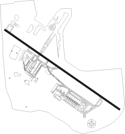
Omaha - Offutt Afb
Airport details
| Country | United States of America |
| State | Nebraska |
| Region | K3 |
| Airspace | Minneapolis Ctr |
| Municipality | Sarpy County |
| Elevation | 1046ft (319m) |
| Timezone | GMT -6 |
| Coordinates | 41.11933, -95.90852 |
| Magnetic var | |
| Type | land |
| Available since | X-Plane v10.40 |
| ICAO code | KOFF |
| IATA code | OFF |
| FAA code | OFF |
Communication
| Offutt AFB ATIS | 126.025 |
| Offutt AFB Ground Control | 121.700 |
| Offutt AFB Tower | 123.700 |
| Offutt AFB OMAHA Approach | 124.500 |
| Offutt AFB OMAHA Approach | 120.100 |
| Offutt AFB OMAHA Departure | 124.500 |
| Offutt AFB OMAHA Departure | 120.100 |
Approach frequencies
| ILS-cat-I | RW30 | 109.5 | 18.00mi |
| IGS | RW12 | 111.7 | 18.00mi |
| 3° GS | RW12 | 111.7 | 18.00mi |
| 2.8° GS | RW30 | 109.5 | 18.00mi |
Nearby Points of Interest:
William Hamilton House
-William E. Gordon House
-Fontenelle Forest
-Zweibel Farmstead
-Packer's National Bank Building
-South Omaha Main Street Historic District
-South Omaha Veterans Memorial Bridge
-Livestock Exchange Building
-St. Martin of Tours Episcopal Church
-John Sautter Farmhouse
-Robbins School
-Cass County Courthouse
-Plattsmouth Main Street Historic District
-Vinton Street Commercial Historic District
-Gottfried Gustav Pitz Barn
-Gallagher Building
-Center School
-St. Joseph Parish Complex
-Joel N. Cornish House
-Omaha Quartermaster Depot Historic District
-Swoboda Bakery
-Elsasser Bakery
-Boulevards in Omaha, Nebraska
-G. C. Moses Block
-Burlington Station
Nearby beacons
| code | identifier | dist | bearing | frequency |
|---|---|---|---|---|
| OFF | OFFUTT (OMAHA) TACAN | 0.4 | 104° | 111.70 |
| OVR | OMAHA VORTAC | 8.2 | 74° | 116.30 |
| PMV | PLATTSMOUTH NDB | 10.5 | 181° | 329 |
| AFK | NEBRASKA CITY NDB | 30.9 | 175° | 347 |
| AHQ | WAHOO NDB | 32 | 280° | 400 |
| LNK | LINCOLN VORTAC | 39.5 | 257° | 116.10 |
| SCB | SCRIBNER VOR/DME | 43.6 | 304° | 111 |
| LN | POTTS (LINCOLN) NDB | 44.7 | 246° | 385 |
| PWE | PAWNEE CITY VORTAC | 56.8 | 198° | 112.40 |
| BIE | BEATRICE VOR | 62.4 | 226° | 110.60 |
Departure and arrival routes
| Transition altitude | 18000ft |
| Transition level | 18000ft |
| STAR starting points | distance | inbound heading | |
|---|---|---|---|
| ALL | |||
| LANTK1 | 42.2 | 243° | |
| MARWI3 | 42.6 | 292° | |
| RW12 | |||
| PWE1 | 15.8 | 42° | |
| HOWRY2 | 45.1 | 105° | |
| RW30 | |||
| PWE1 | 15.8 | 42° | |
| HOWRY2 | 45.1 | 105° | |
Instrument approach procedures
| runway | airway (heading) | route (dist, bearing) |
|---|---|---|
| RW12 | BEJOU (95°) | BEJOU 4300ft RALVE (10mi, 47°) 4300ft |
| RW12 | LECIP (155°) | LECIP 4300ft RALVE (10mi, 227°) 4300ft |
| RW12 | RALVE (121°) | RALVE 4300ft |
| RNAV | RALVE 4300ft AGATT (10mi, 121°) 2800ft KOFF (6mi, 122°) 1090ft (5672mi, 113°) 1299ft WONSI (5669mi, 293°) SLPRS (7mi, 122°) 3000ft SLPRS (turn) 6000ft | |
| RW30 | OPORT (274°) | OPORT 3900ft SLOON (10mi, 227°) 3900ft |
| RW30 | SLOON (302°) | SLOON 3900ft |
| RW30 | WAKAN (338°) | WAKAN 3900ft SLOON (10mi, 47°) 3900ft |
| RNAV | SLOON 3900ft ARESE (10mi, 302°) 2300ft KOFF (5mi, 302°) 1030ft (5672mi, 113°) 1185ft WOPGA (5675mi, 293°) SUNNI (9mi, 301°) 3600ft SUNNI (turn) 10000ft |
Disclaimer
The information on this website is not for real aviation. Use this data with the X-Plane flight simulator only! Data taken with kind consent from X-Plane 12 source code and data files. Content is subject to change without notice.