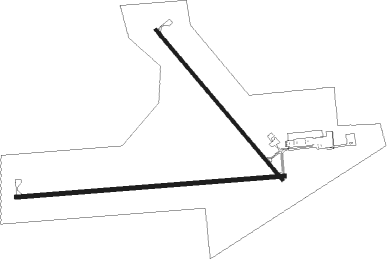
Ogallala - Searle Field
Airport details
| Country | United States of America |
| State | Nebraska |
| Region | K3 |
| Airspace | Denver Ctr |
| Municipality | Keith County |
| Elevation | 3278ft (999m) |
| Timezone | GMT -7 |
| Coordinates | 41.11947, -101.76969 |
| Magnetic var | |
| Type | land |
| Available since | X-Plane v10.40 |
| ICAO code | KOGA |
| IATA code | OGA |
| FAA code | OGA |
Communication
| Searle Field AWOS 3 | 121.275 |
| Searle Field CTAF/UNICOM | 122.800 |
| Searle Field DENVER ApproachROACH | 132.700 |
| Searle Field DENVER DepartureARTURE | 132.700 |
Nearby Points of Interest:
Standard Oil Red Crown Service Station
-US Post Office-Ogallala
-Leonidas A. Brandhoefer Mansion
-Dr. Burdette and Myrna Gainsforth House
-California Hill
-Wallace W. Waterman Sod House
-Menter Farmstead
-Perkins County Courthouse
-Grant Commercial Historic District
-Sedgwick County Courthouse
-First Arthur County Courthouse and Jail
Nearby beacons
| code | identifier | dist | bearing | frequency |
|---|---|---|---|---|
| SAE | SEARLE (OGALLALA) VOR/DME | 0.2 | 267° | 110.20 |
| GGF | GRANT NDB | 15 | 171° | 359 |
| CNP | CHAPPELL NDB | 31.2 | 266° | 383 |
| OKS | OSHKOSH NDB | 31.2 | 296° | 233 |
| HCT | HAYES CENTER VORTAC | 55.4 | 128° | 117.70 |
Instrument approach procedures
| runway | airway (heading) | route (dist, bearing) |
|---|---|---|
| RW08 | AHUFU (90°) | AHUFU 5300ft |
| RNAV | AHUFU 5300ft EZIFU (7mi, 90°) 5200ft YEYUC (3mi, 90°) 4200ft KOGA (3mi, 89°) 3300ft (5936mi, 112°) 3510ft TUKWY (5923mi, 292°) 5200ft TUKWY (turn) | |
| RW13 | WUVIR (137°) | WUVIR 5400ft |
| RNAV | WUVIR 5400ft AYAYO (6mi, 136°) 5300ft ZASDA (3mi, 136°) 4460ft KOGA (4mi, 139°) 3319ft (5936mi, 112°) 3679ft KUYEL (5930mi, 292°) 5500ft KUYEL (turn) | |
| RW26 | TUKWY (270°) | TUKWY 5200ft |
| RNAV | TUKWY 5200ft ERWOM (7mi, 270°) 4900ft ZEDMO (3mi, 270°) 3900ft KOGA (2mi, 272°) 3293ft (5936mi, 112°) 3495ft AHUFU (5950mi, 292°) 5300ft AHUFU (turn) | |
| RW31 | KUYEL (315°) | KUYEL 5500ft |
| RNAV | KUYEL 5500ft OYUSE (6mi, 316°) 5100ft ZETOD (3mi, 316°) 4080ft KOGA (3mi, 312°) 3285ft (5936mi, 112°) 3495ft WUVIR (5942mi, 292°) 5400ft WUVIR (turn) |
Disclaimer
The information on this website is not for real aviation. Use this data with the X-Plane flight simulator only! Data taken with kind consent from X-Plane 12 source code and data files. Content is subject to change without notice.

