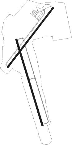
Orangeburg - Orangeburg Muni
Airport details
| Country | United States of America |
| State | South Carolina |
| Region | K7 |
| Airspace | Jacksonville Ctr |
| Municipality | Orangeburg |
| Elevation | 194ft (59m) |
| Timezone | GMT -5 |
| Coordinates | 33.45692, -80.85941 |
| Magnetic var | |
| Type | land |
| Available since | X-Plane v10.40 |
| ICAO code | KOGB |
| IATA code | OGB |
| FAA code | OGB |
Communication
| Orangeburg Muni ASOS | 118.525 |
| Orangeburg Muni CTAF/UNICOM | 122.700 |
| Orangeburg Muni COLUMBIA Approach | 124.150 |
| Orangeburg Muni COLUMBIA Departure | 124.150 |
Nearby Points of Interest:
Orangeburg County Fair Main Exhibit Building
-Williams Chapel A.M.E. Church
-Enterprise Cotton Mills Building
-Orangeburg County Jail
-F.H.W. Briggman House
-Orangeburg City Cemetery
-All-Star Triangle Bowl
-Dixie Library Building
-Hodge Hall
-Tingley Memorial Hall, Claflin College
-Donald Bruce House
-Maj. John Hammond Fordham House
-William P. Stroman House
-Ulmer-Summers House
-Woodlands
-Haigler House
-Southern Railway Passenger Depot
-Puritan Farm
-Col. J.A. Banks House
-Calhoun County Courthouse
-Col. Olin M. Dantzler House
-Bamberg Post Office
-Bamberg City Hall
-David Houser House
-Calhoun County Library
Nearby beacons
| code | identifier | dist | bearing | frequency |
|---|---|---|---|---|
| VAN | VANCE VORTAC | 20.6 | 88° | 110.40 |
| CAE | COLUMBIA VORTAC | 25.9 | 334° | 114.70 |
| MMT | MC ENTIRE (COLUMBIA) VORTAC | 28.2 | 7° | 113.20 |
| MNI | MANNING NDB | 33.6 | 79° | 381 |
| ALD | ALLENDALE VOR | 34.4 | 224° | 116.70 |
| CA | MURRY (COLUMBIA) NDB | 36.1 | 323° | 362 |
| SSC | SHAW (SUMTER) TACAN | 36.9 | 37° | 110.10 |
| DYB | DORCHESTER COUNTY(SUMMERVILLE) NDB | 37.6 | 124° | 365 |
| SMS | SUMTER NDB | 40.6 | 43° | 252 |
| AIK | AIKEN NDB | 42.5 | 283° | 347 |
| CH | ASHLY (CHARLESTON) NDB | 47.9 | 122° | 329 |
| CHS | CHARLESTON VORTAC | 53.3 | 124° | 113.50 |
| NBC | BEAUFORT TACAN | 59.1 | 172° | 110.50 |
| JYL | SYLVANIA NDB | 61 | 222° | 245 |
| EOE | ENOREE (NEWBERRY) NDB | 64.2 | 318° | 278 |
| HVS | HARTSVILLE NDB | 67.9 | 38° | 341 |
Instrument approach procedures
| runway | airway (heading) | route (dist, bearing) |
|---|---|---|
| RW05 | ALD (44°) | ALD GACEC (23mi, 42°) 2000ft |
| RW05 | CAE (154°) | CAE HAXIB (29mi, 184°) 2000ft GACEC (5mi, 127°) 2000ft |
| RW05 | GACEC (48°) | GACEC 2000ft |
| RW05 | VAN (268°) | VAN HIBDO (28mi, 247°) 2000ft GACEC (5mi, 307°) 2000ft |
| RNAV | GACEC 2000ft DUCGE (6mi, 47°) 1800ft JILBI (2mi, 47°) 1020ft KOGB (3mi, 50°) 225ft (4948mi, 112°) 463ft FOLGI (4941mi, 293°) 2000ft FOLGI (turn) | |
| RW17 | ALD (44°) | ALD JENAK (39mi, 25°) 2000ft SUNOE (5mi, 79°) 2000ft |
| RW17 | COINT (204°) | COINT KAVNE (21mi, 210°) 2000ft SUNOE (5mi, 259°) 2000ft |
| RW17 | SUNOE (165°) | SUNOE 2000ft |
| RNAV | SUNOE 2000ft YAYUS (6mi, 165°) 1800ft HILMI (2mi, 165°) 1180ft KOGB (3mi, 164°) 216ft (4948mi, 112°) 595ft CUGRA (4944mi, 292°) 2000ft CUGRA (turn) | |
| RW23 | CAE (154°) | CAE UCERI (18mi, 126°) 2100ft FOLGI (5mi, 127°) 2000ft |
| RW23 | FOLGI (227°) | FOLGI 2000ft |
| RW23 | VAN (268°) | VAN WEVLU (10mi, 291°) 2000ft FOLGI (5mi, 307°) 2000ft |
| RNAV | FOLGI 2000ft TOSCU (6mi, 227°) 1800ft RUVVO (2mi, 227°) 1020ft KOGB (3mi, 225°) 235ft (4948mi, 112°) 459ft GACEC (4955mi, 292°) 2000ft GACEC (turn) | |
| RW35 | ALD (44°) | ALD CUBAB (24mi, 58°) 2000ft CUGRA (5mi, 79°) 2000ft |
| RW35 | CUGRA (345°) | CUGRA 2000ft |
| RW35 | VAN (268°) | VAN JASRI (17mi, 234°) 2000ft CUGRA (5mi, 259°) 2000ft |
| RNAV | CUGRA 2000ft HIPTI (6mi, 345°) 1800ft KOGB (6mi, 346°) 228ft (4948mi, 112°) 436ft SUNOE (4951mi, 293°) 2000ft SUNOE (turn) |
Disclaimer
The information on this website is not for real aviation. Use this data with the X-Plane flight simulator only! Data taken with kind consent from X-Plane 12 source code and data files. Content is subject to change without notice.

