Ogden - Ogden-hinckley
Airport details
| Country | United States of America |
| State | Utah |
| Region | K2 |
| Airspace | Salt Lake City Ctr |
| Municipality | Ogden |
| Elevation | 4473ft (1363m) |
| Timezone | GMT -7 |
| Coordinates | 41.18640, -112.01592 |
| Magnetic var | |
| Type | land |
| Available since | X-Plane v10.40 |
| ICAO code | KOGD |
| IATA code | OGD |
| FAA code | OGD |
Communication
| Ogden-Hinckley ASOS | 125.550 |
| Ogden-Hinckley CTAF | 118.700 |
| Ogden-Hinckley UNICOM | 122.950 |
| Ogden-Hinckley Ground Control | 121.700 |
| Ogden-Hinckley Tower | 118.700 |
| Ogden-Hinckley Approach Freq | 121.100 |
| Ogden-Hinckley Departure Freq | 121.100 |
Approach frequencies
| ILS-cat-I | RW03 | 111.7 | 18.00mi |
| 3° GS | RW03 | 111.7 | 18.00mi |
Nearby Points of Interest:
Fairview Apartments
-Union Station
-Historic 25th Street
-Geffas Apartments
-D&RGW 223
-Barnhart Apartments
-Browning Apartments
-La Frantz Apartments
-Avelan Apartments
-John Moses Browning House
-Ogden/Weber Municipal Building
-Jefferson Avenue Historic District
-Scowcroft Warehouse
-United States Post Office and Courthouse
-Fern-Marylyn Apartments
-United States Forest Service Building
-Peery Apartments
-Eccles Building
-Farnsworth Apartments
-Flowers Apartments
-Ladywood Apartments
-Dennis A. Smyth House
-American Can Company of Utah Building Complex
-Andrew J. Warner House
-Upton Apartments
Runway info
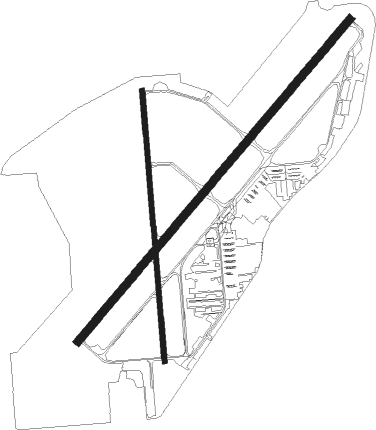
Runway 3 / 21  | ||
| length | 2470m (8104ft) | |
| bearing | 53° / 233° | |
| width | 46m (150ft) | |
| surface | asphalt | |
| displ threshold | 0m (0ft) / 259m (850ft) | |
| blast zone | 61m (200ft) / 93m (305ft) | |
| Runway 17 / 35 | ||
| length | 1588m (5210ft) | |
| bearing | 180° / 360° | |
| width | 30m (100ft) | |
| surface | asphalt | |
| blast zone | 49m (161ft) / 0m (0ft) | |
Nearby beacons
| code | identifier | dist | bearing | frequency |
|---|---|---|---|---|
| OGD | OGDEN VORTAC | 4.3 | 295° | 115.70 |
| HIF | HILL (OGDEN) TACAN | 4.6 | 142° | 111.20 |
| TCH | WASATCH VORTAC | 20.2 | 174° | 116.80 |
| LHO | BRIGHAM CITY (LOGAN) VOR/DME | 36.4 | 1° | 112.90 |
| EVW | EVANSTON VOR/DME | 44 | 85° | 109.60 |
| FFU | FAIRFIELD (PROVO) VORTAC | 54.8 | 175° | 116.60 |
| PVU | PROVO VOR/DME | 59.8 | 163° | 108.40 |
| MIJ | MICHAEL (DUGWAY) TACAN | 72.6 | 222° | 113.20 |
Departure and arrival routes
| Transition altitude | 18000ft |
| Transition level | 18000ft |
| SID end points | distance | outbound heading | |
|---|---|---|---|
| RW03 | |||
| EMONT3 | 20mi | 252° | |
| RW21 | |||
| EMONT3 | 20mi | 252° | |
| RW35 | |||
| EMONT3 | 20mi | 252° | |
Instrument approach procedures
| runway | airway (heading) | route (dist, bearing) |
|---|---|---|
| RW03 | MOINT (99°) | MOINT RIDEN (6mi, 179°) 9000ft CISBI (12mi, 118°) 7700ft |
| RW03 | STACO (48°) | STACO CISBI (16mi, 43°) 7700ft |
| RW03 | TCH (354°) | TCH CISBI (16mi, 308°) 7700ft |
| RNAV | CISBI 7700ft WULFE (8mi, 53°) 6000ft KOGD (5mi, 55°) 4522ft (6389mi, 110°) 5000ft MOINT (6406mi, 290°) 9000ft MOINT (turn) 9000ft |
Disclaimer
The information on this website is not for real aviation. Use this data with the X-Plane flight simulator only! Data taken with kind consent from X-Plane 12 source code and data files. Content is subject to change without notice.