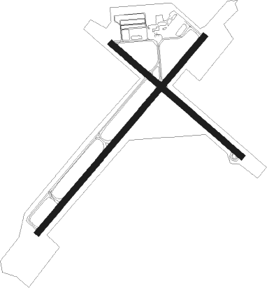
Kokomo - Kokomo Muni
Airport details
| Country | United States of America |
| State | Indiana |
| Region | K5 |
| Airspace | Chicago Ctr |
| Municipality | Howard County |
| Elevation | 830ft (253m) |
| Timezone | GMT -4 |
| Coordinates | 40.52818, -86.05899 |
| Magnetic var | |
| Type | land |
| Available since | X-Plane v10.40 |
| ICAO code | KOKK |
| IATA code | OKK |
| FAA code | OKK |
Communication
| Kokomo Muni AWOS | 113.500 |
| Kokomo Muni CTAF/UNICOM | 123.000 |
| Kokomo Muni GRISSOM Approach | 121.050 |
| Kokomo Muni GRISSOM Departure | 121.050 |
Approach frequencies
| ILS-cat-I | RW23 | 108.9 | 18.00mi |
| 3° GS | RW23 | 108.9 | 18.00mi |
Nearby Points of Interest:
Lake Erie and Western Depot Historic District
-Learner Building
-Kokomo Courthouse Square Historic District
-Kokomo City Building
-Old Silk Stocking Neighborhood
-Hy-Red Gasoline Station
-Elwood Haynes Museum
-Kokomo Country Club
-Henry W. Smith House
-Converse-Jackson Township Public Library
-44-83690
-Converse Depot
-Terrell Jacobs Circus Winter Quarters
-Westleigh Farms
-Shirk-Edwards House
-James Omar Cole House
-Peru High School Historic District
-Brownell Block/Senger Dry Goods Company Building
-International Circus Hall of Fame
-Tipton County Courthouse
-Tipton County Jail and Sheriff's Home
-Meshingomesia Cemetery and Indian School Historic District
-Teague Barn Wabash Importing Company Farm Stable
-J. Woodrow Wilson House
-Dr. Richard Davis House
Nearby beacons
| code | identifier | dist | bearing | frequency |
|---|---|---|---|---|
| OKK | KOKOMO VORTAC | 0 | 112° | 113.50 |
| GUS | GRISSOM (PERU) VORTAC | 8.1 | 322° | 108.45 |
| MZZ | MARION VOR/DME | 17.4 | 95° | 108.60 |
| MIE | MUNCIE VOR/DME | 35 | 114° | 114.40 |
| UMP | METROPOLITAN (INDIANAPOLIS) NDB | 35.4 | 179° | 338 |
| AI | VIDEO (ANDERSON) NDB | 37.2 | 130° | 394 |
| JN | BALLL (MUNCIE) NDB | 39.6 | 115° | 365 |
| MI | BALLL (MUNCIE) NDB | 39.7 | 115° | 365 |
| FV | LAREZ (INDIANAPOLIS) NDB | 44.9 | 190° | 349 |
| VHP | BRICKYARD VORTAC | 45.1 | 203° | 116.30 |
| LA | EARLE (LAFAYETTE) NDB | 45.7 | 264° | 401 |
| FWA | FORT WAYNE VORTAC | 47.9 | 63° | 117.80 |
| OLK | WEBSTER LAKE VOR | 50.1 | 38° | 110.40 |
| CFJ | CRAWFORDSVILLE NDB | 51.2 | 237° | 388 |
| UWL | NEW CASTLE NDB | 51.6 | 131° | 385 |
| CO | COLFA (INDIANAPOLIS) NDB | 52.6 | 188° | 232 |
| OXI | KNOX VOR/DME | 54.6 | 323° | 115.60 |
| SHB | SHELBYVILLE VOR/DME | 54.8 | 165° | 112 |
| GSH | GOSHEN VORTAC | 59.8 | 2° | 113.70 |
| SQ | PNTHR (CONNERSVILLE) NDB | 62 | 129° | 227 |
| VP | SEDLY (VALPARAISO) NDB | 66.7 | 318° | 212 |
Instrument approach procedures
| runway | airway (heading) | route (dist, bearing) |
|---|---|---|
| RW05 | MIE (294°) | MIE EDMEW (36mi, 273°) 2700ft WEBUX (8mi, 337°) 2400ft |
| RW05 | OKK (292°) | OKK WEBUX (11mi, 233°) 2400ft WEBUX (turn) 2400ft |
| RNAV | WEBUX 2400ft BRIMM (6mi, 52°) 2200ft ZODIR (2mi, 53°) 1500ft KOKK (3mi, 53°) 872ft (5225mi, 115°) 1082ft HADUN (5218mi, 295°) 3000ft HADUN (turn) | |
| RW14 | CEGEG (99°) | CEGEG IJCIL (8mi, 53°) 3000ft |
| RW14 | IJCIL (128°) | IJCIL 3000ft |
| RW14 | UYAGU (166°) | UYAGU IJCIL (8mi, 233°) 3000ft |
| RNAV | IJCIL 3000ft ZAVIX (6mi, 127°) 2600ft CUTUD (3mi, 127°) 1500ft KOKK (2mi, 130°) 878ft (5225mi, 115°) 1076ft EKQOR (5217mi, 295°) 3000ft EKQOR (turn) | |
| RW23 | FWA (243°) | FWA HADUN (38mi, 245°) 2400ft |
| RW23 | MZZ (275°) | MZZ HADUN (14mi, 306°) 2400ft HADUN (turn) 2400ft |
| RW23 | OKK (292°) | OKK HADUN (11mi, 52°) 2400ft HADUN (turn) 2400ft |
| RNAV | HADUN 2400ft WOXOG (6mi, 233°) 2200ft FROWN (2mi, 233°) 1400ft KOKK (2mi, 232°) 863ft (5225mi, 115°) 1027ft WEBUX (5233mi, 295°) 3000ft WEBUX (turn) | |
| RW32 | EKQOR (307°) | EKQOR 3000ft |
| RW32 | POYIK (278°) | POYIK EKQOR (8mi, 233°) 3000ft |
| RW32 | YILRU (345°) | YILRU EKQOR (8mi, 53°) 3000ft |
| RNAV | EKQOR 3000ft UHCEF (6mi, 308°) 2600ft OQXUQ (3mi, 308°) 1540ft KOKK (2mi, 305°) 874ft (5225mi, 115°) 1200ft IJCIL (5234mi, 295°) 3000ft IJCIL (turn) |
Disclaimer
The information on this website is not for real aviation. Use this data with the X-Plane flight simulator only! Data taken with kind consent from X-Plane 12 source code and data files. Content is subject to change without notice.

