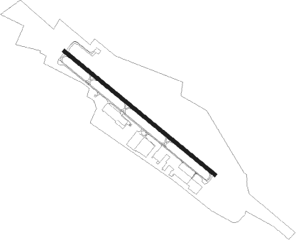
Winchester - Winchester Regl
Airport details
| Country | United States of America |
| State | Virginia |
| Region | K6 |
| Airspace | Washington Ctr |
| Municipality | Frederick County |
| Elevation | 726ft (221m) |
| Timezone | GMT -5 |
| Coordinates | 39.14353, -78.14445 |
| Magnetic var | |
| Type | land |
| Available since | X-Plane v10.40 |
| ICAO code | KOKV |
| IATA code | WGO |
| FAA code | OKV |
Communication
| Winchester Regl AWOS 3 | 124.850 |
| Winchester Regl CTAF/UNICOM | 122.700 |
| Winchester Regl POTOMAC Approach/Departure | 120.450 |
Approach frequencies
| ILS-cat-I | RW32 | 109.55 | 18.00mi |
| 3° GS | RW32 | 109.55 | 18.00mi |
Nearby Points of Interest:
Winchester Coca-Cola Bottling Works
-Patsy Cline House
-Triangle Diner
-Mount Hebron Cemetery and Gatehouse
-Adam Kurtz House
-Homespun (Winchester, Virginia)
-Handley Library
-Daniel Morgan House
-Fort Loudoun
-Fair Mount
-Douglas School
-Valley Mill Farm
-Rose Hill Farm (Winchester, Virginia)
-Sunrise (Gore, Virginia)
-John Hite House
-Fort Collier
-Springdale Mill Complex
-Millbank
-Long Meadow
-Huntingdon (Boyce, Virginia)
-Opequon Historic District
-Boyce Historic District
-Newtown-Stephensburg Historic District
-High Banks
-Saratoga (Boyce, Virginia)
Nearby beacons
| code | identifier | dist | bearing | frequency |
|---|---|---|---|---|
| LDN | LINDEN VORTAC | 17.5 | 192° | 114.30 |
| MRB | MARTINSBURG VORTAC | 20 | 51° | 112.10 |
| LUA | CAVERNS (LURAY) NDB | 30.7 | 216° | 245 |
| CSN | CASANOVA VORTAC | 32.8 | 151° | 116.30 |
| AML | ARMEL (WASH.,D.C.) VOR/DME | 34 | 107° | 113.50 |
| HGR | HAGERSTOWN VOR | 35.8 | 28° | 109.80 |
| FDK | FREDERICK VOR | 39.2 | 71° | 109 |
| ESL | KESSEL VOR/DME | 39.6 | 276° | 110.80 |
| MSQ | NAILR (CULPEPER) NDB | 42.8 | 161° | 351 |
| THS | SAINT THOMAS VORTAC | 48.2 | 14° | 115 |
| GRV | DME | 51.3 | 298° | 112.30 |
| BRV | BROOKE VORTAC | 61 | 136° | 114.50 |
| EZF | SHANNON (FREDERICKSBURG) NDB | 61.9 | 142° | 237 |
| SYS | STOYSTOWN (SOMERSET) NDB | 66.9 | 321° | 209 |
| SH | STAUT(STAUNTON-WAYNESBORO-HARR NDB | 68.2 | 221° | 375 |
Departure and arrival routes
| Transition altitude | 18000ft |
| Transition level | 18000ft |
| SID end points | distance | outbound heading | |
|---|---|---|---|
| ALL | |||
| JDUBB4 | 139mi | 203° | |
| SCRAM6 | 111mi | 208° | |
| CLTCH3 | 94mi | 223° | |
| STAR starting points | distance | inbound heading | |
|---|---|---|---|
| ALL | |||
| HYPER8 | 85.9 | 242° | |
| TRSTN3 | 65.8 | 341° | |
Instrument approach procedures
| runway | airway (heading) | route (dist, bearing) |
|---|---|---|
| RW14 | CAPON (120°) | CAPON BONCI (4mi, 95°) 3700ft |
| RW14 | MUMSY (179°) | MUMSY ACELO (7mi, 254°) 4200ft BONCI (6mi, 221°) 3700ft |
| RW14 | SOGBE (95°) | SOGBE ZENDI (4mi, 19°) 4200ft BONCI (5mi, 60°) 3700ft |
| RNAV | BONCI 3700ft EMNAR (4mi, 127°) 3500ft BIPME (3mi, 127°) 2700ft WOGDI (2mi, 127°) 2000ft WUSBI (2mi, 127°) 1400ft KOKV (2mi, 127°) 771ft (4855mi, 117°) 976ft CLADD (4845mi, 297°) 3700ft CLADD (turn) 3700ft | |
| RW32 | HOAGE (285°) | HOAGE CLADD (10mi, 134°) 3700ft CLADD (turn) 3700ft CEDER (3mi, 307°) 3200ft |
| RW32 | JASEN (287°) | JASEN CLADD (5mi, 239°) 3700ft CEDER (3mi, 307°) 3200ft |
| RW32 | LDN (12°) | LDN DORGY (10mi, 62°) 4700ft CLADD (5mi, 51°) 3700ft CEDER (3mi, 307°) 3200ft |
| RNAV | CEDER 3200ft COGAN (4mi, 307°) 2200ft KOKV (5mi, 307°) 745ft IMHEM (6mi, 307°) MEPEW (7mi, 10°) 5000ft MEPEW (turn) |
Holding patterns
| STAR name | hold at | type | turn | heading* | altitude | leg | speed limit |
|---|---|---|---|---|---|---|---|
| HYPER8 | BINNS | VHF | right | 68 (248)° | 1.0min timed | 265 | |
| HYPER8 | HYPER | VHF | left | 65 (245)° | 6001ft - 14000ft | 1.0min timed | 210 |
| TRSTN3 | JOHOF | VHF | right | 214 (34)° | DME 10.0mi | ICAO rules | |
| *) magnetic outbound (inbound) holding course | |||||||
Disclaimer
The information on this website is not for real aviation. Use this data with the X-Plane flight simulator only! Data taken with kind consent from X-Plane 12 source code and data files. Content is subject to change without notice.
