Olney-noble
Airport details
| Country | United States of America |
| State | Illinois |
| Region | K5 |
| Airspace | Kansas City Ctr |
| Municipality | Richland County |
| Elevation | 480ft (146m) |
| Timezone | GMT -6 |
| Coordinates | 38.72183, -88.17643 |
| Magnetic var | |
| Type | land |
| Available since | X-Plane v10.40 |
| ICAO code | KOLY |
| IATA code | n/a |
| FAA code | OLY |
Communication
| Olney-Noble AWOS 3 | 119.275 |
| Olney-Noble CTAF/UNICOM | 123.000 |
Approach frequencies
| LOC | RW11 | 110.5 | 18.00mi |
Nearby Points of Interest:
Ambrose Hopkinson House
-Larchmound
-Olney Carnegie Library
-Pearl and Bess Meyer House
-Shriver House
-Baltimore and Ohio Railroad Depot
-Clay County Courthouse
-Clay County Jail
-Paine House (Xenia, Illinois)
-G.J. George House
-Lawrence County Courthouse
-Bridge at Thirteenth Street
-Beall-Orr House
-Old Morrison Mill
-William W. Gray House
-Mayberry Mound and Village Site
-Effingham County Courthouse
-Forts of Vincennes, Indiana
-St. Francis Xavier Cathedral and Library
-Thornton Ward Estate
-Old State Bank
-Grouseland
-Vincennes Fortnightly Club
-Hack and Simon Office Building
-Stoner Site
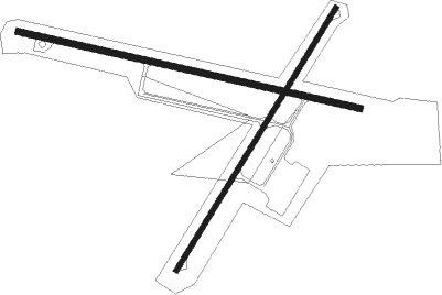
Runway info
Runway 11 / 29  | ||
| length | 1251m (4104ft) | |
| bearing | 104° / 284° | |
| width | 23m (75ft) | |
| surface | asphalt | |
| Runway 3 / 21 | ||
| length | 1098m (3602ft) | |
| bearing | 43° / 223° | |
| width | 18m (60ft) | |
| surface | asphalt | |
Nearby beacons
| code | identifier | dist | bearing | frequency |
|---|---|---|---|---|
| OLY | OLNEY NDB | 0.2 | 134° | 272 |
| SAM | SAMSVILLE VOR/DME | 14.8 | 159° | 116.60 |
| BIB | BIBLE GROVE VORTAC | 18.6 | 303° | 109 |
| FWC | WAYNE CO (FAIRFIELD) NDB | 23.2 | 214° | 257 |
| LWV | DME | 26.9 | 85° | 108.80 |
| PLX | PALESTINE (ROBINSON) NDB | 30.5 | 61° | 391 |
| VNN | VERNON DME | 36.6 | 240° | 113.80 |
| MTO | DME | 45.6 | 352° | 109.40 |
| ENL | CENTRALIA VORTAC | 49.5 | 253° | 115 |
| EVV | VICCI (EVANSVILLE) NDB | 49.7 | 129° | 219 |
| VLA | VANDALIA VOR/DME | 51.2 | 291° | 114.30 |
| PXV | POCKET CITY (EVANSVILLE) VORTAC | 51.4 | 152° | 113.30 |
| SYZ | SHELBYVILLE NDB | 51.5 | 316° | 365 |
| HU | YINNO (TERRE HAUTE) NDB | 54 | 49° | 245 |
| TTH | TERRE HAUTE VORTAC | 63.1 | 50° | 115.30 |
| MW | JONNY (MARION) NDB | 64.9 | 222° | 382 |
| MWA | DME | 70.2 | 221° | 110.40 |
Instrument approach procedures
| runway | airway (heading) | route (dist, bearing) |
|---|---|---|
| RW04 | HOGTU (42°) | HOGTU 6000ft HOGTU (turn) 3000ft |
| RW04 | KILDE (66°) | KILDE HOGTU (5mi, 119°) 3000ft |
| RW04 | PUPJE (14°) | PUPJE HOGTU (5mi, 300°) 3000ft |
| RNAV | HOGTU 3000ft OBCUJ (6mi, 43°) 2000ft KOLY (5mi, 42°) 505ft (5320mi, 114°) 882ft HOGTU (5326mi, 294°) 3000ft HOGTU (turn) | |
| RW11 | FOYWU (104°) | FOYWU 3000ft |
| RNAV | FOYWU 3000ft WAKDU (7mi, 103°) 2000ft KOLY (5mi, 104°) 522ft (5320mi, 114°) 1500ft FOYWU (5331mi, 294°) 3000ft FOYWU (turn) |
Disclaimer
The information on this website is not for real aviation. Use this data with the X-Plane flight simulator only! Data taken with kind consent from X-Plane 12 source code and data files. Content is subject to change without notice.