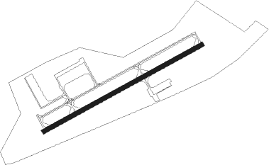
Orange - Orange County
Airport details
| Country | United States of America |
| State | Virginia |
| Region | K6 |
| Airspace | Washington Ctr |
| Municipality | Orange County |
| Elevation | 462ft (141m) |
| Timezone | GMT -5 |
| Coordinates | 38.24720, -78.04561 |
| Magnetic var | |
| Type | land |
| Available since | X-Plane v10.40 |
| ICAO code | KOMH |
| IATA code | n/a |
| FAA code | OMH |
Communication
| Orange County AWOS 3 | 118.075 |
| Orange County CTAF/UNICOM | 122.800 |
| Orange County POTOMAC Approach/Departure | 132.850 |
Nearby Points of Interest:
Bloomsbury
-Hare Forest Farm
-Ballard-Marshall House
-Berry Hill (Orange, Virginia)
-Rebel Hall
-Orange Commercial Historic District
-Orange County Courthouse
-St. Thomas Church (Orange, Virginia)
-Chestnut Hill (Orange, Virginia)
-Orange High School
-Mayhurst
-Waddell Memorial Presbyterian Church
-Rapidan Historic District
-Grelen
-Locust Grove (Rapidan, Virginia)
-Williston (Orange, Virginia)
-Brampton (Orange, Virginia)
-The Residence
-Willow Grove (Madison Mills, Virginia)
-Greenwood (Orange, Virginia)
-Greenway (Madison Mills, Virginia)
-Belle Plaine
-Locust Hill (Locust Dale, Virginia)
-Black Meadow
-Rocklands (Gordonsville, Virginia)
Nearby beacons
| code | identifier | dist | bearing | frequency |
|---|---|---|---|---|
| MSQ | NAILR (CULPEPER) NDB | 14 | 34° | 351 |
| GVE | GORDONSVILLE VORTAC | 14.9 | 205° | 115.60 |
| CSN | CASANOVA VORTAC | 25.1 | 25° | 116.30 |
| EZF | SHANNON (FREDERICKSBURG) NDB | 28 | 88° | 237 |
| BRV | BROOKE VORTAC | 33 | 83° | 114.50 |
| LUA | CAVERNS (LURAY) NDB | 33.7 | 317° | 245 |
| LDN | LINDEN VORTAC | 37.2 | 345° | 114.30 |
| SH | STAUT(STAUNTON-WAYNESBORO-HARR NDB | 43.1 | 267° | 375 |
| FAK | FLAT ROCK VORTAC | 44.3 | 163° | 113.30 |
| AML | ARMEL (WASH.,D.C.) VOR/DME | 49.4 | 40° | 113.50 |
| DAA | DAVEE (FT BELVOIR) NDB | 50.5 | 66° | 223 |
| RIC | RICHMOND VORTAC | 56.4 | 136° | 114.10 |
| GTN | GEORGETOWN (WASH., D.C.) NDB | 59.5 | 53° | 323 |
| HPW | HOPEWELL VORTAC | 70.6 | 135° | 112 |
| ESL | KESSEL VOR/DME | 73.5 | 316° | 110.80 |
Instrument approach procedures
| runway | airway (heading) | route (dist, bearing) |
|---|---|---|
| RW08 | GVE (25°) | GVE OPTUE (5mi, 302°) 4000ft ZAVRO (6mi, 330°) 3100ft |
| RW08 | WITTO (105°) | WITTO FIMAS (5mi, 157°) 4000ft ZAVRO (6mi, 150°) 3100ft |
| RW08 | ZAVRO (70°) | ZAVRO 3100ft |
| RNAV | ZAVRO 3100ft ELIME (4mi, 70°) 2600ft AVADY (3mi, 70°) 2200ft ZENUP (3mi, 70°) 1340ft KOMH (3mi, 70°) 485ft (4843mi, 116°) 864ft OTTTR (4832mi, 296°) 3000ft OTTTR (turn) | |
| RW26 | BRV (263°) | BRV FIMAR (10mi, 270°) 3000ft OTTTR (11mi, 270°) 3000ft |
| RW26 | CSN (205°) | CSN DAGME (10mi, 168°) 3000ft OTTTR (9mi, 168°) 3000ft |
| RW26 | OTTTR (251°) | OTTTR 3000ft |
| RNAV | OTTTR 3000ft IDUNE (6mi, 251°) 2500ft WOGVO (3mi, 251°) 1460ft KOMH (3mi, 250°) 504ft (4843mi, 116°) 864ft ZAVRO (4854mi, 296°) 3100ft ZAVRO (turn) |
Disclaimer
The information on this website is not for real aviation. Use this data with the X-Plane flight simulator only! Data taken with kind consent from X-Plane 12 source code and data files. Content is subject to change without notice.
