Ormond Beach - Ormond Beach Muni
Airport details
| Country | United States of America |
| State | Florida |
| Region | K7 |
| Airspace | Jacksonville Ctr |
| Municipality | Ormond Beach |
| Elevation | 26ft (8m) |
| Timezone | GMT -5 |
| Coordinates | 29.30144, -81.10912 |
| Magnetic var | |
| Type | land |
| Available since | X-Plane v10.40 |
| ICAO code | KOMN |
| IATA code | OMN |
| FAA code | OMN |
Communication
| Ormond Beach Muni AWOS 3 | 118.475 |
| Ormond Beach Muni UNICOM | 123.050 |
| Ormond Beach Muni Ground Control/Clearance DEL | 121.625 |
| Ormond Beach Muni Tower | 119.075 |
| Ormond Beach Muni DAYTONA Approach/Departure | 125.800 |
Nearby Points of Interest:
Dix House
-Ormond Yacht Club
-The Hammocks
-Lippincott Mansion
-The Porches
-Rowallan
-Nocoroco
-Talahloka
-John Anderson Lodge
-Anderson-Price Memorial Library Building
-The Casements
-Ormond Fire House
-Holly Hill Municipal Building
-El Pino Parque Historic District
-Bartholomew J. Donnelly House
-White Hall
-United States Post Office
-Rogers House
-S. Cornelia Young Memorial Library
-Amos Kling House
-Seybold Baking Company Factory
-S. H. Kress and Co. Building
-Jackie Robinson Ballpark
-Olds Hall
-Delos A. Blodgett House
Runway info
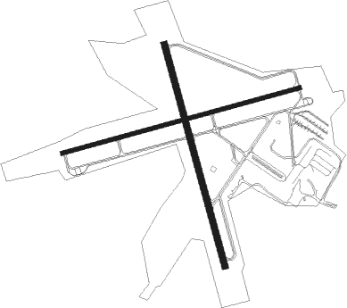
Runway 17 / 35  | ||
| length | 1136m (3727ft) | |
| bearing | 168° / 348° | |
| width | 30m (100ft) | |
| surface | asphalt | |
| blast zone | 46m (151ft) / 49m (161ft) | |
| Runway 8 / 26 | ||
| length | 1222m (4009ft) | |
| bearing | 81° / 261° | |
| width | 23m (75ft) | |
| surface | asphalt | |
Nearby beacons
| code | identifier | dist | bearing | frequency |
|---|---|---|---|---|
| OMN | ORMOND BEACH VORTAC | 0.2 | 297° | 112.60 |
| SGJ | SAINT AUGUSTINE VOR/DME | 41 | 341° | 109.40 |
| ORL | ORLANDO VORTAC | 47 | 197° | 112.20 |
| RYD | REYNOLDS (GREEN COVE SPRINGS) NDB | 49.1 | 321° | 338 |
| OR | HERNY (ORLANDO) NDB | 50.6 | 202° | 221 |
| NIP | JACKSONVILLE TACAN | 63.3 | 329° | 108.20 |
| NZC | CECIL TACAN | 67.9 | 320° | 114.10 |
Departure and arrival routes
| Transition altitude | 18000ft |
| Transition level | 18000ft |
| STAR starting points | distance | inbound heading | |
|---|---|---|---|
| ALL | |||
| TTHOR2 | 22.7 | 161° | |
Instrument approach procedures
| runway | airway (heading) | route (dist, bearing) |
|---|---|---|
| RW09 | ARSUF (81°) | ARSUF 2800ft |
| RNAV | ARSUF 2800ft EZADO (7mi, 80°) 1600ft DRMAR (2mi, 80°) 900ft KOMN (3mi, 82°) 88ft (4940mi, 110°) 600ft ARSUF (4952mi, 290°) 2800ft ARSUF (turn) | |
| RW17 | FLYHI (166°) | FLYHI 2800ft |
| RNAV | FLYHI 2800ft HATOS (7mi, 168°) 1600ft GIGBE (2mi, 168°) 900ft KOMN (3mi, 162°) 85ft (4940mi, 110°) 600ft FLYHI (4943mi, 290°) 2800ft FLYHI (turn) | |
| RW27 | JEREL (260°) | JEREL 2800ft |
| RNAV | JEREL 2800ft ZUMEK (7mi, 260°) 1600ft KLNGN (3mi, 260°) 720ft KOMN (2mi, 259°) 71ft (4940mi, 110°) 600ft JEREL (4929mi, 290°) 2800ft JEREL (turn) |
Holding patterns
| STAR name | hold at | type | turn | heading* | altitude | leg | speed limit |
|---|---|---|---|---|---|---|---|
| TTHOR2 | LPERD | VHF | right | 14 (194)° | DME 10.0mi | ICAO rules | |
| TTHOR2 | WEEEK | VHF | left | 2 (182)° | DME 10.0mi | ICAO rules | |
| *) magnetic outbound (inbound) holding course | |||||||
Disclaimer
The information on this website is not for real aviation. Use this data with the X-Plane flight simulator only! Data taken with kind consent from X-Plane 12 source code and data files. Content is subject to change without notice.