Socorro - Socorro Muni
Airport details
| Country | United States of America |
| State | New Mexico |
| Region | K2 |
| Airspace | Albuquerque Ctr |
| Municipality | Socorro |
| Elevation | 4875ft (1486m) |
| Timezone | GMT -7 |
| Coordinates | 34.02247, -106.90314 |
| Magnetic var | |
| Type | land |
| Available since | X-Plane v10.40 |
| ICAO code | KONM |
| IATA code | n/a |
| FAA code | ONM |
Communication
| Socorro Muni AWOS | 118.325 |
| Socorro Muni CTAF/UNICOM | 122.800 |
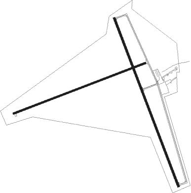
Runway info
Runway 15 / 33  | ||
| length | 1784m (5853ft) | |
| bearing | 160° / 340° | |
| width | 23m (75ft) | |
| surface | asphalt | |
| displ threshold | 56m (184ft) / 56m (184ft) | |
| Runway 6 / 24 | ||
| length | 1396m (4580ft) | |
| bearing | 76° / 256° | |
| width | 18m (60ft) | |
| surface | asphalt | |
Nearby beacons
| code | identifier | dist | bearing | frequency |
|---|---|---|---|---|
| ONM | SOCORRO VORTAC | 19.4 | 15° | 116.80 |
| BRG | DME | 37.8 | 6° | 114.75 |
| TCS | TRUTH OR CONSEQUENCES VORTAC | 48.2 | 207° | 112.70 |
Instrument approach procedures
| runway | airway (heading) | route (dist, bearing) |
|---|---|---|
| RW33 | ONM (195°) | ONM HETUD (32mi, 189°) 9000ft HETUD (turn) 7800ft |
| RW33 | WOLKI (20°) | WOLKI HETUD (10mi, 43°) 7800ft |
| RNAV | HETUD 7800ft ZOBTU (6mi, 21°) 6900ft OBNAE (4mi, 346°) 5620ft KONM (3mi, 342°) 4796ft (6243mi, 108°) 5080ft ONM (6235mi, 288°) 8000ft ONM (turn) |
Disclaimer
The information on this website is not for real aviation. Use this data with the X-Plane flight simulator only! Data taken with kind consent from X-Plane 12 source code and data files. Content is subject to change without notice.