Newport - Newport Muni
Airport details
| Country | United States of America |
| State | Oregon |
| Region | K1 |
| Airspace | Seattle Ctr |
| Municipality | Newport |
| Elevation | 160ft (49m) |
| Timezone | GMT -8 |
| Coordinates | 44.58036, -124.05791 |
| Magnetic var | |
| Type | land |
| Available since | X-Plane v10.40 |
| ICAO code | KONP |
| IATA code | n/a |
| FAA code | ONP |
Communication
| Newport Muni AWOS 3 | 133.900 |
| Newport Muni CTAF/UNICOM | 122.800 |
Approach frequencies
| ILS-cat-I | RW16 | 111.5 | 18.00mi |
| 3° GS | RW16 | 111.5 | 18.00mi |
Nearby Points of Interest:
Yaquina Bay Bridge
-Charles and Theresa Roper House
-St. John's Episcopal Church
-Siletz Agency Site
-Depoe Bay Bridge
-Depoe Bay Whale Watching Center
-Ten Mile Creek Bridge
-Big Creek Bridge
-Charles King House
-Drift Creek Bridge
-Fort Hoskins
-Cape Creek Bridge
-Isaac King House and Barn
-Riley–Cutler House
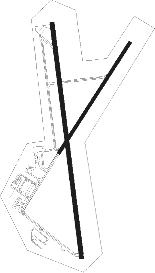
Runway info
Runway 2 / 20  | ||
| length | 914m (2999ft) | |
| bearing | 47° / 227° | |
| width | 23m (75ft) | |
| surface | asphalt | |
| blast zone | 0m (0ft) / 123m (404ft) | |
| Runway 16 / 34 | ||
| length | 1647m (5404ft) | |
| bearing | 176° / 356° | |
| width | 30m (100ft) | |
| surface | asphalt | |
| displ threshold | 0m (0ft) / 92m (302ft) | |
Nearby beacons
| code | identifier | dist | bearing | frequency |
|---|---|---|---|---|
| ONP | NEWPORT VORTAC | 0.3 | 208° | 117.10 |
| CVO | CORVALLIS VOR/DME | 33 | 96° | 115.40 |
| LWG | LEWISBURG (CORVALLIS) NDB | 33.7 | 88° | 225 |
| EUG | EUGENE VORTAC | 45.2 | 119° | 112.90 |
Instrument approach procedures
| runway | airway (heading) | route (dist, bearing) |
|---|---|---|
| RW16 | CUTEL (186°) | CUTEL BOILR (5mi, 219°) 3700ft |
| RW16 | LANKE (234°) | LANKE DOYER (6mi, 313°) 4000ft BOILR (8mi, 268°) 3700ft |
| RW16 | ONP (28°) | ONP BOILR (16mi, 357°) 3700ft BOILR (turn) 3700ft |
| RNAV | BOILR 3700ft BUHRS (9mi, 176°) 2100ft CALAX (2mi, 176°) 1480ft KONP (4mi, 175°) 207ft (6817mi, 110°) 600ft BOILR (6811mi, 290°) 3700ft BOILR (turn) | |
| RW34 | BOSVE (6°) | BOSVE TULBE (10mi, 43°) 4000ft |
| RW34 | ONP (28°) | ONP TULBE (17mi, 161°) 4000ft TULBE (turn) 4000ft |
| RNAV | TULBE 4000ft WILIK (7mi, 341°) 2700ft JONLA (5mi, 341°) 2100ft AVAVE (5mi, 341°) 397ft (6817mi, 110°) 2500ft TULBE (6821mi, 290°) 4000ft TULBE (turn) |
Disclaimer
The information on this website is not for real aviation. Use this data with the X-Plane flight simulator only! Data taken with kind consent from X-Plane 12 source code and data files. Content is subject to change without notice.