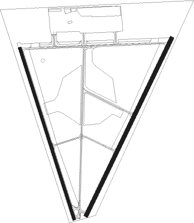
Detroit/grosse Ile - Grosse Ile Muni
Airport details
| Country | United States of America |
| State | Michigan |
| Region | K5 |
| Airspace | Cleveland Ctr |
| Municipality | Grosse Ile Township |
| Elevation | 589ft (180m) |
| Timezone | GMT -5 |
| Coordinates | 42.10626, -83.16127 |
| Magnetic var | |
| Type | land |
| Available since | X-Plane v10.40 |
| ICAO code | KONZ |
| IATA code | n/a |
| FAA code | ONZ |
Communication
Nearby Points of Interest:
St. James Episcopal Church
-East River Road Historic District
-Gibraltar Road–Waterway Canal Bridge
-Amherstburg MCR Station
-Amherstburg First Baptist Church
-Parke Lane Road–Thorofare Canal Bridge
-Hull's Trace North Huron River Corduroy Segment
-Jefferson Avenue–Huron River and Harbin Drive–Silver Creek Canal Bridges
-Marx House
-Ford-Bacon House
-John and Emma Lacey Eberts House
-George P. MacNichol House
-Lincoln Park Post Office
-Mellus Newspapers Building
-Ste. Claire
-West Jefferson Avenue–Rouge River Bridge
-Fort Street–Pleasant Street and Norfolk & Western Railroad Viaduct
-Ford River Rouge Complex
-Springwells Park Historic District
-James A. Garfield School
-West Vernor-Lawndale Historic District
-Dominion House
-Dearborn City Hall Complex
-West Vernor-Junction Historic District
-US 12 Bridges

Nearby beacons
| code | identifier | dist | bearing | frequency |
|---|---|---|---|---|
| RYS | GROSSE ILE (DETROIT) NDB | 0.4 | 122° | 419 |
| DM | SPENC (DETROIT) NDB | 7 | 340° | 223 |
| DXO | DETROIT VOR/DME | 11.1 | 297° | 113.40 |
| DT | REVUP (DETROIT) NDB | 12 | 273° | 388 |
| CRL | CARLETON VOR/DME | 13.6 | 259° | 115.70 |
| QG | WINDSOR NDB | 17.9 | 55° | 353 |
| SVM | SALEM VORTAC | 26.4 | 305° | 114.30 |
| TCU | TECUMSEH NDB | 32.6 | 264° | 239 |
| MTC | SELFRIDGE (MOUNT CLEMENS) TACAN | 33.7 | 33° | 133.70 |
| PCW | PORT CLINTON NDB | 37.6 | 154° | 423 |
| PSI | DME | 39.3 | 328° | 111 |
| TOL | TOLEDO TACAN | 41.9 | 231° | 112.50 |
| ADG | ADRIAN NDB | 43.2 | 256° | 278 |
| TO | TOPHR (TOLEDO) NDB | 47.5 | 234° | 219 |
| PH | PHURN (PORT HURON) NDB | 50.8 | 37° | 332 |
| FNT | FLINT VORTAC | 57.8 | 326° | 116.90 |
| DJB | DRYER VOR/DME | 63.4 | 127° | 113.60 |
Departure and arrival routes
| Transition altitude | 18000ft |
| Transition level | 18000ft |
| SID end points | distance | outbound heading | |
|---|---|---|---|
| RW04 | |||
| ZETTR3 | 65mi | 40° | |
| HHOWE3 | 74mi | 85° | |
| PAVYL2 | 70mi | 90° | |
| LIDDS2 | 107mi | 118° | |
| CLVIN2 | 196mi | 197° | |
| BARII2 | 114mi | 216° | |
| SNDRS2 | 100mi | 223° | |
| CCOBB2 | 86mi | 274° | |
| KAYLN2 | 134mi | 277° | |
| MIGGY2 | 112mi | 307° | |
| TRMML3 | 99mi | 343° | |
| RW17 | |||
| ZETTR3 | 65mi | 40° | |
| HHOWE3 | 74mi | 85° | |
| PAVYL2 | 70mi | 90° | |
| LIDDS2 | 107mi | 118° | |
| CLVIN2 | 196mi | 197° | |
| BARII2 | 114mi | 216° | |
| SNDRS2 | 100mi | 223° | |
| CCOBB2 | 86mi | 274° | |
| KAYLN2 | 134mi | 277° | |
| MIGGY2 | 112mi | 307° | |
| TRMML3 | 99mi | 343° | |
| RW22 | |||
| ZETTR3 | 65mi | 40° | |
| HHOWE3 | 74mi | 85° | |
| PAVYL2 | 70mi | 90° | |
| LIDDS2 | 107mi | 118° | |
| CLVIN2 | 196mi | 197° | |
| BARII2 | 114mi | 216° | |
| SNDRS2 | 100mi | 223° | |
| CCOBB2 | 86mi | 274° | |
| KAYLN2 | 134mi | 277° | |
| MIGGY2 | 112mi | 307° | |
| TRMML3 | 99mi | 343° | |
| RW35 | |||
| ZETTR3 | 65mi | 40° | |
| HHOWE3 | 74mi | 85° | |
| PAVYL2 | 70mi | 90° | |
| LIDDS2 | 107mi | 118° | |
| CLVIN2 | 196mi | 197° | |
| BARII2 | 114mi | 216° | |
| SNDRS2 | 100mi | 223° | |
| CCOBB2 | 86mi | 274° | |
| KAYLN2 | 134mi | 277° | |
| MIGGY2 | 112mi | 307° | |
| TRMML3 | 99mi | 343° | |
| STAR starting points | distance | inbound heading | |
|---|---|---|---|
| ALL | |||
| PETTE2 | 52.7 | 89° | |
| RRALF3 | 49.4 | 114° | |
| GIGGY2 | 67.9 | 238° | |
| FOREY2 | 27.1 | 298° | |
Instrument approach procedures
| runway | airway (heading) | route (dist, bearing) |
|---|---|---|
| RW04 | AMXUX (36°) | AMXUX 2400ft |
| RNAV | AMXUX 2400ft MONLE (6mi, 38°) 2200ft STRGN (3mi, 38°) 1200ft KONZ (3mi, 29°) 617ft (5101mi, 117°) 960ft UFDIV (5096mi, 297°) 2400ft UFDIV (turn) | |
| RW22 | LLEEO (296°) | LLEEO YEGHI (27mi, 321°) 3000ft UFDIV (5mi, 294°) 2400ft |
| RW22 | UFDIV (220°) | UFDIV 2400ft |
| RNAV | UFDIV 2400ft WIQSU (6mi, 218°) 2200ft STEFI (2mi, 218°) 1400ft KONZ (2mi, 227°) 630ft (5101mi, 117°) 980ft AMXUX (5106mi, 297°) 2400ft AMXUX (turn) |
Holding patterns
| STAR name | hold at | type | turn | heading* | altitude | leg | speed limit |
|---|---|---|---|---|---|---|---|
| FOREY2 | FOREY | VHF | right | 144 (324)° | DME 10.0mi | ICAO rules | |
| PETTE2 | PETTE | VHF | left | 241 (61)° | DME 10.0mi | ICAO rules | |
| RRALF3 | KILTT | VHF | right | 313 (133)° | DME 10.0mi | ICAO rules | |
| *) magnetic outbound (inbound) holding course | |||||||
Disclaimer
The information on this website is not for real aviation. Use this data with the X-Plane flight simulator only! Data taken with kind consent from X-Plane 12 source code and data files. Content is subject to change without notice.