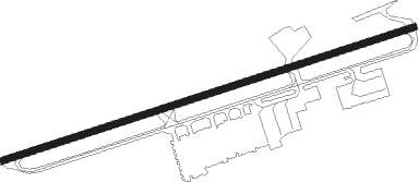
West Chester - Brandywine
Airport details
| Country | United States of America |
| State | Pennsylvania |
| Region | K6 |
| Airspace | New York Ctr |
| Municipality | West Goshen Township |
| Elevation | 463ft (141m) |
| Timezone | GMT -5 |
| Coordinates | 39.99096, -75.57934 |
| Magnetic var | |
| Type | land |
| Available since | X-Plane v11.00 |
| ICAO code | KOQN |
| IATA code | OQN |
| FAA code | OQN |
Communication
| BRANDYWINE CTAF/UNICOM | 123.075 |
| BRANDYWINE PHILADELPHIA Approach/Departure | 124.350 |
Nearby Points of Interest:
Goodwin Acres
-William Everhart House
-Collins Mansion
-Kirkland Station
-Benjamin Rush House
-Daniel Meredith House
-Greenwood School
-Goshenville Historic District
-David Ashbridge Log House
-Autun
-Woodland Station
-Sharples Separator Works
-West Chester Boarding School for Boys
-Barclay House
-Joseph Rothrock House
-Bank of Chester County
-West Chester Downtown Historic District
-Buckwalter Building
-Warner Theatre
-William Everhart Buildings
-Sharples Homestead
-New Century Clubhouse
-Ellis Williams House
-George Hoffman House
-West Chester State College Quadrangle Historic District
Nearby beacons
| code | identifier | dist | bearing | frequency |
|---|---|---|---|---|
| MXE | MODENA VORTAC | 6 | 231° | 113.20 |
| PTW | POTTSTOWN VORTAC | 13.9 | 5° | 116.50 |
| ING | AMBLER NDB | 15.7 | 65° | 275 |
| DQO | DUPONT (WILMINGTON) VORTAC | 18.8 | 185° | 114 |
| IL | HADIN (WILMINGTON) NDB | 24.6 | 185° | 248 |
| OOD | WOODSTOWN VORTAC | 24.8 | 142° | 112.80 |
| LRP | LANCASTER VOR/DME | 33.6 | 280° | 117.30 |
| ARD | YARDLEY VOR/DME | 34.6 | 69° | 108.20 |
| ETX | EAST TEXAS VOR/DME | 35.7 | 350° | 110.20 |
| VCN | CEDAR LAKE (MILLVILLE) VOR/DME | 39.2 | 127° | 115.20 |
| RNB | RAINBOW (MILLVILLE) NDB | 40 | 142° | 363 |
| FJC | ALLENTOWN VORTAC | 44.5 | 10° | 117.50 |
| GXU | MC GUIRE (WRIGHTSTOWN) VORTAC | 45.2 | 89° | 110.60 |
| ENO | SMYRNA (KENTON) VORTAC | 45.6 | 175° | 111.40 |
| DOV | DOVER TACAN | 51.8 | 173° | 110 |
| BZJ | BELLGROVE (INDIANTOWN GAP) NDB | 52 | 295° | 328 |
| SBJ | SOLBERG VOR/DME | 52.3 | 55° | 112.90 |
| MTN | MARTIN (BALTIMORE) TACAN | 55.2 | 232° | 134.10 |
| BWZ | BROADWAY (SCHOOLEY'S MT) VOR/DME | 59.5 | 43° | 114.20 |
| SIE | SEA ISLE VORTAC | 64.7 | 139° | 114.80 |
Instrument approach procedures
| runway | airway (heading) | route (dist, bearing) |
|---|---|---|
| RW09-Y | GLOMO (73°) | GLOMO CEFSY (10mi, 65°) 2900ft |
| RW09-Y | PTW (185°) | PTW ECZEL (17mi, 234°) 4000ft CEFSY (5mi, 163°) 2900ft |
| RNAV | CEFSY 2900ft WACCY (5mi, 79°) 2100ft LYTTA (3mi, 80°) 1000ft KOQN (2mi, 79°) 495ft (4745mi, 118°) 1000ft CEFSY (4754mi, 298°) 2900ft CEFSY (turn) | |
| RW09-Z | GLOMO (73°) | GLOMO CEFSY (10mi, 65°) 2900ft |
| RW09-Z | PTW (185°) | PTW ECZEL (17mi, 234°) 4000ft CEFSY (5mi, 163°) 2900ft |
| RNAV | CEFSY 2900ft WACCY (5mi, 79°) 2100ft LYTTA (3mi, 80°) 1000ft KOQN (2mi, 79°) 495ft (4745mi, 118°) 865ft CELPA (4740mi, 298°) DASDE (7mi, 36°) 2900ft DASDE (turn) | |
| RW27 | DASDE (235°) | DASDE GONVE (6mi, 163°) 2900ft |
| RW27 | MXE (51°) | MXE GONVE (16mi, 70°) 2900ft GONVE (turn) 2900ft |
| RNAV | GONVE 2900ft CELPA (5mi, 260°) 2100ft GEEKS (3mi, 260°) 1040ft KOQN (2mi, 260°) 507ft (4745mi, 118°) 1500ft GONVE (4735mi, 298°) 2900ft GONVE (turn) |
Disclaimer
The information on this website is not for real aviation. Use this data with the X-Plane flight simulator only! Data taken with kind consent from X-Plane 12 source code and data files. Content is subject to change without notice.
