North Kingstown - Quonset State
Airport details
| Country | United States of America |
| State | Rhode Island |
| Region | K6 |
| Airspace | Boston Ctr |
| Municipality | North Kingstown |
| Elevation | 18ft (5m) |
| Timezone | GMT -5 |
| Coordinates | 41.59647, -71.41394 |
| Magnetic var | |
| Type | land |
| Available since | X-Plane v10.40 |
| ICAO code | KOQU |
| IATA code | NCO |
| FAA code | OQU |
Communication
| Quonset State ATIS | 118.600 |
| Quonset State CTAF | 126.350 |
| Quonset State UNICOM | 122.950 |
| Quonset State QUONSET GROUND | 134.500 |
| Quonset State QUONSET TOWER | 126.350 |
| Quonset State PROVIDENCE Approach/Departure | 123.675 |
Approach frequencies
| ILS-cat-I | RW16 | 109.5 | 18.00mi |
| 3° GS | RW16 | 109.5 | 18.00mi |
Nearby Points of Interest:
Camp Endicott
-Allen-Madison House
-Smith's Castle
-St. Paul's Church
-Palmer-Northrup House
-David S. Baker Estate
-Davisville Historic District
-Apponaug Historic District
-Forge Road Historic District
-Forge Farm
-Hamilton Mill Village Historic District
-Stephen Northup House
-Esbon Sanford House
-Elizabeth Spring
-Hopelands
-Benoni Ross House
-Crowfield Historic District
-Col. Micah Whitmarsh House
-Spencer–Shippee–Lillbridge House
-Kent County Courthouse
-East Greenwich Historic District
-Shady Lea Historic District
-Rathbun House
-Fry's Hamlet Historic District
-Richard Briggs Farm
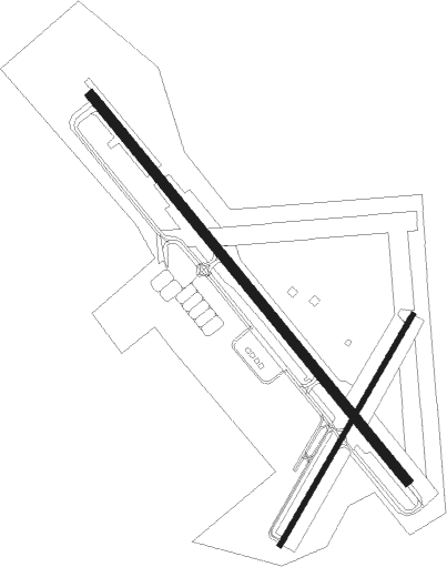
Runway info
Runway 16 / 34  | ||
| length | 2288m (7507ft) | |
| bearing | 137° / 317° | |
| width | 46m (150ft) | |
| surface | asphalt | |
| displ threshold | 0m (0ft) / 122m (400ft) | |
| blast zone | 69m (226ft) / 0m (0ft) | |
| Runway 5 / 23 | ||
| length | 1220m (4003ft) | |
| bearing | 42° / 222° | |
| width | 23m (75ft) | |
| surface | asphalt | |
Nearby beacons
| code | identifier | dist | bearing | frequency |
|---|---|---|---|---|
| PVD | PROVIDENCE VOR/DME | 7.7 | 353° | 115.60 |
| ORW | NORWICH VOR/DME | 26.4 | 266° | 110 |
| SEY | SANDY POINT (BLOCK ISLAND VOR/DME | 26.7 | 201° | 117.80 |
| PUT | PUTNAM VOR/DME | 28.9 | 310° | 117.40 |
| GON | GROTON VOR/DME | 32.8 | 247° | 110.85 |
| OW | STOGE (NORWOOD) NDB | 33.9 | 29° | 397 |
| MVY | MARTHA'S VINEYARD VOR/DME | 37.9 | 104° | 114.50 |
| FMH | OTIS (FALMOUTH) TACAN | 40.5 | 86° | 115.80 |
| BOS | BOSTON VOR/DME | 49.4 | 29° | 112.70 |
| HTO | HAMPTON (EAST HAMPTON) VORTAC | 57.5 | 233° | 113.60 |
| GDM | GARDNER VOR/DME | 63.8 | 326° | 110.60 |
Departure and arrival routes
| Transition altitude | 18000ft |
| Transition level | 18000ft |
| STAR starting points | distance | inbound heading | |
|---|---|---|---|
| ALL | |||
| WIPOR3 | 34.4 | 94° | |
Instrument approach procedures
| runway | airway (heading) | route (dist, bearing) |
|---|---|---|
| RW16 | FOSTY (137°) | FOSTY SALME (5mi, 137°) 2200ft |
| RNAV | SALME 2200ft FALAG (6mi, 137°) 2000ft BEYEL (3mi, 137°) 960ft KOQU (4mi, 139°) 68ft (4577mi, 120°) 218ft BADTA (4569mi, 300°) FALMA (6mi, 126°) 3000ft FALMA (turn) | |
| RW34 | FALMA (313°) | FALMA BADTA (6mi, 306°) 2100ft |
| RNAV | BADTA 2100ft COSAX (2mi, 317°) 2100ft CONEZ (4mi, 317°) 1500ft HULEM (2mi, 317°) 760ft KOQU (3mi, 315°) 60ft (4577mi, 120°) 418ft SALME (4586mi, 300°) FOSTY (5mi, 317°) 2500ft FOSTY (turn) |
Disclaimer
The information on this website is not for real aviation. Use this data with the X-Plane flight simulator only! Data taken with kind consent from X-Plane 12 source code and data files. Content is subject to change without notice.