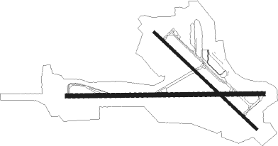
Worcester - Worcester Rgnl
Airport details
| Country | United States of America |
| State | Massachusetts |
| Region | K6 |
| Airspace | Boston Ctr |
| Municipality | Worcester |
| Elevation | 1006ft (307m) |
| Timezone | GMT -5 |
| Coordinates | 42.26714, -71.87561 |
| Magnetic var | |
| Type | land |
| Available since | X-Plane v10.40 |
| ICAO code | KORH |
| IATA code | ORH |
| FAA code | ORH |
Communication
| Worcester Rgnl ATIS | 126.550 |
| Worcester Rgnl CTAF | 120.500 |
| Worcester Rgnl UNICOM | 122.950 |
| Worcester Rgnl Clearance DEL | 128.650 |
| Worcester Rgnl Ground Control | 123.850 |
| Worcester Rgnl Tower | 120.500 |
| Worcester Rgnl BRADLEY Approach/Departure | 119.000 |
Approach frequencies
| ILS-cat-III | RW11 | 110.9 | 18.00mi |
| ILS-cat-I | RW29 | 110.9 | 18.00mi |
| 3° GS | RW29 | 110.9 | 18.00mi |
| 3° GS | RW11 | 110.9 | 18.00mi |
Nearby Points of Interest:
Thomas Lumb Three-Decker
-Liberty Farm
-Washburn Square-Leicester Common Historic District
-Fairlawn
-George Gabriel House
-Samuel Hirst Three-Decker
-Quinsigamond Branch Library
-Chamberlain-Flagg House
-Downing Street School
-Helen Dodge Three-Decker
-William McFarland House
-Levi Flagg Three-Decker
-Elvira Drew Three-Decker
-Abbott Street School
-Thomas Crabtree Three-Decker
-B. E. Ridyard Three-Decker
-Charles A. Hall Three-Decker
-Freeland Street School
-Harry B. Ingraham Three-Decker
-John Wescott Three-Decker
-John B. McDermott Three-Decker
-Elm Street Historic District
-Woodland Street Firehouse
-Norcross Brothers Houses

Nearby beacons
| code | identifier | dist | bearing | frequency |
|---|---|---|---|---|
| GDM | GARDNER VOR/DME | 18.5 | 327° | 110.60 |
| PUT | PUTNAM VOR/DME | 18.7 | 174° | 117.40 |
| CEF | WESTOVER(SPRINGFIELD/CHIC TACAN | 29.2 | 264° | 114 |
| OW | STOGE (NORWOOD) NDB | 34.4 | 101° | 397 |
| EEN | DME | 36.6 | 322° | 109.40 |
| BAF | BARNES (WESTFIELD/SPRINGF VORTAC | 37.9 | 263° | 113 |
| PVD | PROVIDENCE VOR/DME | 38.1 | 141° | 115.60 |
| MJ | FITZY (MANCHESTER) NDB | 38.9 | 30° | 209 |
| BOS | BOSTON VOR/DME | 39.7 | 84° | 112.70 |
| MHT | MANCHESTER VOR/DME | 42.4 | 40° | 114.40 |
| ORW | NORWICH VOR/DME | 43 | 190° | 110 |
| LWM | DME | 44.7 | 59° | 112.50 |
| HFD | HARTFORD VOR/DME | 48.1 | 227° | 114.90 |
| CO | EPSOM (CONCORD) NDB | 54.4 | 26° | 216 |
| GON | GROTON VOR/DME | 56.8 | 191° | 110.85 |
| CON | CONCORD VOR/DME | 58.7 | 17° | 112.90 |
| MAD | MADISON VOR/DME | 67.9 | 221° | 110.40 |
Departure and arrival routes
| Transition altitude | 18000ft |
| Transition level | 18000ft |
| STAR starting points | distance | inbound heading | |
|---|---|---|---|
| ALL | |||
| STELA1 | 71.0 | 98° | |
Instrument approach procedures
| runway | airway (heading) | route (dist, bearing) |
|---|---|---|
| RW11 | BAF (83°) | BAF SPENO (26mi, 78°) 3000ft |
| RW11 | WITNY (59°) | WITNY SPENO (14mi, 20°) 3000ft |
| RNAV | SPENO 3000ft RILOC (6mi, 93°) 2800ft KORH (6mi, 93°) 1035ft (4606mi, 120°) 1180ft SPAGS (4600mi, 300°) 2700ft SPAGS (turn) | |
| RW29 | WHYBE (272°) | WHYBE DEWEE (9mi, 270°) 3000ft |
| RNAV | DEWEE 3000ft SPAGS (6mi, 273°) 2700ft KORH (6mi, 273°) 1042ft (4606mi, 120°) 1190ft RILOC (4612mi, 300°) 3000ft RILOC (turn) | |
| RW33 | GDM (147°) | GDM BOSOX (28mi, 129°) 3600ft PAMLA (5mi, 232°) 3000ft |
| RW33 | GRAYM (43°) | GRAYM TROYY (11mi, 95°) 3000ft PAMLA (5mi, 56°) 3000ft |
| RW33 | PUT (354°) | PUT TROYY (8mi, 21°) 3000ft PAMLA (5mi, 56°) 3000ft |
| RNAV | PAMLA 3000ft SLOWW (6mi, 309°) 2400ft KORH (5mi, 308°) 1038ft (4606mi, 120°) 1410ft GRIPE (4606mi, 300°) 3000ft GRIPE (turn) |
Holding patterns
| STAR name | hold at | type | turn | heading* | altitude | leg | speed limit |
|---|---|---|---|---|---|---|---|
| STELA1 | STELA | VHF | right | 327 (147)° | < 14000ft | 1.0min timed | ICAO rules |
| *) magnetic outbound (inbound) holding course | |||||||
Disclaimer
The information on this website is not for real aviation. Use this data with the X-Plane flight simulator only! Data taken with kind consent from X-Plane 12 source code and data files. Content is subject to change without notice.