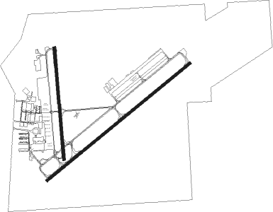
North Little Rock - North Little Rock Muni
Airport details
| Country | United States of America |
| State | Arkansas |
| Region | K4 |
| Airspace | Memphis Ctr |
| Municipality | North Little Rock |
| Elevation | 543ft (166m) |
| Timezone | GMT -6 |
| Coordinates | 34.83314, -92.25414 |
| Magnetic var | |
| Type | land |
| Available since | X-Plane v10.40 |
| ICAO code | KORK |
| IATA code | n/a |
| FAA code | ORK |
Communication
| North Little Rock Muni CTAF/UNICOM | 123.075 |
| North Little Rock Muni LITTLE ROCK Approach/Departure | 119.500 |
Approach frequencies
| LOC | RW05 | 111.9 | 18.00mi |
Nearby Points of Interest:
Sylvan Hills Country Club Golf Course
-Lakewood Park
-Edgemere Street Bridge
-T. R. Pugh Memorial Park
-Amboy Overpass
-Park Hill Fire Station and Water Company Complex
-Pruniski House
-Barney L. Elias House
-Duffy House
-Kleiber House
-Matthews-Dillon House
-Matthews-Godt House
-Cherry House
-Justin Matthews Jr. House
-Joseph E. England, Jr., House
-Matthews-MacFadyen House
-Bailey Allinder House
-Matthews-Bryan House
-Owings House
-Jeffries House
-Matthews-Bradshaw House
-North Little Rock High School
-Engelberger House
-Roundtop Filling Station
-Barth-Hempfling House

Nearby beacons
| code | identifier | dist | bearing | frequency |
|---|---|---|---|---|
| LRF | JACKSONVILLE TACAN | 6.9 | 49° | 109.20 |
| LIT | LITTLE ROCK VORTAC | 10 | 155° | 113.90 |
| LI | LASKY (LITTLE ROCK) NDB | 10.1 | 197° | 353 |
| DS | CERCY (SEARCY) NDB | 29.8 | 60° | 375 |
| TT | STUTT (STUTTGART) NDB | 38.5 | 116° | 338 |
| PBF | PINE BLUFF VOR/DME | 38.7 | 151° | 116 |
| HOT | HOT SPRINGS VOR/DME | 46.4 | 247° | 110 |
| RUE | RUSSELLVILLE NDB | 48.5 | 297° | 379 |
| HO | HOSSY (HOT SPRINGS) NDB | 52.3 | 246° | 385 |
| BV | ALMND (BATESVILLE) NDB | 56.8 | 28° | 335 |
Instrument approach procedures
| runway | airway (heading) | route (dist, bearing) |
|---|---|---|
| RW05 | BEGAN (55°) | BEGAN TADAW (10mi, 49°) 2400ft |
| RW05 | PARON (76°) | PARON TADAW (9mi, 96°) 2400ft |
| RNAV | TADAW 2400ft IYASO (7mi, 60°) 2200ft ZABDO (3mi, 60°) 1120ft KORK (2mi, 58°) 581ft (5516mi, 111°) 854ft SICOD (5514mi, 291°) BRAUM (11mi, 80°) 2000ft BRAUM (turn) | |
| RW35 | CIPOP (1°) | CIPOP 3300ft |
| RW35 | HOBER (333°) | HOBER CIPOP (5mi, 270°) 3300ft |
| RW35 | JENAN (35°) | JENAN CIPOP (7mi, 90°) 3300ft |
| RNAV | CIPOP 3300ft AJIMO (7mi, 360°) 2200ft RASNE (5mi, 360°) 743ft (5516mi, 111°) 945ft JENAN (5523mi, 291°) 3300ft JENAN (turn) |
Disclaimer
The information on this website is not for real aviation. Use this data with the X-Plane flight simulator only! Data taken with kind consent from X-Plane 12 source code and data files. Content is subject to change without notice.