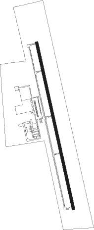
Mount Pleasant - Mount Pleasant Rgnl
Airport details
| Country | United States of America |
| State | Texas |
| Region | K4 |
| Airspace | Ft Worth Ctr |
| Municipality | Mount Pleasant |
| Elevation | 360ft (110m) |
| Timezone | GMT -6 |
| Coordinates | 33.09735, -94.96340 |
| Magnetic var | |
| Type | land |
| Available since | X-Plane v10.40 |
| ICAO code | KOSA |
| IATA code | n/a |
| FAA code | OSA |
Communication
| Mount Pleasant Rgnl AWOS 3 | 119.775 |
| Mount Pleasant Rgnl CTAF/UNICOM | 122.700 |
| Mount Pleasant Rgnl FORT WORTH CNTR | 132.025 |
Nearby Points of Interest:
Pittsburg Commercial Historic District
-Marcus DeWitt Carlock House
-Pleasant Hill School
-Cass County Courthouse
-Hopkins County Courthouse
-Florence Robinson Cottage
Nearby beacons
| code | identifier | dist | bearing | frequency |
|---|---|---|---|---|
| UIM | DME | 24.1 | 242° | 114 |
| SLR | SULPHUR SPRINGS VOR/DME | 29.7 | 280° | 109 |
| ABG | AMBASSADOR (BIG SANDY) NDB | 31.6 | 196° | 404 |
| PRX | PARIS VOR/DME | 36.1 | 313° | 113.60 |
| ATA | ATLANTA NDB | 38.9 | 89° | 347 |
| GG | VEELS (LONGVIEW) NDB | 39.4 | 166° | 410 |
| GGG | GREGG CO. (LONGVIEW) VORTAC | 42.1 | 163° | 112.90 |
| TYR | TYLER VOR/DME | 49.7 | 211° | 114.20 |
| TXK | TEXARKANA VORTAC | 51.2 | 65° | 116.30 |
| RPF | CARTHAGE NDB | 64.5 | 144° | 332 |
Instrument approach procedures
| runway | airway (heading) | route (dist, bearing) |
|---|---|---|
| RW17 | AVORE (171°) | AVORE 2000ft |
| RW17 | CAMTU (144°) | CAMTU 2600ft AVORE (5mi, 83°) 2000ft |
| RW17 | HIBOS (198°) | HIBOS 2100ft AVORE (5mi, 263°) 2000ft |
| RNAV | AVORE 2000ft FENDI (6mi, 170°) 2000ft KOSA (5mi, 171°) 403ft JAVOT (12mi, 170°) 2100ft JAVOT (turn) | |
| RW35 | AVIBE (17°) | AVIBE 2600ft JAVOT (5mi, 83°) 2100ft |
| RW35 | BUNLE (324°) | BUNLE 2500ft JAVOT (5mi, 263°) 2100ft |
| RW35 | JAVOT (350°) | JAVOT 2100ft |
| RNAV | JAVOT 2100ft CENSO (6mi, 350°) 2000ft KOSA (6mi, 350°) 386ft AVORE (12mi, 351°) 2000ft AVORE (turn) |
Disclaimer
The information on this website is not for real aviation. Use this data with the X-Plane flight simulator only! Data taken with kind consent from X-Plane 12 source code and data files. Content is subject to change without notice.