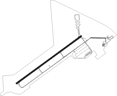
Oscoda - Oscoda Wurtsmith
Airport details
| Country | United States of America |
| State | Michigan |
| Region | K5 |
| Airspace | Minneapolis Ctr |
| Municipality | Oscoda Township |
| Elevation | 631ft (192m) |
| Timezone | GMT -5 |
| Coordinates | 44.45153, -83.39417 |
| Magnetic var | |
| Type | land |
| Available since | X-Plane v10.40 |
| ICAO code | KOSC |
| IATA code | OSC |
| FAA code | OSC |
Communication
| Oscoda Wurtsmith CTAF/UNICOM | 123.000 |
Approach frequencies
| ILS-cat-I | RW25 | 108.5 | 18.00mi |
| 3° GS | RW25 | 108.5 | 18.00mi |
Nearby Points of Interest:
Tawas Point Light
-Sturgeon Point Light
-Alabaster Historic District
Nearby beacons
| code | identifier | dist | bearing | frequency |
|---|---|---|---|---|
| ASP | SABLE (OSCODA) DME | 0.1 | 183° | 116.10 |
| AP | FELPS (ALPENA) NDB | 31.3 | 342° | 206 |
| APN | ALPENA VORTAC | 38.5 | 346° | 108.80 |
| MBS | SAGINAW VOR/DME | 62.6 | 217° | 112.90 |
| MB | OLSTE (SAGINAW) NDB | 68.4 | 218° | 257 |
Instrument approach procedures
| runway | airway (heading) | route (dist, bearing) |
|---|---|---|
| RW07 | CEDPA (66°) | CEDPA 6000ft CEDPA (turn) 3000ft |
| RW07 | SNOWW (55°) | SNOWW CEDPA (18mi, 46°) 3000ft |
| RW07 | TUSYU (94°) | TUSYU CEDPA (10mi, 139°) 3000ft |
| RNAV | CEDPA 3000ft MUBIE (6mi, 66°) 2500ft PEROY (3mi, 66°) 1380ft KOSC (3mi, 66°) 688ft (5122mi, 118°) 892ft KOWKU (5112mi, 298°) 2500ft KOWKU (turn) | |
| RW25 | AILES (144°) | AILES ODAXY (22mi, 111°) 2600ft KOWKU (5mi, 139°) 2500ft |
| RW25 | KOWKU (246°) | KOWKU 6000ft KOWKU (turn) 2500ft |
| RW25 | SNOWW (55°) | SNOWW JAVOD (42mi, 64°) 2500ft KOWKU (5mi, 319°) 2500ft |
| RW25 | ZABLE (105°) | ZABLE ODAXY (46mi, 93°) 2900ft KOWKU (5mi, 139°) 2500ft |
| RNAV | KOWKU 2500ft SALTR (6mi, 246°) 2500ft KOSC (7mi, 246°) 676ft (5122mi, 118°) 824ft CEDPA (5132mi, 298°) 3000ft CEDPA (turn) |
Disclaimer
The information on this website is not for real aviation. Use this data with the X-Plane flight simulator only! Data taken with kind consent from X-Plane 12 source code and data files. Content is subject to change without notice.
