Oshkosh - Wittman Regl.
Airport details
| Country | United States of America |
| State | Wisconsin |
| Region | K5 |
| Airspace | Chicago Ctr |
| Municipality | Oshkosh |
| Elevation | 808ft (246m) |
| Timezone | GMT -6 |
| Coordinates | 43.98449, -88.55694 |
| Magnetic var | |
| Type | land |
| Available since | X-Plane v10.40 |
| ICAO code | KOSH |
| IATA code | OSH |
| FAA code | OSH |
Communication
| Wittman Regl. Wittman ATIS | 125.900 |
| Wittman Regl. CTAF | 118.500 |
| Wittman Regl. Oshkosh Ground | 132.300 |
| Wittman Regl. Oshkosh Tower | 118.500 |
Approach frequencies
| ILS-cat-I | RW36 | 110.5 | 18.00mi |
| 3° GS | RW36 | 110.5 | 18.00mi |
Nearby Points of Interest:
Robert Lutz House
-Brooklyn No. 4 Fire House
-Trinity Episcopal Church
-First Methodist Church
-Richard Guenther House
-Oviatt House
-Jessie Jack Hooper House
-Algoma Boulevard United Methodist Church
-Algoma Boulevard Historic District
-Omro Village Hall and Engine House
-Sisson's Peony Gardens
-George O. Bergstrom House
-Franklyn C. Shattuck House
-Havilah Babcock House
-Hiram Smith House
-Henry Sherry House
-Aetna Station No. 5
-Neenah Light
-Edward D. & Vina Shattuck Beals House
-Wallace-Jagdfeld Octagon House
-Ellis Jennings House
-Judge J. C. Kerwin House
-St. John the Baptist Catholic Church
-El Dorado Apartments
-Henry Spencer Smith House
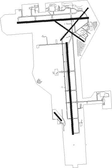
Runway info
Runway 18 / 36  | ||
| length | 2442m (8012ft) | |
| bearing | 181° / 1° | |
| width | 46m (150ft) | |
| surface | concrete | |
| Runway 9 / 27 | ||
| length | 1885m (6184ft) | |
| bearing | 90° / 270° | |
| width | 46m (150ft) | |
| surface | concrete | |
| displ threshold | 0m (0ft) / 164m (538ft) | |
| Runway 5 / 23 | ||
| length | 1125m (3691ft) | |
| bearing | 54° / 234° | |
| width | 23m (75ft) | |
| surface | asphalt | |
| displ threshold | 0m (0ft) / 84m (276ft) | |
| Runway 13 / 31 | ||
| length | 940m (3084ft) | |
| bearing | 121° / 301° | |
| width | 23m (75ft) | |
| surface | asphalt | |
| Runway 14 / 32 | ||
| length | 280m (919ft) | |
| bearing | 134° / 314° | |
| width | 29m (95ft) | |
| surface | grass | |
Nearby beacons
| code | identifier | dist | bearing | frequency |
|---|---|---|---|---|
| OSH | OSHKOSH VORTAC | 0.3 | 10° | 116.75 |
| OS | POBER (OSHKOSH) NDB | 6.6 | 180° | 395 |
| AQ | KOOKY (APPLETON) NDB | 15.4 | 34° | 407 |
| GR | FAMIS (GREEN BAY) NDB | 30.6 | 35° | 356 |
| SG | DEPRE (GREEN BAY) NDB | 30.8 | 46° | 332 |
| FAH | (SHEBOYGAN) DME | 33.2 | 107° | 110 |
| UNU | JUNEAU NDB | 33.9 | 195° | 344 |
| GRB | GREEN BAY VORTAC | 37.6 | 32° | 115.50 |
| BJB | WEST BEND VOR | 38.6 | 142° | 109.80 |
| MTW | DME | 38.8 | 81° | 111 |
| MT | MAWOC (MANITOWOC) NDB | 39 | 76° | 362 |
| RYV | ROCK RIVER (WATERTOWN) NDB | 49.2 | 192° | 371 |
| BAE | BADGER (MILWAUKEE) VOR/DME | 53.4 | 163° | 116.40 |
| LJT | (MILWAUKEE) DME | 57.1 | 149° | 115.65 |
| MSN | MADISON VORTAC | 60.8 | 223° | 108.60 |
Instrument approach procedures
| runway | airway (heading) | route (dist, bearing) |
|---|---|---|
| RW09 | HETUP (92°) | HETUP 3000ft |
| RW09 | RICIB (113°) | RICIB 3000ft HETUP (6mi, 181°) 3000ft |
| RW09 | WUVMO (71°) | WUVMO 3000ft HETUP (6mi, 1°) 3000ft |
| RNAV | HETUP 3000ft CEKEP (6mi, 90°) 2500ft JAGEP (3mi, 90°) 1380ft KOSH (2mi, 98°) 847ft (5343mi, 116°) 1055ft PRIMO (5331mi, 296°) 3000ft PRIMO (turn) | |
| RW18 | FAVBU (181°) | FAVBU 3000ft |
| RW18 | JEXIV (219°) | JEXIV 3000ft FAVBU (6mi, 270°) 3000ft |
| RW18 | JOBNA (143°) | JOBNA 3000ft FAVBU (6mi, 90°) 3000ft |
| RNAV | FAVBU 3000ft DAGTE (6mi, 181°) 2500ft COKPA (3mi, 181°) 1440ft KOSH (2mi, 182°) 837ft (5343mi, 116°) 1040ft DOCEN (5343mi, 296°) 2800ft DOCEN (turn) | |
| RW27 | IGVEW (290°) | IGVEW 3000ft PRIMO (6mi, 1°) 3000ft |
| RW27 | PRIMO (269°) | PRIMO 3000ft |
| RW27 | YEGUC (248°) | YEGUC 3000ft PRIMO (6mi, 181°) 3000ft |
| RNAV | PRIMO 3000ft PEENA (6mi, 271°) 2600ft KOSH (6mi, 267°) 825ft (5343mi, 116°) 1028ft HETUP (5355mi, 296°) 3000ft HETUP (turn) | |
| RW36 | DOCEN (1°) | DOCEN 2800ft |
| RW36 | WIGIH (34°) | WIGIH 2800ft DOCEN (6mi, 90°) 2800ft |
| RW36 | YATUD (327°) | YATUD 2800ft DOCEN (6mi, 270°) 2800ft |
| RNAV | DOCEN 2800ft WIVLI (7mi, 1°) 2500ft JUMVO (3mi, 1°) 1460ft KOSH (3mi, 0°) 861ft (5343mi, 116°) 1008ft FAVBU (5343mi, 297°) 2800ft FAVBU (turn) |
Disclaimer
The information on this website is not for real aviation. Use this data with the X-Plane flight simulator only! Data taken with kind consent from X-Plane 12 source code and data files. Content is subject to change without notice.