Columbus - Ohio State University
Airport details
| Country | United States of America |
| State | Ohio |
| Region | K5 |
| Airspace | Indianapolis Ctr |
| Municipality | Columbus |
| Elevation | 899ft (274m) |
| Timezone | GMT -5 |
| Coordinates | 40.08478, -83.06853 |
| Magnetic var | |
| Type | land |
| Available since | X-Plane v10.40 |
| ICAO code | KOSU |
| IATA code | OSU |
| FAA code | OSU |
Communication
| Ohio State University ATIS | 121.350 |
| Ohio State University CTAF | 118.800 |
| Ohio State University UNICOM | 122.950 |
| Ohio State University Ground Control/CLEARANCE DELIVERY | 121.700 |
| Ohio State University Tower | 118.800 |
| Ohio State University COLUMBUS Approach/Departure | 125.950 |
Approach frequencies
| ILS-cat-I | RW09R | 108.5 | 18.00mi |
| 3° GS | RW09R | 108.5 | 18.00mi |
Nearby Points of Interest:
Brelsford-Seese House
-Demas Adams House
-Artz House
-Gilbert House
-Samuel Davis House
-Asher Brand Residence
-Highbank Park Works
-Myer House
-A.B. Graham House
-Richard Berry Jr. House
-Truman and Sylvia Bull Coe House
-Saint Paul's Episcopal Church
-Highbanks Metropolitan Park Mounds I and II
-Columbus International High School
-Open Air School
-Dr. James Merryman House
-Hilliard Methodist Episcopal Church
-Odd Fellows Hall
-Carl H. Shier Farm
-Indianola Junior High School
-Hale Hall
-Pataskala Presbyterian Church
-Pataskala United Methodist Church
-Gooding House and Tavern
-Felix A. Jacobs House
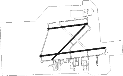
Runway info
Runway 9R / 27L  | ||
| length | 1522m (4993ft) | |
| bearing | 88° / 268° | |
| width | 30m (98ft) | |
| surface | asphalt | |
| blast zone | 58m (190ft) / 61m (200ft) | |
| Runway 5 / 23 | ||
| length | 1084m (3556ft) | |
| bearing | 56° / 236° | |
| width | 30m (98ft) | |
| surface | asphalt | |
| blast zone | 31m (102ft) / 31m (102ft) | |
| Runway 9L / 27R | ||
| length | 908m (2979ft) | |
| bearing | 88° / 268° | |
| width | 30m (98ft) | |
| surface | asphalt | |
Nearby beacons
| code | identifier | dist | bearing | frequency |
|---|---|---|---|---|
| OS | FULER (COLUMBUS) NDB | 5.9 | 265° | 515 |
| LC | PICKL (COLUMBUS) NDB | 16.2 | 131° | 376 |
| BU | BOUTN (COLUMBUS) NDB | 17.1 | 207° | 230 |
| LCK | RICKENBACKER (COLUMBUS) TACAN | 17.8 | 153° | 134.20 |
| DD | COBBS (COLUMBUS) NDB | 20.6 | 172° | 253 |
| APE | APPLETON VORTAC | 22.4 | 82° | 116.70 |
| BUD | BUCKEYE (MARION) VOR | 31.9 | 1° | 109.80 |
| CSS | COURT HOUSE (WASHINGTON) NDB | 32.6 | 214° | 414 |
| XUB | YELLOW BUD (CIRCLEVILLE) VOR | 33.7 | 171° | 112.50 |
| XSF | SPRINGFIELD TACAN | 38.5 | 252° | 133.80 |
| SGH | DME | 38.7 | 252° | 113.20 |
| ROD | ROSEWOOD VORTAC | 46.3 | 282° | 117.50 |
| IL | AIRBO (WILMINGTON) NDB | 47 | 229° | 407 |
| FFO | PATTERSON (DAYTON) TACAN | 48.1 | 255° | 115.20 |
| MF | MANNS (MANSFIELD) NDB | 49.8 | 42° | 372 |
| MFD | MANSFIELD VORTAC | 51.8 | 31° | 108.80 |
| MXQ | MIDWEST (WILMINGTON) VOR/DME | 51.8 | 228° | 112.90 |
| EOP | WAVERLY NDB | 55.4 | 172° | 385 |
| HW | CUBLA (WILMINGTON) NDB | 57.6 | 228° | 299 |
| FBC | FLAG CITY VORTAC | 60.9 | 322° | 108.20 |
| UGS | UNIVERSITY (ATHENS) NDB | 66 | 131° | 250 |
Departure and arrival routes
| Transition altitude | 18000ft |
| Transition level | 18000ft |
| SID end points | distance | outbound heading | |
|---|---|---|---|
| RW09 (ALL) | |||
| NCLUS2 | 23mi | 210° | |
| RW27 (ALL) | |||
| NCLUS2 | 23mi | 210° | |
| STAR starting points | distance | inbound heading | |
|---|---|---|---|
| ALL | |||
| JAKTZ1 | 33.7 | 35° | |
| DUBLN1 | 15.9 | 142° | |
| CBUSS2 | 40.2 | 232° | |
| CLPRR1 | 51.4 | 296° | |
| SCRLT1 | 48.1 | 309° | |
Instrument approach procedures
| runway | airway (heading) | route (dist, bearing) |
|---|---|---|
| RW09R | APE (262°) | APE GLYBU (34mi, 264°) 3000ft GLYBU (turn) 3000ft |
| RW09R | MECAN (90°) | MECAN GLYBU (9mi, 96°) 3000ft |
| RNAV | GLYBU 3000ft YOPDU (6mi, 88°) 2600ft KOSU (6mi, 84°) 952ft (5087mi, 116°) 1101ft KOLNY (5077mi, 296°) 3200ft KOLNY (turn) | |
| RW27L | APE (262°) | APE KOLNY (12mi, 256°) 3000ft |
| RW27L | DIPNE (113°) | DIPNE KOLNY (13mi, 95°) 3000ft KOLNY (turn) 3000ft |
| RNAV | KOLNY 3000ft RITOQ (5mi, 268°) 2500ft HUBIM (3mi, 268°) 1420ft KOSU (2mi, 278°) 934ft (5087mi, 116°) 1139ft GLYBU (5099mi, 296°) 3200ft GLYBU (turn) |
Holding patterns
| STAR name | hold at | type | turn | heading* | altitude | leg | speed limit |
|---|---|---|---|---|---|---|---|
| DUBLN1 | IKALE | VHF | right | 261 (81)° | DME 15.0mi | ICAO rules | |
| DUBLN1 | JADUB | VHF | right | 260 (80)° | DME 15.0mi | ICAO rules | |
| JAKTZ1 | JAKTZ | VHF | left | 251 (71)° | DME 15.0mi | ICAO rules | |
| JAKTZ1 | JIMUR | VHF | left | 241 (61)° | DME 15.0mi | ICAO rules | |
| *) magnetic outbound (inbound) holding course | |||||||
Disclaimer
The information on this website is not for real aviation. Use this data with the X-Plane flight simulator only! Data taken with kind consent from X-Plane 12 source code and data files. Content is subject to change without notice.