Oroville
Airport details
| Country | United States of America |
| State | California |
| Region | K2 |
| Airspace | Oakland Ctr |
| Municipality | Oroville |
| Elevation | 190ft (58m) |
| Timezone | GMT -8 |
| Coordinates | 39.48780, -121.62200 |
| Magnetic var | |
| Type | land |
| Available since | X-Plane v10.40 |
| ICAO code | KOVE |
| IATA code | OVE |
| FAA code | OVE |
Communication
| Oroville ASOS | 121.425 |
| Oroville CTAF/UNICOM | 122.800 |
| Oroville NORCAL Approach/Departure | 125.400 |
Nearby Points of Interest:
Old Bidwell Bar Bridge
-Live Oak Historic Commercial District
-A. H. Chapman House
-Chico Midtown Station
-Silberstein Park Building
-South Campus Neighborhood
-Packard Library
-Hart Building
-West Butte Schoolhouse
-Gianella Bridge
-Colusa Carnegie Library
-United States Post Office (Willows, California)
-Wheatland Masonic Temple
-Grass Valley Public Library
-North Star House
-Aaron A. Sargent House
-Doris Foley Library for Historical Research
-Nevada City Firehouse No. 2
-Nevada City Downtown Historic District
-Ott's Assay Office
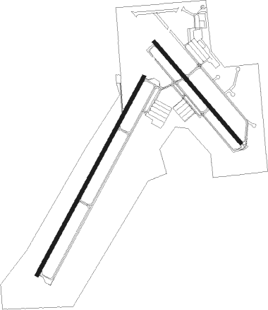
Runway info
Runway 2 / 20  | ||
| length | 1836m (6024ft) | |
| bearing | 40° / 220° | |
| width | 30m (100ft) | |
| surface | asphalt | |
| blast zone | 46m (151ft) / 255m (837ft) | |
| Runway 13 / 31 | ||
| length | 1079m (3540ft) | |
| bearing | 137° / 317° | |
| width | 30m (100ft) | |
| surface | asphalt | |
| blast zone | 255m (837ft) / 20m (66ft) | |
Nearby beacons
| code | identifier | dist | bearing | frequency |
|---|---|---|---|---|
| BAB | BEALE (MARYSVILLE) TACAN | 22.8 | 153° | 108.60 |
| MYV | MARYSVILLE VOR/DME | 23.4 | 173° | 110.80 |
| ILA | WILLIAMS VORTAC | 31.3 | 224° | 114.40 |
| RBL | RED BLUFF VORTAC | 46.3 | 315° | 115.70 |
| MCC | MC CLELLAN (SACRAMENTO) VOR/DME | 50.3 | 165° | 109.20 |
| HNW | HANGTOWN (PLACERVILLE) VOR/DME | 61.2 | 131° | 115.50 |
Instrument approach procedures
| runway | airway (heading) | route (dist, bearing) |
|---|---|---|
| RW02 | MRGGO (308°) | MRGGO ESVOW (24mi, 280°) 3600ft ESVOW (turn) 3600ft |
| RW02 | YUBBA (22°) | YUBBA ESVOW (11mi, 360°) 3600ft |
| RNAV | ESVOW 3600ft IXACE (6mi, 40°) 2100ft VIGCE (4mi, 40°) 820ft KOVE (3mi, 42°) 222ft (6839mi, 108°) 650ft MRGGO (6830mi, 288°) 6000ft MRGGO (turn) |
Disclaimer
The information on this website is not for real aviation. Use this data with the X-Plane flight simulator only! Data taken with kind consent from X-Plane 12 source code and data files. Content is subject to change without notice.