Oxford - Miami University
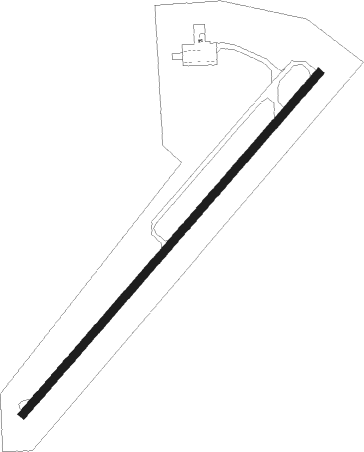
Airport details
| Country | United States of America |
| State | Ohio |
| Region | K5 |
| Airspace | Indianapolis Ctr |
| Municipality | Oxford Township |
| Elevation | 1040ft (317m) |
| Timezone | GMT -5 |
| Coordinates | 39.50225, -84.78436 |
| Magnetic var | |
| Type | land |
| Available since | X-Plane v10.40 |
| ICAO code | KOXD |
| IATA code | OXD |
| FAA code | OXD |
Communication
| Miami University CTAF/UNICOM | 122.800 |
Nearby Points of Interest:
Oxford Railroad Depot and Junction House
-Oxford Female Institute
-Dr. William S. Alexander House
-Elias Kumler House
-Henry Maltby House
-William H. McGuffey House
-Elliott and Stoddard Halls
-Herron Gymnasium
-Sigma Alpha Epsilon Chapter House of Miami University
-Langstroth Cottage
-Austin-Magie Farm and Mill District
-Hunting Lodge Farm
-James P. Hidley Cottage
-Lane's Mill Historic Buildings
-Joseph Shafer Farm
-Unzicker-Cook House
-Roberts Mound
-Beckett-Manrod House
-Matthew Hueston House
-Cochran Farm
-Liberty Residential Historic District
-Union County Courthouse
-Liberty Courthouse Square Historic District
-Edgeton
-Thomas Select School
Nearby beacons
| code | identifier | dist | bearing | frequency |
|---|---|---|---|---|
| RID | RICHMOND VOR/DME | 15.3 | 348° | 110.60 |
| HKF | HOOK FIELD (MIDDLETOWN) NDB | 15.6 | 91° | 239 |
| MW | ONIDA (MIDDLETOWN) NDB | 21.8 | 81° | 223 |
| SQ | PNTHR (CONNERSVILLE) NDB | 22.9 | 309° | 227 |
| HLB | BATESVILLE NDB | 23.9 | 252° | 254 |
| AT | BRUNY (DAYTON) NDB | 29.3 | 53° | 315 |
| CVG | CINCINNATI VORTAC | 29.4 | 171° | 117.30 |
| UWL | NEW CASTLE NDB | 33.5 | 305° | 385 |
| DQN | DAYTON VOR/DME | 35.6 | 37° | 114.50 |
| PWF | SPORTYS (BATAVIA) NDB | 36.7 | 127° | 245 |
| FFO | PATTERSON (DAYTON) TACAN | 38.6 | 67° | 115.20 |
| AWW | WINCHESTER NDB | 40.4 | 348° | 212 |
| HW | CUBLA (WILMINGTON) NDB | 43 | 99° | 299 |
| MXQ | MIDWEST (WILMINGTON) VOR/DME | 45.7 | 94° | 112.90 |
| JN | BALLL (MUNCIE) NDB | 47.6 | 322° | 365 |
| MI | BALLL (MUNCIE) NDB | 47.6 | 322° | 365 |
| AI | VIDEO (ANDERSON) NDB | 47.7 | 308° | 394 |
| SGH | DME | 47.8 | 70° | 113.20 |
| XSF | SPRINGFIELD TACAN | 48 | 70° | 133.80 |
| MIE | MUNCIE VOR/DME | 52.3 | 320° | 114.40 |
| GVR | (MADISON) DME | 54.9 | 223° | 114.65 |
| FLM | FALMOUTH VOR/DME | 55.7 | 151° | 117 |
| ROD | ROSEWOOD VORTAC | 58.2 | 43° | 117.50 |
| MZZ | MARION VOR/DME | 72.3 | 318° | 108.60 |
Instrument approach procedures
| runway | airway (heading) | route (dist, bearing) |
|---|---|---|
| RW05 | FETAV (77°) | FETAV 3000ft JOSPU (9mi, 110°) 3000ft |
| RW05 | JOSPU (53°) | JOSPU 3000ft |
| RW05 | ZIBUR (21°) | ZIBUR 3000ft JOSPU (9mi, 330°) 3000ft |
| RNAV | JOSPU 3000ft WIRGO (7mi, 53°) 2600ft UHOBI (3mi, 53°) 1600ft KOXD (2mi, 53°) 1085ft (5164mi, 115°) 1303ft JUSAL (5155mi, 295°) 3000ft JUSAL (turn) | |
| RW23 | JUSAL (233°) | JUSAL 3000ft |
| RW23 | YIVUN (258°) | YIVUN 3000ft JUSAL (9mi, 290°) 3000ft |
| RW23 | ZITIS (202°) | ZITIS 3000ft JUSAL (9mi, 150°) 3000ft |
| RNAV | JUSAL 3000ft WUPIP (7mi, 233°) 2600ft USOPY (3mi, 233°) 1580ft KOXD (2mi, 233°) 1079ft (5164mi, 115°) 1400ft JOSPU (5172mi, 295°) 3000ft JOSPU (turn) |
Disclaimer
The information on this website is not for real aviation. Use this data with the X-Plane flight simulator only! Data taken with kind consent from X-Plane 12 source code and data files. Content is subject to change without notice.