St Marys - St Marys Muni
Airport details
| Country | United States of America |
| State | Pennsylvania |
| Region | K6 |
| Airspace | Cleveland Ctr |
| Municipality | Saint Marys |
| Elevation | 1934ft (589m) |
| Timezone | GMT -5 |
| Coordinates | 41.41248, -78.50263 |
| Magnetic var | |
| Type | land |
| Available since | X-Plane v10.40 |
| ICAO code | KOYM |
| IATA code | STQ |
| FAA code | OYM |
Communication
| St Marys Muni AWOS 3 | 118.050 |
| St Marys Muni CTAF/UNICOM | 122.700 |
Approach frequencies
| LOC | RW28 | 108.9 | 18.00mi |
Nearby Points of Interest:
John E. Weidenboerner House
-St. Marys Historic District
-Johnsonburg Commercial Historic District
-Ridgway Historic District
-Ridgway Armory
-O.B. Grant House
-Bonifels
-Swedish Lutheran Parsonage
-Parker Dam State Park Family Cabin District
-Redferd Segers House
-Brockway station
-S. B. Elliott State Park Day Use District
-S. B. Elliott State Park Family Cabin District
-Anoatok
-Thomas L. Kane Memorial Chapel
-Kane Armory
-DuBois Historic District
-Kinzua Bridge
-Old Town Historic District
-Clearfield County Courthouse
-Thomas Murray House
-Gomez Mill House
-Clearfield Armory
-Joseph F. and Anna B. Schrot Farm
-Herpel Brothers Foundry and Machine Shop
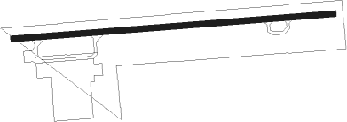
Runway info
| Runway 10 / 28 | ||
| length | 1308m (4291ft) | |
| bearing | 90° / 270° | |
| width | 23m (75ft) | |
| surface | asphalt | |
| blast zone | 46m (151ft) / 0m (0ft) | |
Nearby beacons
| code | identifier | dist | bearing | frequency |
|---|---|---|---|---|
| ETG | KEATING VORTAC | 20.1 | 119° | 116 |
| BFD | DME | 23 | 343° | 116.60 |
| SLT | SLATE RUN VORTAC | 24.7 | 79° | 113.90 |
| PSB | PHILIPSBURG VORTAC | 37.6 | 134° | 115.50 |
| TDT | DME | 44.8 | 288° | 117.60 |
| UN | PENUE (STATE COLLEGE) NDB | 45.7 | 123° | 388 |
| CIP | DME | 45.9 | 254° | 112.90 |
| ELZ | DME | 46.4 | 37° | 111.40 |
| REC | REVLOC VOR/DME | 53.1 | 196° | 110.60 |
| JHW | JAMESTOWN VOR/DME | 54.2 | 321° | 114.70 |
Instrument approach procedures
| runway | airway (heading) | route (dist, bearing) |
|---|---|---|
| RW10 | DETPE (99°) | DETPE PUNKS (12mi, 107°) 4000ft |
| RNAV | PUNKS 4000ft CIMLO (6mi, 90°) 3600ft KOYM (5mi, 90°) 1942ft (4889mi, 118°) 2334ft MINSK (4878mi, 298°) 4000ft MINSK (turn) | |
| RW28 | ETG (299°) | ETG MINSK (13mi, 331°) 4000ft |
| RW28 | SLT (259°) | SLT MINSK (14mi, 250°) 4000ft |
| RNAV | MINSK 4000ft LYCEE (6mi, 270°) 3600ft ELOCI (2mi, 270°) 3040ft KOYM (4mi, 270°) 1974ft (4889mi, 118°) 2290ft PUNKS (4900mi, 298°) 4000ft PUNKS (turn) |
Disclaimer
The information on this website is not for real aviation. Use this data with the X-Plane flight simulator only! Data taken with kind consent from X-Plane 12 source code and data files. Content is subject to change without notice.