Pikeville - Pike Co.- Hatcher Field
Airport details
| Country | United States of America |
| State | Kentucky |
| Region | K5 |
| Airspace | Indianapolis Ctr |
| Municipality | Pikeville |
| Elevation | 1473ft (449m) |
| Timezone | GMT -5 |
| Coordinates | 37.56181, -82.56644 |
| Magnetic var | |
| Type | land |
| Available since | X-Plane v10.40 |
| ICAO code | KPBX |
| IATA code | PVL |
| FAA code | PBX |
Communication
| Pike Co.- Hatcher Field CTAF/UNICOM | 122.800 |
Approach frequencies
| ILS-cat-I | RW27 | 109.7 | 18.00mi |
| 3° GS | RW27 | 109.7 | 18.00mi |
Nearby Points of Interest:
Chesapeake and Ohio Passenger Depot
-Pikeville College Academy Building
-Methodist Episcopal Church, South (Prestonsburg, Kentucky)
-Samuel May House
-Mine No. 5 Store
-Foster Hardware
-Coal House
-Williamson Historic District
-Martin Himler House
-Francis M. Stafford House
-Paintsville City Hall
-First National Bank Building
-H.B. Rice Insurance Building
-Paintsville Public Library Building
-First United Methodist Church
-Mayo Mansion
-Hindman Historic District
-Hindman Ben Franklin
-Bolen Building
-Sunnydale Farm
-Dickenson County Courthouse
-David McKenzie Log Cabin
-Salyersville National Bank
-Buchanan County Courthouse
-Flat Gap High School
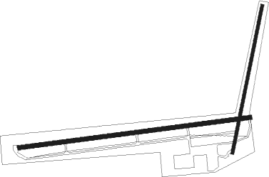
Runway info
Runway 9 / 27  | ||
| length | 1629m (5344ft) | |
| bearing | 88° / 268° | |
| width | 30m (100ft) | |
| surface | asphalt | |
| displ threshold | 107m (351ft) / 107m (351ft) | |
| Runway 2 / 20 | ||
| length | 1054m (3458ft) | |
| bearing | 20° / 200° | |
| width | 23m (75ft) | |
| surface | asphalt | |
Nearby beacons
| code | identifier | dist | bearing | frequency |
|---|---|---|---|---|
| AZQ | DME | 34.7 | 256° | 111.20 |
| ECB | DME | 39.3 | 330° | 110.40 |
| GZG | GLADE SPRING (BLACKFORD) VOR/DME | 50 | 147° | 110.20 |
| HVQ | CHARLESTON VOR/DME | 60.5 | 45° | 117.40 |
Instrument approach procedures
| runway | airway (heading) | route (dist, bearing) |
|---|---|---|
| RW09 | CILOM (87°) | CILOM 4500ft |
| RNAV | CILOM 4500ft GYMUS (6mi, 87°) 3200ft XUYBU (3mi, 88°) 2220ft KPBX (3mi, 87°) 1489ft (5052mi, 114°) 1709ft OBSEW (5039mi, 295°) 4500ft OBSEW (turn) | |
| RW27 | OBSEW (268°) | OBSEW 4500ft |
| RNAV | OBSEW 4500ft PEAIR (6mi, 268°) 3700ft KPBX (7mi, 268°) 1510ft (5052mi, 114°) 1663ft CILOM (5064mi, 294°) 4500ft CILOM (turn) |
Disclaimer
The information on this website is not for real aviation. Use this data with the X-Plane flight simulator only! Data taken with kind consent from X-Plane 12 source code and data files. Content is subject to change without notice.