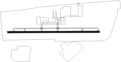
Plant City - Plant City Muni
Airport details
| Country | United States of America |
| State | Florida |
| Region | K7 |
| Airspace | Miami Oceanic Ctr |
| Municipality | Hillsborough County |
| Elevation | 152ft (46m) |
| Timezone | GMT -5 |
| Coordinates | 28.00017, -82.16331 |
| Magnetic var | |
| Type | land |
| Available since | X-Plane v10.40 |
| ICAO code | KPCM |
| IATA code | n/a |
| FAA code | PCM |
Communication
| Plant City Muni AWOS 3 | 120.025 |
| Plant City Muni CTAF/UNICOM | 123.000 |
| Plant City Muni TAMPA Approach/Departure | 120.650 |
| Plant City Muni TAMPA Approach/Departure | 119.900 |
Nearby Points of Interest:
Downtown Plant City Historic Residential District
-Plant City High School
-North Plant City Residential District
-Standard Oil Service Station
-Bing Rooming House
-Lake Hunter Terrace Historic District
-Dixieland Historic District
-Beacon Hill-Alta Vista Residential District
-Polk Theatre
-Oates Building
-Old Lakeland High School
-South Lake Morton Historic District
-Frances Langford Promenade
-Child of the Sun
-East Lake Morton Residential District
-Hermitage-Whitney Historic District
-Biltmore-Cumberland Historic District
-Temple Terrace Golf and Country Club
-Zephyrhills Downtown Historic District
-Capt. Howard B. Jeffries House
-Horace T. Robles House
-Ybor City Historic District
-El Pasaje
-Old People's Home
-Ybor Factory Building
Runway info
| Runway 10 / 28 | ||
| length | 1201m (3940ft) | |
| bearing | 94° / 274° | |
| width | 23m (75ft) | |
| surface | asphalt | |
| displ threshold | 61m (200ft) / 0m (0ft) | |
Nearby beacons
| code | identifier | dist | bearing | frequency |
|---|---|---|---|---|
| LAL | LAKELAND VORTAC | 7.9 | 95° | 116 |
| TP | COSME (TAMPA) NDB | 19.8 | 283° | 368 |
| MCF | MACDILL (TAMPA) TACAN | 20.3 | 248° | 111 |
| PIE | SAINT PETERSBURG VORTAC | 28.1 | 260° | 116.40 |
| PI | CAPOK(ST PETERSBURG-CLEARWATER NDB | 28.6 | 269° | 360 |
| SRQ | SARASOTA VOR/DME | 41.4 | 214° | 117 |
| OR | HERNY (ORLANDO) NDB | 49.1 | 55° | 221 |
| ORL | ORLANDO VORTAC | 54.5 | 57° | 112.20 |
Instrument approach procedures
| runway | airway (heading) | route (dist, bearing) |
|---|---|---|
| RW10 | PIE (80°) | PIE HOJLO (17mi, 91°) 2000ft UJURO (7mi, 5°) 2000ft |
| RW10 | PLUMY (191°) | PLUMY IZCAY (12mi, 257°) 2000ft UJURO (7mi, 185°) 2000ft |
| RNAV | UJURO 2000ft OBBIX (6mi, 94°) 1700ft FIKNI (2mi, 94°) 820ft KPCM (2mi, 94°) 209ft (4990mi, 109°) 600ft LAL (4982mi, 289°) 2000ft LAL (turn) | |
| RW28 | EYWIM (274°) | EYWIM 2000ft |
| RW28 | FIDKU (300°) | FIDKU 2000ft EYWIM (5mi, 5°) 2000ft |
| RW28 | HIPWO (247°) | HIPWO 2000ft EYWIM (5mi, 185°) 2000ft |
| RNAV | EYWIM 2000ft JUXUP (4mi, 274°) 1700ft KPCM (4mi, 274°) 195ft (4990mi, 109°) 414ft UJURO (5000mi, 289°) 2000ft UJURO (turn) |
Disclaimer
The information on this website is not for real aviation. Use this data with the X-Plane flight simulator only! Data taken with kind consent from X-Plane 12 source code and data files. Content is subject to change without notice.