Atlanta - Dekalb Peachtree
Airport details
| Country | United States of America |
| State | Georgia |
| Region | K7 |
| Airspace | Atlanta Ctr |
| Municipality | Chamblee |
| Elevation | 1000ft (305m) |
| Timezone | GMT -5 |
| Coordinates | 33.88416, -84.30624 |
| Magnetic var | |
| Type | land |
| Available since | X-Plane v10.40 |
| ICAO code | KPDK |
| IATA code | PDK |
| FAA code | PDK |
Communication
Approach frequencies
| ILS-cat-I | RW21L | 111.1 | 18.00mi |
| 3° GS | RW21L | 111.1 | 18.00mi |
Nearby Points of Interest:
Brookhaven Historic District
-Donaldson-Bannister House and Cemetery
-Peachtree Park
-Decatur Waterworks
-Tullie Smith House
-Swan House
-Henry B. Tompkins House
-Emory Grove Historic District
-Island Ford Lodge
-Druid Hills Historic District
-Ponce de Leon Court Historic District
-Pythagoras Lodge No. 41, Free and Accepted Masons
-Mary Gay House
-Swanton House
-Neville and Helen Farmer Lustron House
-Reid House
-Atkins Park
-Piedmont Park Apartments
-South Candler Street-Agnes Scott College Historic District
-Midtown Historic District
-Ford Motor Company Assembly Plant
-Candler Park Historic District
-William Perrin Nicolson House
-Old Scottish Rite Hospital
-Isaac Roberts House
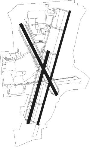
Runway info
Runway 3R / 21L  | ||
| length | 1832m (6010ft) | |
| bearing | 24° / 204° | |
| width | 30m (98ft) | |
| surface | concrete | |
| displ threshold | 0m (0ft) / 305m (1001ft) | |
| blast zone | 209m (686ft) / 0m (0ft) | |
| Runway 3L / 21R | ||
| length | 1145m (3757ft) | |
| bearing | 24° / 204° | |
| width | 46m (151ft) | |
| surface | asphalt | |
| blast zone | 0m (0ft) / 12m (39ft) | |
| Runway 16 / 34 | ||
| length | 1217m (3993ft) | |
| bearing | 154° / 334° | |
| width | 46m (151ft) | |
| surface | asphalt | |
Nearby beacons
| code | identifier | dist | bearing | frequency |
|---|---|---|---|---|
| PDK | PEACHTREE (ATLANTA) VOR/DME | 0.6 | 139° | 116.60 |
| DOB | DOBBINS (MARIETTA) TACAN | 10.1 | 279° | 113 |
| ATL | ATLANTA VORTAC | 16.6 | 207° | 116.90 |
| AT | CATTA (ATLANTA) NDB | 18.4 | 225° | 375 |
| TX | GWNET (LAWRENCEVILLE) NDB | 23.5 | 73° | 419 |
| DJD | CHERO NDB | 23.8 | 334° | 415 |
| FKV | FLOWERY BRANCH (GAINESVILLE) NDB | 27.6 | 51° | 365 |
| VOF | ALCOVY (COVINGTON) NDB | 30.3 | 116° | 370 |
| BMW | BARROW COUNTY (WINDER) NDB | 35.8 | 86° | 404 |
| FFC | PECAT (ATLANTA) NDB | 36.1 | 197° | 316 |
| EQQ | COWETA COUNTY (NEWNAN) NDB | 42.8 | 213° | 234 |
| RMG | ROME VORTAC | 43.7 | 289° | 115.40 |
| GPQ | CARROLLTON NDB | 45.4 | 249° | 278 |
| AHN | ATHENS VOR/DME | 49 | 86° | 109.60 |
| OP | YATES (THOMASTON) NDB | 58.2 | 173° | 339 |
| LGC | LA GRANGE VORTAC | 67.4 | 227° | 115.60 |
Departure and arrival routes
| Transition altitude | 18000ft |
| Transition level | 18000ft |
| STAR starting points | distance | inbound heading | |
|---|---|---|---|
| ALL | |||
| DIFFI4 | 67.4 | 47° | |
| BOKRT3 | 56.2 | 53° | |
| SWTEE2 | 42.2 | 95° | |
| BUKHD3 | 54.3 | 127° | |
| DEHAN3 | 39.2 | 208° | |
| WRGNZ3 | 43.9 | 308° | |
Instrument approach procedures
| runway | airway (heading) | route (dist, bearing) |
|---|---|---|
| RW03R | CADUR (278°) | CADUR ACERA (17mi, 278°) 3000ft |
| RW03R | DIFFI (85°) | DIFFI DALAS (14mi, 58°) 5000ft ZUVRU (24mi, 84°) 5000ft SUCGO (6mi, 98°) 5000ft ACERA (8mi, 154°) 3000ft |
| RW03R | DLUTH (209°) | DLUTH ACERA (13mi, 180°) 3000ft |
| RW03R | KADEE (111°) | KADEE ZUVRU (19mi, 98°) 5000ft SUCGO (6mi, 98°) 5000ft ACERA (8mi, 154°) 3000ft |
| RW03R | LOGEN (247°) | LOGEN ACERA (10mi, 228°) 3000ft |
| RNAV | ACERA 3000ft HUKAP (4mi, 219°) 2500ft WANBU (4mi, 270°) 2500ft ULUTE (2mi, 352°) KPDK (3mi, 13°) 1051ft SUCGO (7mi, 28°) 4000ft QUARR (6mi, 335°) BAPPY (7mi, 293°) 4000ft BAPPY (turn) | |
| RW21LY | AWSON (208°) | AWSON WODUS (14mi, 180°) 4000ft LOGEC (15mi, 221°) 3100ft |
| RW21LY | LOGEC (222°) | LOGEC 3100ft |
| RNAV | LOGEC 3100ft KOVEY (6mi, 221°) 2900ft SEDOY (3mi, 221°) 1800ft JOPUN (2mi, 221°) 1192ft (5121mi, 112°) 1398ft BAPPY (5128mi, 292°) 4000ft BAPPY (turn) | |
| RW21LZ | AWSON (208°) | AWSON ZESIV (19mi, 209°) 3300ft AABEE (8mi, 209°) 3000ft |
| RW21LZ | BUNNI (119°) | BUNNI RUKKO (27mi, 90°) 5000ft AABEE (9mi, 140°) 3000ft |
| RW21LZ | DIFFI (85°) | DIFFI DALAS (14mi, 58°) 5000ft DODME (27mi, 64°) 5000ft RUKKO (3mi, 77°) 5000ft AABEE (9mi, 140°) 3000ft |
| RW21LZ | TUCKR (286°) | TUCKR CALUX (22mi, 326°) 3100ft AABEE (7mi, 266°) 3000ft |
| RW21LZ | WOMAC (238°) | WOMAC FELOR (8mi, 259°) 3200ft AABEE (8mi, 259°) 3000ft |
| RNAV | AABEE 3000ft CHAMB (6mi, 204°) 2900ft KPDK (6mi, 209°) 1041ft (5121mi, 112°) 1800ft BAPPY (5128mi, 292°) 4000ft BAPPY (turn) | |
| RWNVA | JUDYY (276°) | JUDYY 3000ft |
| RNAV | JUDYY 3000ft LIPPY (6mi, 274°) 2600ft TOMTE (5mi, 274°) 2060ft (5121mi, 112°) 2060ft BAPPY (5128mi, 292°) 4000ft BAPPY (turn) |
Holding patterns
| STAR name | hold at | type | turn | heading* | altitude | leg | speed limit |
|---|---|---|---|---|---|---|---|
| BUKHD3 | HLNDS | VHF | right | 327 (147)° | DME 10.0mi | ICAO rules | |
| DEHAN3 | AWSON | VHF | left | 29 (209)° | DME 10.0mi | ICAO rules | |
| DEHAN3 | TRALZ | VHF | right | 32 (212)° | DME 10.0mi | ICAO rules | |
| DIFFI4 | LGC | NDB | right | 228 (48)° | 1.0min timed | ICAO rules | |
| SWTEE2 | BIZKT | VHF | left | 292 (112)° | DME 10.0mi | ICAO rules | |
| *) magnetic outbound (inbound) holding course | |||||||
Disclaimer
The information on this website is not for real aviation. Use this data with the X-Plane flight simulator only! Data taken with kind consent from X-Plane 12 source code and data files. Content is subject to change without notice.