Pendleton - Eastern Oregon Regional At Pendleton
Airport details
| Country | United States of America |
| State | Oregon |
| Region | K1 |
| Airspace | Seattle Ctr |
| Municipality | Pendleton |
| Elevation | 1497ft (456m) |
| Timezone | GMT -8 |
| Coordinates | 45.69476, -118.84301 |
| Magnetic var | |
| Type | land |
| Available since | X-Plane v10.40 |
| ICAO code | KPDT |
| IATA code | PDT |
| FAA code | PDT |
Communication
| Eastern Oregon Regional At Pendleton ASOS | 118.325 |
| Eastern Oregon Regional At Pendleton CTAF | 119.700 |
| Eastern Oregon Regional At Pendleton UNICOM | 122.950 |
| Eastern Oregon Regional At Pendleton Ground Control | 121.900 |
| Eastern Oregon Regional At Pendleton PENDLETON Tower | 119.700 |
| Eastern Oregon Regional At Pendleton CHINOOK Approach/Departure | 133.150 |
Approach frequencies
| ILS-cat-I | RW26 | 110.3 | 18.00mi |
| 3° GS | RW26 | 110.3 | 18.00mi |
Nearby Points of Interest:
John F. Kilkenny United States Post Office and Courthouse
-Masonic Temple
-Greasewood Finnish Apostolic Lutheran Church
-Adams Odd Fellows Hall
-Bank of Echo Building
-Echo Methodist Church
-Umatilla Masonic Lodge Hall
-James H. and Cynthia Koontz House
-St. Peter's Roman Catholic Church
-Wallula Gap
-Whitman Mission National Historic Site
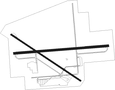
Runway info
Runway 7 / 25  | ||
| length | 1916m (6286ft) | |
| bearing | 90° / 270° | |
| width | 46m (150ft) | |
| surface | asphalt | |
| Runway 11 / 29 | ||
| length | 1698m (5571ft) | |
| bearing | 119° / 299° | |
| width | 30m (100ft) | |
| surface | asphalt | |
| displ threshold | 0m (0ft) / 139m (456ft) | |
Nearby beacons
| code | identifier | dist | bearing | frequency |
|---|---|---|---|---|
| PDT | PENDLETON VORTAC | 4 | 272° | 114.70 |
| ALW | WALLA WALLA VOR/DME | 32.9 | 55° | 116.40 |
| PSC | PASCO VOR/DME | 36.4 | 335° | 109.80 |
| AL | TRINA (WALLA WALLA) NDB | 39.5 | 53° | 353 |
| LGD | LA GRANDE NDB | 42.6 | 112° | 296 |
Instrument approach procedures
| runway | airway (heading) | route (dist, bearing) |
|---|---|---|
| RW08 | CORDO (113°) | CORDO EFAKE (9mi, 170°) 4300ft |
| RW08 | LOAMS (80°) | LOAMS EFAKE (20mi, 74°) 4300ft |
| RW08 | PDT (92°) | PDT EFAKE (9mi, 269°) 4300ft EFAKE (turn) 4300ft |
| RW08 | TEBKE (68°) | TEBKE EFAKE (7mi, 360°) 4300ft |
| RNAV | EFAKE 4300ft CIMAG (7mi, 90°) 3400ft CESMI (4mi, 90°) 2180ft KPDT (2mi, 90°) 1542ft (6588mi, 111°) 2100ft ZUTED (6573mi, 291°) 5000ft ZUTED (turn) | |
| RW11 | CORDO (113°) | CORDO PRUCE (3mi, 93°) 4500ft |
| RW11 | ECHOD (82°) | ECHOD PRUCE (12mi, 28°) 4500ft |
| RW11 | GINLE (149°) | GINLE PRUCE (12mi, 200°) 4500ft |
| RW11 | PDT (92°) | PDT PRUCE (11mi, 310°) 4500ft PRUCE (turn) 4500ft |
| RNAV | PRUCE 4500ft DRVIG (8mi, 119°) 3300ft KPDT (6mi, 118°) 1530ft (6588mi, 111°) 1737ft ADXAB (6585mi, 291°) ZUTED (18mi, 31°) 5000ft ZUTED (turn) | |
| RW26 | ALW (235°) | ALW GARYC (25mi, 204°) 5600ft |
| RW26 | LACED (312°) | LACED ATRAW (18mi, 351°) 7000ft GARYC (6mi, 350°) 5600ft |
| RW26 | TOLGA (254°) | TOLGA BUMVE (9mi, 234°) 6800ft GARYC (6mi, 234°) 5600ft |
| RNAV | GARYC 5600ft REYOT (5mi, 270°) 4800ft FAVUB (2mi, 270°) 4300ft SAYOS (6mi, 270°) 2320ft KPDT (3mi, 269°) 1541ft (6588mi, 111°) 1687ft CESMI (6590mi, 291°) PDT (2mi, 275°) 4300ft PDT (turn) 4300ft | |
| RW29 | HAGRD (291°) | HAGRD SERDY (11mi, 279°) 6400ft |
| RW29 | LACED (312°) | LACED SERDY (15mi, 329°) 6400ft |
| RW29 | PDT (92°) | PDT SERDY (20mi, 114°) 6400ft SERDY (turn) 6400ft |
| RNAV | SERDY 6400ft CUPOK (6mi, 299°) 4800ft ADXAB (5mi, 299°) 3160ft KPDT (5mi, 300°) 1551ft (6588mi, 111°) 1747ft DRVIG (6591mi, 291°) GINLE (17mi, 343°) 5000ft GINLE (turn) |
Disclaimer
The information on this website is not for real aviation. Use this data with the X-Plane flight simulator only! Data taken with kind consent from X-Plane 12 source code and data files. Content is subject to change without notice.