Penn Yan
Airport details
| Country | United States of America |
| State | New York |
| Region | K6 |
| Airspace | Cleveland Ctr |
| Municipality | Town of Milo |
| Elevation | 990ft (302m) |
| Timezone | GMT -5 |
| Coordinates | 42.63708, -77.05286 |
| Magnetic var | |
| Type | land |
| Available since | X-Plane v10.40 |
| ICAO code | KPEO |
| IATA code | n/a |
| FAA code | PEO |
Communication
| Penn Yan ASOS | 121.175 |
| Penn Yan CTAF/UNICOM | 123.000 |
| Penn Yan ELIMIRA Approach/Departure | 124.300 |
Nearby Points of Interest:
Charles Wagener House
-United States Post Office
-Sampson Theatre
-Penn Yan Historic District
-Yates County Courthouse Park District
-Crooked Lake Outlet Historic District
-Christopher Willis House
-Dundee Village Historic District
-Levi Barden Cobblestone Farmhouse
-Abraham Wagener House
-Aaron Wilson House
-David and Mary Kinne Farmstead
-Lodi Methodist Church
-Seneca County Courthouse Complex at Ovid
-Granger Cottage
-Gold Seal Winery
-Weston Schoolhouse
-Nester House
-South Main Street Historic District
-Smith's Opera House
-Geneva Armory
-Farmers and Merchants Bank
-Geneva Downtown Commercial Historic District
-Rose Hill Mansion
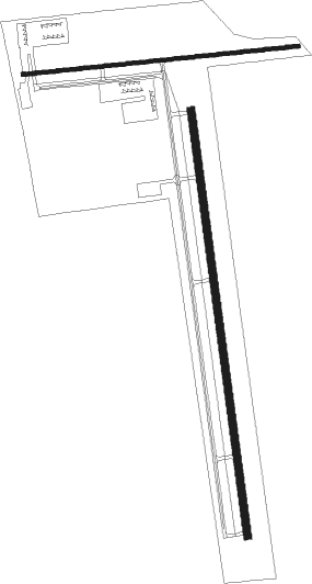
Runway info
Runway 1 / 19  | ||
| length | 1678m (5505ft) | |
| bearing | 356° / 176° | |
| width | 30m (100ft) | |
| surface | asphalt | |
| Runway 10 / 28 | ||
| length | 1086m (3563ft) | |
| bearing | 89° / 269° | |
| width | 15m (50ft) | |
| surface | asphalt | |
| displ threshold | 110m (361ft) / 117m (384ft) | |
Nearby beacons
| code | identifier | dist | bearing | frequency |
|---|---|---|---|---|
| PYA | PENN YAN NDB | 0.4 | 334° | 260 |
| ALP | ALPINE (ELMIRA) NDB | 27.1 | 144° | 245 |
| ITH | DME | 27.5 | 103° | 111.80 |
| GEE | GENESEO VOR/DME | 32.2 | 286° | 108.20 |
| ULW | ELMIRA VOR/DME | 32.6 | 177° | 109.65 |
| IT | VRNAH (ITHACA) NDB | 32.7 | 107° | 266 |
| ROC | ROCHESTER VOR/DME | 39.7 | 308° | 110 |
| SYR | SYRACUSE VORTAC | 48.7 | 58° | 117 |
| CFB | BINGHAMTON VOR/DME | 49.8 | 118° | 112.20 |
| FZ | FALLN (FULTON) NDB | 51 | 49° | 220 |
| ELZ | DME | 53.3 | 240° | 111.40 |
| SFK | STONYFORK VOR/DME | 58.8 | 201° | 108.60 |
Instrument approach procedures
| runway | airway (heading) | route (dist, bearing) |
|---|---|---|
| RW01 | EGELY (26°) | EGELY 4100ft NIRVY (5mi, 88°) 4100ft |
| RW01 | ELREQ (327°) | ELREQ 4100ft NIRVY (5mi, 268°) 4100ft |
| RW01 | NIRVY (356°) | NIRVY 4100ft |
| RNAV | NIRVY 4100ft AGFUB (6mi, 356°) 2700ft ZETEX (1mi, 356°) 2240ft KPEO (4mi, 355°) 1028ft WOFIL (10mi, 356°) 4000ft WOFIL (turn) | |
| RW19 | OJIVO (143°) | OJIVO 4000ft WOFIL (5mi, 88°) 4000ft |
| RW19 | WOFIL (176°) | WOFIL 4000ft |
| RW19 | WOWYE (210°) | WOWYE 4000ft WOFIL (5mi, 268°) 4000ft |
| RNAV | WOFIL 4000ft NUFXO (5mi, 176°) 2600ft 20THR (3mi, 176°) 1620ft KPEO (2mi, 177°) 956ft (4835mi, 119°) 1376ft GIBBE (4832mi, 299°) 4000ft GIBBE (turn) |
Disclaimer
The information on this website is not for real aviation. Use this data with the X-Plane flight simulator only! Data taken with kind consent from X-Plane 12 source code and data files. Content is subject to change without notice.