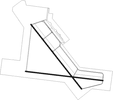
Pecos - Pecos Muni
Airport details
| Country | United States of America |
| State | Texas |
| Region | K4 |
| Airspace | Albuquerque Ctr |
| Municipality | Pecos |
| Elevation | 2610ft (796m) |
| Timezone | GMT -6 |
| Coordinates | 31.38239, -103.51072 |
| Magnetic var | |
| Type | land |
| Available since | X-Plane v10.40 |
| ICAO code | KPEQ |
| IATA code | PEQ |
| FAA code | PEQ |
Communication
| Pecos Muni AWOS 3 | 118.175 |
| Pecos Muni CTAF/UNICOM | 122.800 |
Nearby beacons
| code | identifier | dist | bearing | frequency |
|---|---|---|---|---|
| PEQ | PECOS (PECOS CITY) VOR/DME | 6.1 | 324° | 111.80 |
| INK | WINK VORTAC | 32.5 | 28° | 112.10 |
| FST | FORT STOCKTON VORTAC | 37.7 | 129° | 116.90 |
| XAA | KENT NDB | 42 | 242° | 225 |
| BWR | BREWSTER COUNTY (ALPINE) NDB | 55.9 | 188° | 412 |
| CNM | CARLSBAD VORTAC | 63.9 | 321° | 116.30 |
| CV | CARLZ (CARLSBAD) NDB | 67.8 | 317° | 402 |
Instrument approach procedures
| runway | airway (heading) | route (dist, bearing) |
|---|---|---|
| RW14 | FST (309°) | FST WALOM (51mi, 312°) 5100ft WALOM (turn) 4600ft |
| RW14 | INK (208°) | INK ZEKPI (18mi, 229°) 4600ft WALOM (10mi, 240°) 4600ft |
| RNAV | WALOM 4600ft RISDY (7mi, 142°) 4300ft WIRVA (3mi, 142°) 3220ft KPEQ (2mi, 143°) 2648ft (6096mi, 107°) 2808ft HUGPA (6090mi, 287°) 4500ft HUGPA (turn) | |
| RW32 | FST (309°) | FST NUBIY (15mi, 303°) 5100ft HUGPA (10mi, 302°) 4500ft |
| RW32 | HUGPA (322°) | HUGPA 4500ft |
| RW32 | INK (208°) | INK LEYIS (35mi, 177°) 4500ft HUGPA (10mi, 240°) 4500ft |
| RNAV | HUGPA 4500ft ONCAQ (7mi, 322°) 4300ft EVOQU (3mi, 322°) 3200ft KPEQ (2mi, 321°) 2641ft (6096mi, 107°) 2801ft WALOM (6102mi, 287°) 4600ft WALOM (turn) |
Disclaimer
The information on this website is not for real aviation. Use this data with the X-Plane flight simulator only! Data taken with kind consent from X-Plane 12 source code and data files. Content is subject to change without notice.

