Paynesville - Paynesville Muni
Airport details
| Country | United States of America |
| State | Minnesota |
| Region | K3 |
| Airspace | Minneapolis Ctr |
| Municipality | Paynesville |
| Elevation | 1180ft (360m) |
| Timezone | GMT -6 |
| Coordinates | 45.37206, -94.74473 |
| Magnetic var | |
| Type | land |
| Available since | X-Plane v10.40 |
| ICAO code | KPEX |
| IATA code | n/a |
| FAA code | PEX |
Communication
| Paynesville Muni AWOS 3 | 120.350 |
| Paynesville Muni CTAF | 122.900 |
Nearby Points of Interest:
Christopher Borgerding House
-Ferdinand Peters House
-Eugene Hermanutz House
-John Oster House
-Litchfield Opera House
-Swany White Flour Mills
-Church of the Sacred Heart
-Church of St. Boniface
-Clark and McCormack Quarry and House
-Brightwood Beach Cottage
-Anton Gogala Farmstead
-Church of the Immaculate Conception-Catholic
-Saint Benedict's Monastery
-Church of St. Joseph-Catholic
-First State Bank
-Urjans Iverson House
-Monson Lake State Park CCC/WPA/Rustic Style Historic Resources
-Original Main Street Historic District
-Minnesota Home School for Girls Historic District
-Universal Laboratories Building
-Pan Motor Company Office and Sheet Metal Works
-Church of St. Mary Help of Christians-Catholic
-Saint Cloud and Red River Valley Stage Road–Kandota Section
-the thayer
-Michael Majerus House
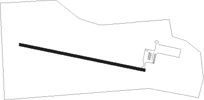
Runway info
| Runway 11 / 29 | ||
| length | 1007m (3304ft) | |
| bearing | 101° / 281° | |
| width | 23m (75ft) | |
| surface | asphalt | |
Nearby beacons
| code | identifier | dist | bearing | frequency |
|---|---|---|---|---|
| DWN | DARWIN VORTAC | 21 | 134° | 109 |
| BDH | WILLMAR VOR/DME | 22.2 | 236° | 113.70 |
| STC | SAINT CLOUD VOR/DME | 30.8 | 76° | 112.10 |
| ST | HUSSK (ST CLOUD) NDB | 33.3 | 82° | 342 |
| AXN | ALEXANDRIA VOR/DME | 40.7 | 320° | 112.80 |
| XCR | RIPLEY NDB | 45.6 | 30° | 404 |
| MVE | MONTEVIDEO VOR/DME | 47.4 | 248° | 111.60 |
| RWF | REDWOOD FALLS VOR/DME | 56.7 | 203° | 113.30 |
Instrument approach procedures
| runway | airway (heading) | route (dist, bearing) |
|---|---|---|
| RW11 | REBUE (101°) | REBUE 3000ft |
| RNAV | REBUE 3000ft HUNIR (7mi, 101°) 2800ft KPEX (5mi, 101°) 1225ft (5605mi, 116°) 1383ft UDALE (5594mi, 296°) 3000ft UDALE (turn) | |
| RW29 | UDALE (281°) | UDALE 3000ft |
| RNAV | UDALE 3000ft WAPSA (7mi, 281°) 2800ft KPEX (5mi, 281°) 1228ft (5605mi, 116°) 1383ft REBUE (5617mi, 296°) 3000ft REBUE (turn) |
Disclaimer
The information on this website is not for real aviation. Use this data with the X-Plane flight simulator only! Data taken with kind consent from X-Plane 12 source code and data files. Content is subject to change without notice.