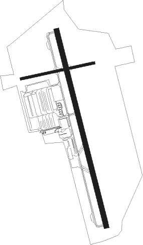
Page - Page Muni
Airport details
| Country | United States of America |
| State | Arizona |
| Region | K2 |
| Airspace | Denver Ctr |
| Municipality | Page City Limits |
| Elevation | 4312ft (1314m) |
| Timezone | GMT -7 |
| Coordinates | 36.92608, -111.44836 |
| Magnetic var | |
| Type | land |
| Available since | X-Plane v10.40 |
| ICAO code | KPGA |
| IATA code | PGA |
| FAA code | PGA |
Communication
| Page Muni ASOS | 120.625 |
| Page Muni CTAF/UNICOM | 122.800 |
Nearby Points of Interest:
Charles H. Spencer Hulk
-Lee's Ferry
-Lee's Ferry and Lonely Dell Ranch
Nearby beacons
| code | identifier | dist | bearing | frequency |
|---|---|---|---|---|
| PGA | PAGE VOR/DME | 0.3 | 11° | 117.60 |
| TBC | TUBA CITY VORTAC | 49 | 167° | 113.50 |
| BCE | BRYCE CANYON VORTAC | 61.4 | 312° | 112.80 |
| GCN | GRAND CANYON VOR/DME | 67 | 216° | 111.65 |
Instrument approach procedures
| runway | airway (heading) | route (dist, bearing) |
|---|---|---|
| RW15 | CABER (155°) | CABER RASCO (15mi, 144°) 8000ft IYOGY (4mi, 168°) 7200ft |
| RW15 | PGA (191°) | PGA RASCO (15mi, 347°) 8000ft RASCO (turn) 8000ft IYOGY (4mi, 168°) 7200ft |
| RNAV | IYOGY 7200ft PAGSY (4mi, 168°) 6600ft KPGA (8mi, 168°) 4295ft FAPOV (2mi, 167°) AROGE (8mi, 167°) 9000ft AROGE (turn) | |
| RW33 | CELAY (347°) | CELAY EKAME (4mi, 345°) 8200ft DIBEY (5mi, 348°) 7500ft |
| RW33 | KLIFF (36°) | KLIFF EKAME (13mi, 93°) 8200ft DIBEY (5mi, 348°) 7500ft |
| RNAV | DIBEY 7500ft CADRI (4mi, 348°) 6900ft JATKA (3mi, 348°) 5800ft AYAVA (2mi, 348°) 5280ft KPGA (3mi, 347°) 4366ft BIGNE (1mi, 348°) ACOSI (11mi, 334°) 8500ft ACOSI (turn) |
Disclaimer
The information on this website is not for real aviation. Use this data with the X-Plane flight simulator only! Data taken with kind consent from X-Plane 12 source code and data files. Content is subject to change without notice.

