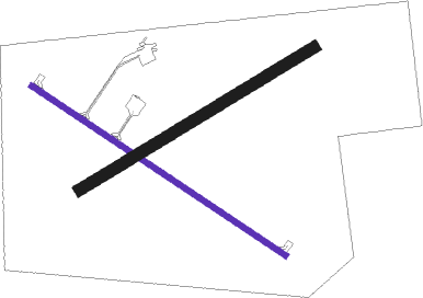
Philip
Airport details
| Country | United States of America |
| State | South Dakota |
| Region | K3 |
| Airspace | Denver Ctr |
| Municipality | Haakon County |
| Elevation | 2207ft (673m) |
| Timezone | GMT -7 |
| Coordinates | 44.04873, -101.59884 |
| Magnetic var | |
| Type | land |
| Available since | X-Plane v10.40 |
| ICAO code | KPHP |
| IATA code | PHP |
| FAA code | PHP |
Communication
| Philip ASOS | 118.375 |
| Philip CTAF/UNICOM | 122.800 |
Nearby Points of Interest:
Mt. Moriah Masonic Lodge No. 155
-Chicago, Milwaukee, and St. Paul Railroad Depot
-Quinn Methodist Church
Nearby beacons
| code | identifier | dist | bearing | frequency |
|---|---|---|---|---|
| PHP | PHILIP VOR/DME | 2.8 | 278° | 108.40 |
Instrument approach procedures
| runway | airway (heading) | route (dist, bearing) |
|---|---|---|
| RW12 | CUSED (119°) | CUSED 4500ft |
| RNAV | CUSED 4500ft ZULOK (7mi, 119°) 3800ft IYBUC (2mi, 120°) 3060ft KPHP (3mi, 118°) 2249ft (5904mi, 113°) 2467ft UTMIY (5896mi, 293°) 4500ft UTMIY (turn) | |
| RW30 | UTMIY (300°) | UTMIY 4500ft |
| RNAV | UTMIY 4500ft HUVBI (7mi, 300°) 3800ft KPHP (5mi, 300°) 2234ft (5904mi, 113°) 2444ft CUSED (5913mi, 293°) 4500ft CUSED (turn) |
Disclaimer
The information on this website is not for real aviation. Use this data with the X-Plane flight simulator only! Data taken with kind consent from X-Plane 12 source code and data files. Content is subject to change without notice.

