Paris - Henry County
Airport details
| Country | United States of America |
| State | Tennessee |
| Region | K7 |
| Airspace | Memphis Ctr |
| Municipality | Henry County |
| Elevation | 580ft (177m) |
| Timezone | GMT -6 |
| Coordinates | 36.33595, -88.38445 |
| Magnetic var | |
| Type | land |
| Available since | X-Plane v10.40 |
| ICAO code | KPHT |
| IATA code | PHT |
| FAA code | PHT |
Communication
| Henry County AWOS 3 | 118.825 |
| Henry County CTAF/UNICOM | 123.000 |
Nearby Points of Interest:
Aquone
-West Paris Historic District
-Paris Commercial Historic District
-Porter House
-Mt. Zion Church and Cemetery
-First Baptist Church
-Edwin S. Diuguid House
-Calloway County Courthouse
-First Christian Church
-William Thompson House
-William Parker Caldwell House
-W.W. Morris House
-Fort Donelson National Battlefield
-Jesse Whitesell House and Farm
-Wooldridge Monuments
-Dickey's Octagonal Barbershop
-Mt. Zion Colored Methodist Episcopal Church
-Greyhound Half-Way House
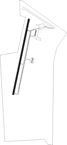
Runway info
| Runway 2 / 20 | ||
| length | 1526m (5007ft) | |
| bearing | 20° / 200° | |
| width | 30m (100ft) | |
| surface | asphalt | |
Nearby beacons
| code | identifier | dist | bearing | frequency |
|---|---|---|---|---|
| EU | MUREY (MURRAY) NDB | 23.5 | 14° | 368 |
| UC | OBION (UNION CITY) NDB | 29.6 | 266° | 212 |
| CNG | CUNNINGHAM (PADUCAH) VOR/DME | 45.9 | 326° | 113.10 |
| HXW | SCREAMING EAGLE TACAN | 46.4 | 70° | 114.90 |
| DYR | DYERSBURG VORTAC | 49 | 251° | 116.80 |
| CK | SNUFF(FT CAMPBELL (CLARKSVILLE NDB | 49.5 | 79° | 335 |
| CKV | CLARKSVILLE VOR/DME | 49.9 | 74° | 110.60 |
| MKL | MC KELLAR (JACKSON) VOR/DME | 50.8 | 216° | 112 |
| FK | AIRBE(FT CAMPBELL/HOPKINSVILLE NDB | 52.6 | 68° | 273 |
| GHM | (CENTERVILLE) DME | 54.3 | 118° | 111.60 |
| MKL | MERSY (JACKSON) NDB | 56.5 | 215° | 394 |
| CIR | CAIRO NDB | 59.3 | 311° | 397 |
Instrument approach procedures
| runway | airway (heading) | route (dist, bearing) |
|---|---|---|
| RW02 | HESIR (45°) | HESIR WASED (5mi, 103°) 2300ft |
| RW02 | OMADY (352°) | OMADY WASED (5mi, 283°) 2300ft |
| RW02 | WASED (20°) | WASED 2300ft |
| RNAV | WASED 2300ft CUMPI (6mi, 20°) 2300ft KPHT (6mi, 20°) 621ft (5327mi, 112°) 780ft CAGAK (5324mi, 292°) 3000ft CAGAK (turn) | |
| RW20 | CAGAK (200°) | CAGAK 3000ft |
| RW20 | LANKY (228°) | LANKY CAGAK (5mi, 287°) 3000ft CAGAK (turn) 3000ft |
| RW20 | NUBEE (172°) | NUBEE CAGAK (11mi, 143°) 3000ft |
| RNAV | CAGAK 3000ft EDEPE (6mi, 200°) 2200ft KPHT (5mi, 200°) 613ft (5327mi, 112°) 821ft WASED (5330mi, 292°) 2300ft WASED (turn) |
Disclaimer
The information on this website is not for real aviation. Use this data with the X-Plane flight simulator only! Data taken with kind consent from X-Plane 12 source code and data files. Content is subject to change without notice.