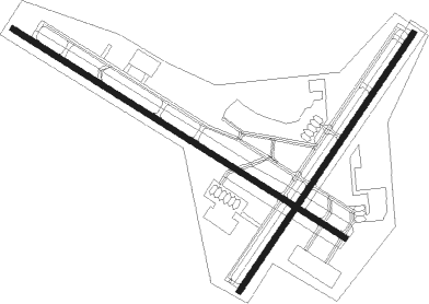
Peoria - Greater Peoria Rgnl
Airport details
| Country | United States of America |
| State | Illinois |
| Region | K5 |
| Airspace | Chicago Ctr |
| Municipality | Peoria County |
| Elevation | 660ft (201m) |
| Timezone | GMT -6 |
| Coordinates | 40.66420, -89.69325 |
| Magnetic var | |
| Type | land |
| Available since | X-Plane v10.40 |
| ICAO code | KPIA |
| IATA code | PIA |
| FAA code | PIA |
Communication
| GREATER PEORIA RGNL ATIS | 126.100 |
| GREATER PEORIA RGNL ASOS | 126.100 |
| GREATER PEORIA RGNL UNICOM | 122.950 |
| GREATER PEORIA RGNL Ground Control | 121.850 |
| GREATER PEORIA RGNL PEORIA Tower | 119.100 |
| GREATER PEORIA RGNL PEORIA Approach/Departure | 124.675 |
| GREATER PEORIA RGNL PEORIA Approach/Departure | 125.800 |
Approach frequencies
| ILS-cat-I | RW13 | 109.9 | 18.00mi |
| ILS-cat-I | RW31 | 109.9 | 18.00mi |
| ILS-cat-I | RW04 | 110.55 | 18.00mi |
| 3° GS | RW13 | 109.9 | 18.00mi |
| 3° GS | RW31 | 109.9 | 18.00mi |
| 3° GS | RW04 | 110.55 | 18.00mi |
Nearby Points of Interest:
Peoria State Hospital
-Christ Church of Lower Kickapoo
-West Bluff Historic District
-John C. Proctor Recreation Center
-Lincoln Branch Peoria Public Library
-Pettingill-Morron House
-International Harvester Building
-Peoria Mineral Springs
-Cumberland Presbyterian Church
-Peoria City Hall
-Marquette Apartments
-Kickapoo Building
-Peoria Federal Building and U.S. Courthouse
-Central National Bank Building
-Grand Army of the Republic Memorial Hall
-YWCA Building
-Judge Jacob Gale House
-John C. Flanagan House Museum
-North Side Historic District
-Tazewell County Courthouse
-Pekin Federal Building
-Illinois Waterway Project Office
-Carl Herget Mansion
-Pleasant Grove School
-Peoria Waterworks

Nearby beacons
| code | identifier | dist | bearing | frequency |
|---|---|---|---|---|
| PIA | PEORIA VORTAC | 4.6 | 279° | 115.20 |
| PI | TUNGG (PEORIA) NDB | 5.7 | 120° | 356 |
| BDF | BRADFORD VORTAC | 30.1 | 12° | 114.70 |
| AAA | ABRAHAM (LINCOLN) NDB | 34.3 | 145° | 329 |
| BMI | BLOOMINGTON VOR/DME | 36.4 | 104° | 108.20 |
| GBG | DME | 37.4 | 290° | 109.80 |
| LH | EGROW (BLOOMINGTON-NORMAL) NDB | 37.8 | 97° | 334 |
| JZY | MACOMB NDB | 40.5 | 260° | 251 |
| PNT | PONTIAC VOR/DME | 44.6 | 81° | 109.60 |
| LQ | LICOL (SPRINGFIELD) NDB | 45.3 | 173° | 375 |
| SPI | SPINNER (SPRINGFIELD) VORTAC | 49.5 | 179° | 112.70 |
| CJ | CALDE (SPRINGFIELD) NDB | 52.4 | 173° | 240 |
| SP | HUSKK (SPRINGFIELD) NDB | 53.6 | 184° | 382 |
| MZV | MOLINE VOR/DME | 58.2 | 305° | 114.40 |
| IJX | DME | 58.8 | 212° | 108.60 |
| DE | ELWIN (DECATUR) NDB | 62.4 | 140° | 275 |
| AXC | ADDERS VORTAC | 67.6 | 138° | 117.20 |
Instrument approach procedures
| runway | airway (heading) | route (dist, bearing) |
|---|---|---|
| RW04 | GREGG (120°) | GREGG SHRIE (16mi, 172°) 2700ft SADEE (6mi, 121°) 2700ft |
| RW04 | MCLEN (295°) | MCLEN CHRSS (28mi, 273°) 2700ft SADEE (6mi, 301°) 2700ft |
| RW04 | PIA (99°) | PIA SADEE (11mi, 198°) 2700ft SADEE (turn) 2700ft |
| RNAV | SADEE 2700ft PADLL (6mi, 46°) 2400ft JINUL (4mi, 46°) 1220ft KPIA (2mi, 37°) 698ft (5391mi, 114°) 857ft WEKAR (5384mi, 295°) 2300ft WEKAR (turn) | |
| RW13 | DULAP (181°) | DULAP HALBU (8mi, 248°) 2500ft FAPSA (5mi, 224°) 2500ft |
| RW13 | FAPSA (119°) | FAPSA 2500ft |
| RW13 | LOGOS (94°) | LOGOS GOGME (9mi, 83°) 2500ft FAPSA (5mi, 44°) 2500ft |
| RNAV | FAPSA 2500ft EPEPE (6mi, 119°) 2500ft KPIA (7mi, 119°) 691ft (5391mi, 114°) 1025ft CASIP (5382mi, 294°) 2400ft CASIP (turn) | |
| RW22 | DULAP (181°) | DULAP WEKAR (10mi, 122°) 2300ft |
| RW22 | MAROC (257°) | MAROC WEKAR (8mi, 297°) 2300ft |
| RW22 | PIA (99°) | PIA WEKAR (15mi, 63°) 2300ft WEKAR (turn) 2300ft |
| RNAV | WEKAR 2300ft CEPOT (6mi, 227°) 2300ft KPIA (6mi, 230°) 712ft (5391mi, 114°) 1061ft SADEE (5398mi, 294°) 2700ft SADEE (turn) | |
| RW31 | LOTTO (7°) | LOTTO BOVME (14mi, 47°) 2500ft CASIP (5mi, 44°) 2400ft |
| RW31 | MAROC (257°) | MAROC AVENE (8mi, 200°) 2500ft CASIP (5mi, 224°) 2400ft |
| RW31 | PIA (99°) | PIA CASIP (16mi, 114°) 2500ft CASIP (turn) 2400ft |
| RNAV | CASIP 2400ft BGRAY (6mi, 300°) 2400ft KPIA (6mi, 300°) 697ft (5391mi, 114°) 939ft FAPSA (5401mi, 294°) 2500ft FAPSA (turn) |
Disclaimer
The information on this website is not for real aviation. Use this data with the X-Plane flight simulator only! Data taken with kind consent from X-Plane 12 source code and data files. Content is subject to change without notice.