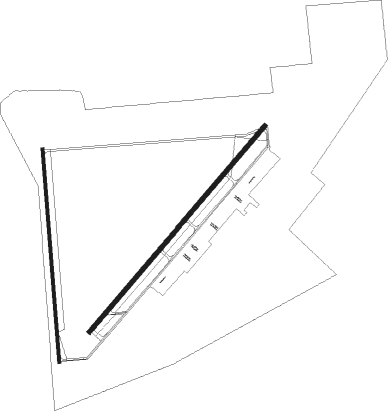
Pocatello - Pocatello Rgnl
Airport details
| Country | United States of America |
| State | Idaho |
| Region | K1 |
| Airspace | Salt Lake City Ctr |
| Municipality | Pocatello |
| Elevation | 4452ft (1357m) |
| Timezone | GMT -7 |
| Coordinates | 42.90981, -112.59592 |
| Magnetic var | |
| Type | land |
| Available since | X-Plane v10.40 |
| ICAO code | KPIH |
| IATA code | PIH |
| FAA code | PIH |
Communication
| POCATELLO RGNL ASOS | 135.625 |
| POCATELLO RGNL CTAF | 119.100 |
| POCATELLO RGNL UNICOM | 122.950 |
| POCATELLO RGNL Clearance DEL | 126.550 |
| POCATELLO RGNL Ground Control | 121.900 |
| POCATELLO RGNL Tower | 119.100 |
Approach frequencies
| ILS-cat-I | RW21 | 110.3 | 18.00mi |
| 3° GS | RW21 | 110.3 | 18.00mi |
Nearby Points of Interest:
Standrod House
-St. Joseph's Catholic Church (Pocatello, Idaho)
-Pocatello Carnegie Library
-Church of the Assumption (Pocatello, Idaho)
-Sullivan-Kinney House
-John Hood House
-Idaho State University Administration Building
-Power County Courthouse
-Walter Sparks House
-Blackfoot LDS Tabernacle
-Idaho Republican Building
-Ross Fork Episcopal Church
-United States Post Office–Blackfoot Main
Nearby beacons
| code | identifier | dist | bearing | frequency |
|---|---|---|---|---|
| PIH | POCATELLO VOR/DME | 3.4 | 235° | 112.60 |
| PI | TYHEE (POCATELLO) NDB | 4.7 | 56° | 383 |
| MLD | MALAD CITY VOR/DME | 43.1 | 168° | 117.40 |
| IDA | IDAHO FALLS VOR/DME | 43.3 | 41° | 113.85 |
Departure and arrival routes
| Transition altitude | 18000ft |
| Transition level | 18000ft |
| SID end points | distance | outbound heading | |
|---|---|---|---|
| RW03 | |||
| KNURL1 | 19mi | 275° | |
| RW17 | |||
| KNURL1 | 19mi | 275° | |
| RW21 | |||
| KNURL1 | 19mi | 275° | |
| RW35 | |||
| KNURL1 | 19mi | 275° | |
Instrument approach procedures
| runway | airway (heading) | route (dist, bearing) |
|---|---|---|
| RW03 | COLAY (73°) | COLAY JELOD (8mi, 109°) 7000ft |
| RW03 | JANIN (94°) | JANIN JELOD (14mi, 141°) 7000ft |
| RNAV | JELOD 7000ft UNADE (6mi, 53°) 6800ft YOGUT (2mi, 54°) 6300ft KPIH (6mi, 52°) 4495ft CUPTA (11mi, 55°) 7300ft CUPTA (turn) | |
| RW21 | IDA (221°) | IDA BARSE (28mi, 213°) 7800ft CUPTA (5mi, 234°) 7000ft |
| RW21 | PIH (55°) | PIH BARSE (19mi, 55°) 7800ft BARSE (turn) 7800ft CUPTA (5mi, 234°) 7000ft |
| RNAV | CUPTA 7000ft HESNO (5mi, 234°) 6000ft KPIH (6mi, 236°) 4504ft HUMBA (3mi, 231°) SICOY (10mi, 283°) 7000ft SICOY (turn) |
Disclaimer
The information on this website is not for real aviation. Use this data with the X-Plane flight simulator only! Data taken with kind consent from X-Plane 12 source code and data files. Content is subject to change without notice.

