Port Isabel - Port Isabel-cameron County
Airport details
| Country | United States of America |
| State | Texas |
| Region | K4 |
| Airspace | Houston Oceanic Ctr |
| Municipality | Cameron County |
| Elevation | 19ft (6m) |
| Timezone | GMT -6 |
| Coordinates | 26.16619, -97.34589 |
| Magnetic var | |
| Type | land |
| Available since | X-Plane v10.40 |
| ICAO code | KPIL |
| IATA code | n/a |
| FAA code | PIL |
Communication
| Port Isabel-Cameron County ASOS | 118.525 |
| Port Isabel-Cameron County CTAF/UNICOM | 122.800 |
| Port Isabel-Cameron County VALLEY Approach/Departure | 119.500 |
Nearby Points of Interest:
Fort Brown
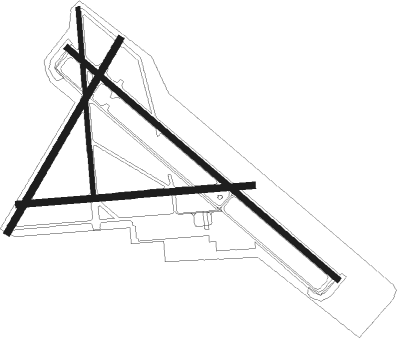
Runway info
Runway 13 / 31  | ||
| length | 2442m (8012ft) | |
| bearing | 132° / 312° | |
| width | 43m (141ft) | |
| surface | asphalt | |
| Runway 8 / 26 | ||
| length | 1613m (5292ft) | |
| bearing | 90° / 270° | |
| width | 46m (150ft) | |
| surface | concrete | |
| Runway 17 / 35 | ||
| length | 1286m (4219ft) | |
| bearing | 180° / 360° | |
| width | 28m (92ft) | |
| surface | asphalt | |
| blast zone | 0m (0ft) / 180m (591ft) | |
| Runway 3 / 21 | ||
| length | 1527m (5010ft) | |
| bearing | 38° / 218° | |
| width | 46m (150ft) | |
| surface | concrete | |
Nearby beacons
| code | identifier | dist | bearing | frequency |
|---|---|---|---|---|
| BR | DEPOO (BROWNSVILLE) NDB | 14 | 222° | 393 |
| BRO | BROWNSVILLE VORTAC | 14.6 | 187° | 116.30 |
| HRL | HARLINGEN VOR/DME | 16.9 | 282° | 113.65 |
| HR | SEBAS (HARLINGEN) NDB | 18.7 | 294° | 338 |
| MAM | MATAMOROS VOR/DME | 25.6 | 204° | 114.30 |
| MFE | MC ALLEN VOR/DME | 48.2 | 270° | 117.20 |
| REX | REYNOSA VOR/DME | 48.6 | 260° | 112.40 |
| MF | MISSI (MC ALLEN) NDB | 52.2 | 275° | 330 |
| EOC | COYOTE (ENCINO) NDB | 62.4 | 308° | 232 |
Instrument approach procedures
| runway | airway (heading) | route (dist, bearing) |
|---|---|---|
| RW13 | BUTAC (133°) | BUTAC 2000ft |
| RW13 | HRL (102°) | HRL GIDGE (5mi, 81°) 2000ft BUTAC (5mi, 48°) 2000ft |
| RW13 | MADRE (133°) | MADRE BUTAC (7mi, 135°) 2000ft |
| RNAV | BUTAC 2000ft GEWAV (6mi, 132°) 1600ft KPIL (5mi, 133°) 54ft COKAX (9mi, 131°) CHICO (6mi, 191°) 3000ft CHICO (turn) |
Disclaimer
The information on this website is not for real aviation. Use this data with the X-Plane flight simulator only! Data taken with kind consent from X-Plane 12 source code and data files. Content is subject to change without notice.