Parkersburg - Mid Ohio Valley Rgnl
Airport details
| Country | United States of America |
| State | West Virginia |
| Region | K6 |
| Airspace | Indianapolis Ctr |
| Municipality | Wood County |
| Elevation | 854ft (260m) |
| Timezone | GMT -5 |
| Coordinates | 39.35365, -81.44203 |
| Magnetic var | |
| Type | land |
| Available since | X-Plane v10.40 |
| ICAO code | KPKB |
| IATA code | PKB |
| FAA code | PKB |
Communication
| Mid Ohio Valley Rgnl ATIS | 124.350 |
| Mid Ohio Valley Rgnl CTAF | 123.700 |
| Mid Ohio Valley Rgnl UNICOM | 122.950 |
| Mid Ohio Valley Rgnl Ground Control | 121.700 |
| Mid Ohio Valley Rgnl PARKERSBURG Tower | 123.700 |
Approach frequencies
| ILS-cat-I | RW03 | 110.7 | 18.00mi |
| 3° GS | RW03 | 110.7 | 18.00mi |
Nearby Points of Interest:
Henderson Hall Historic District
-Tomlinson Mansion
-Harmar Historic District
-Washington County Courthouse
-Rufus Putnam House
-Ohio Company Land Office
-Judge Joseph Barker House
-Henry Cooper House
-Parkersburg High School-Washington Avenue Historic District
-Dr. W. W. Monroe House
-Cook House
-Walton Wait House
-House at 10th and Avery Streets
-First Presbyterian Church
-Masonic Temple
-Windmill Quaker State
-Parkersburg Women's Club
-Oeldorf Building
-Gould House
-Union Trust National Bank
-Henry Logan Memorial AME Church
-Elks Club
-Trinity Episcopal Church Rectory
-Sharon Lodge No. 28 IOOF
-Mather Building
Runway info
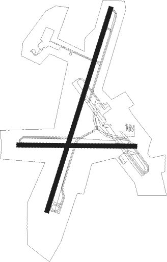
Runway 3 / 21  | ||
| length | 2212m (7257ft) | |
| bearing | 27° / 207° | |
| width | 46m (150ft) | |
| surface | asphalt | |
| displ threshold | 0m (0ft) / 140m (459ft) | |
| Runway 10 / 28 | ||
| length | 1217m (3993ft) | |
| bearing | 94° / 274° | |
| width | 46m (150ft) | |
| surface | asphalt | |
Nearby beacons
| code | identifier | dist | bearing | frequency |
|---|---|---|---|---|
| JPU | PARKERSBURG VOR/DME | 6.1 | 38° | 108.60 |
| PK | VERSI (PARKERSBURG) NDB | 6.3 | 203° | 388 |
| UGS | UNIVERSITY (ATHENS) NDB | 32.3 | 262° | 250 |
| ZZV | ZANESVILLE VOR/DME | 40.9 | 323° | 114.95 |
| HNN | DME | 45.1 | 224° | 115.90 |
| AIR | BELLAIRE VOR/DME | 49.2 | 43° | 117.10 |
| CTW | DME | 52.6 | 358° | 111.80 |
| CFX | CADIZ NDB | 56.6 | 26° | 239 |
| HLG | WHEELING VOR/DME | 67.7 | 44° | 112.20 |
Instrument approach procedures
| runway | airway (heading) | route (dist, bearing) |
|---|---|---|
| RW03 | JACEE (46°) | JACEE UNSAW (5mi, 91°) 3000ft |
| RW03 | JPU (218°) | JPU UNSAW (19mi, 210°) 3000ft UNSAW (turn) 3000ft |
| RW03 | MORAN (13°) | MORAN UNSAW (4mi, 332°) 3000ft |
| RNAV | UNSAW 3000ft ODENN (6mi, 27°) 2600ft WIRNI (3mi, 27°) 1700ft KPKB (4mi, 22°) 851ft (5008mi, 116°) 1202ft OWAVE (5005mi, 296°) 3000ft OWAVE (turn) | |
| RW10 | FARLN (93°) | FARLN FASAT (8mi, 96°) 3000ft |
| RW10 | JPU (218°) | JPU FASAT (15mi, 255°) 3000ft FASAT (turn) 3000ft |
| RW10 | NABLE (73°) | NABLE FASAT (7mi, 36°) 3000ft |
| RNAV | FASAT 3000ft AFAGA (6mi, 94°) 2500ft KPKB (5mi, 88°) 881ft (5008mi, 116°) 1259ft CAPNA (4997mi, 296°) 3000ft CAPNA (turn) | |
| RW21 | CADRE (185°) | CADRE OWAVE (11mi, 158°) 3000ft |
| RW21 | JPU (218°) | JPU OWAVE (6mi, 20°) 3000ft OWAVE (turn) 3000ft |
| RW21 | WEELD (222°) | WEELD OWAVE (14mi, 233°) 3000ft |
| RNAV | OWAVE 3000ft MIDCO (6mi, 208°) 2800ft MARII (3mi, 208°) 1860ft KPKB (3mi, 214°) 913ft (5008mi, 116°) 1137ft UNSAW (5012mi, 296°) 3000ft UNSAW (turn) | |
| RW28 | JPU (218°) | JPU CAPNA (11mi, 123°) 3000ft CAPNA (turn) 3000ft |
| RW28 | JULEA (279°) | JULEA CAPNA (11mi, 283°) 3000ft |
| RW28 | RANDE (259°) | RANDE CAPNA (22mi, 249°) 3000ft |
| RNAV | CAPNA 3000ft BANLE (6mi, 274°) 2400ft KPKB (5mi, 279°) 888ft (5008mi, 116°) 1259ft FASAT (5019mi, 296°) 3000ft FASAT (turn) |
Disclaimer
The information on this website is not for real aviation. Use this data with the X-Plane flight simulator only! Data taken with kind consent from X-Plane 12 source code and data files. Content is subject to change without notice.