Branson / Hollister - M Graham Clark Downtown
Airport details
| Country | United States of America |
| State | Missouri |
| Region | K3 |
| Airspace | Memphis Ctr |
| Municipality | Taney County |
| Elevation | 937ft (286m) |
| Timezone | GMT -6 |
| Coordinates | 36.62593, -93.22892 |
| Magnetic var | |
| Type | land |
| Available since | X-Plane v10.40 |
| ICAO code | KPLK |
| IATA code | PLK |
| FAA code | PLK |
Communication
| M Graham Clark Downtown CTAF/UNICOM | 122.700 |
| M Graham Clark Downtown SPRINGFIELD Approach/Departure | 126.350 |
Nearby Points of Interest:
Cricket and Crest Tunnels
-Stone County Courthouse
-Haggard Ford Swinging Bridge
-W.D. Crawford House
-Yell Masonic Lodge Hall
-Berryville Post Office
-Carroll County Courthouse, Eastern District
-Berryville Gymnasium
-Berryville Agriculture Building
-Ozark Courthouse Square Historic District
-Harrison Courthouse Square Historic District
-Boone County Courthouse
-Grubb Springs School
-Evans-Kirby House
-Harrison High School
-Elliott and Anna Barham House
-Dog Branch School
-Concord School House
-Beaver Bridge (Arkansas)
-Stamps Store
-Sanitarium Lake Bridges Historic District
-Pyatt School Building
-Blue Springs Heritage Center
-Quigley's Castle
-U.S. 62 White River Bridge
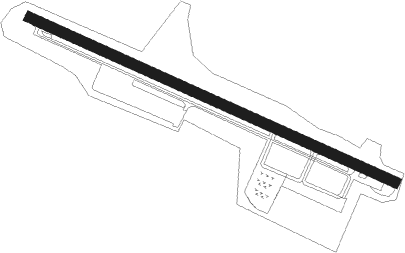
Runway info
| Runway 12 / 30 | ||
| length | 1135m (3724ft) | |
| bearing | 114° / 294° | |
| width | 30m (100ft) | |
| surface | asphalt | |
| displ threshold | 88m (289ft) / 95m (312ft) | |
Nearby beacons
| code | identifier | dist | bearing | frequency |
|---|---|---|---|---|
| HRO | HARRISON VOR/DME | 18.4 | 177° | 112.50 |
| DGD | DOGWOOD VORTAC | 29.2 | 42° | 109.40 |
| FLP | DME | 42 | 113° | 116.05 |
| SGF | SPRINGFIELD VORTAC | 44.1 | 352° | 116.90 |
| RZC | RAZORBACK (FAYETTEVILLE) VORTAC | 48.7 | 247° | 116.40 |
Instrument approach procedures
| runway | airway (heading) | route (dist, bearing) |
|---|---|---|
| RW12 | RAWBE (114°) | RAWBE 3200ft |
| RW12 | WAROF (89°) | WAROF 3200ft RAWBE (6mi, 34°) 3200ft |
| RW12 | ZILNI (143°) | ZILNI 3200ft RAWBE (6mi, 214°) 3200ft |
| RNAV | RAWBE 3200ft GARYY (5mi, 114°) 2600ft BRENL (2mi, 114°) 1920ft KPLK (3mi, 114°) 980ft (5561mi, 111°) 1140ft UZAPO (5551mi, 291°) 3200ft UZAPO (turn) | |
| RW30 | JURUM (321°) | JURUM 3200ft UZAPO (6mi, 34°) 3200ft |
| RW30 | UZAPO (294°) | UZAPO 3200ft |
| RW30 | WOLAS (271°) | WOLAS 3200ft UZAPO (6mi, 214°) 3200ft |
| RNAV | UZAPO 3200ft EFESA (6mi, 294°) 2600ft ROYBI (3mi, 294°) 1780ft KPLK (3mi, 294°) 984ft (5561mi, 111°) 1183ft RAWBE (5570mi, 291°) 3200ft RAWBE (turn) |
Disclaimer
The information on this website is not for real aviation. Use this data with the X-Plane flight simulator only! Data taken with kind consent from X-Plane 12 source code and data files. Content is subject to change without notice.