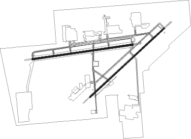
Palmdale - Palmdale Regl Usaf Plt 42
Airport details
| Country | United States of America |
| State | California |
| Region | K2 |
| Airspace | Los Angeles Ctr |
| Municipality | Palmdale |
| Elevation | 2541ft (774m) |
| Timezone | GMT -8 |
| Coordinates | 34.62939, -118.08456 |
| Magnetic var | |
| Type | land |
| Available since | X-Plane v10.40 |
| ICAO code | KPMD |
| IATA code | PMD |
| FAA code | PMD |
Communication
| Palmdale Regl USAF PLT 42 ASOS | 118.275 |
| Palmdale Regl USAF PLT 42 CTAF | 123.700 |
| Palmdale Regl USAF PLT 42 Ground Control | 121.900 |
| Palmdale Regl USAF PLT 42 Tower | 123.700 |
| Palmdale Regl USAF PLT 42 JOSHUA Approach/Departure | 124.550 |
Approach frequencies
| ILS-cat-I | RW25 | 110.7 | 18.00mi |
| 3° GS | RW25 | 110.7 | 18.00mi |
Nearby Points of Interest:
Vasquez Rocks
-Rogers Dry Lake
-Gabrielino Trail
-Mount Lowe Railway
-Gen. Charles S. Farnsworth County Park
-Scripps Hall
-Christmas Tree Lane
-Zane Grey Estate
-Woodbury-Story House
-Andrew McNally House
-Villa Carlotta
-Pacific Electric Railway Company Substation No. 8
-Keyes Bungalow
-Lopez Adobe
-Crank House
-Washington Court
-Samuel Merrill House
-House at 1240 North Los Robles
-House at 1141 North Chester Avenue
-Catalina Verdugo Adobe
-Court at 1274-1282 North Raymond Avenue
-House at 1487 Loma Vista Street
-Court at 940-948 North Raymond Avenue
-Upton Sinclair House
-Kosy Knook Court

Nearby beacons
| code | identifier | dist | bearing | frequency |
|---|---|---|---|---|
| PMD | PALMDALE VORTAC | 1 | 84° | 114.50 |
| LHS | LAKE HUGHES VORTAC | 24.5 | 276° | 114.35 |
| EDW | EDWARDS VORTAC | 27.3 | 45° | 116.40 |
| VNY | VAN NUYS VOR/DME | 31.6 | 225° | 113.10 |
| VCV | VICTORVILLE VOR/DME | 34.3 | 93° | 109.05 |
| POM | POMONA VORTAC | 36.2 | 152° | 110.40 |
| GMN | GORMAN VORTAC | 39.7 | 283° | 116.10 |
| SMO | SANTA MONICA VOR/DME | 41.5 | 211° | 110.80 |
| FIM | FILLMORE VORTAC | 42.7 | 251° | 112.50 |
| LAX | LOS ANGELES VORTAC | 45.2 | 207° | 113.60 |
| SB | PETIS (SAN BERNARDINO) NDB | 49.5 | 129° | 397 |
| PDZ | PARADISE (ONTARIO) VORTAC | 50.8 | 142° | 112.20 |
| SLI | SEAL BEACH (LOS ALAMITOS) VORTAC | 50.8 | 178° | 115.70 |
| RAL | RIVERSIDE VOR | 51.2 | 137° | 112.40 |
| VTU | VENTURA (OXNARD) VOR/DME | 56.9 | 242° | 108.20 |
| RIV | MARCH (RIVERSIDE) TACAN | 59.1 | 132° | 113 |
| ELB | EL TORO (SANTA ANA) VOR/DME | 59.8 | 160° | 117.20 |
| HDF | HOMELAND (RIVERSIDE) VOR | 67.9 | 133° | 113.40 |
Instrument approach procedures
| runway | airway (heading) | route (dist, bearing) |
|---|---|---|
| RW07 | JEFFY (103°) | JEFFY 8000ft YUGKU (5mi, 114°) 7100ft RGAMI (7mi, 114°) 7000ft |
| RNAV | RGAMI 7000ft HIVYU (3mi, 102°) 6200ft JITLA (3mi, 102°) 5500ft UWEJO (3mi, 89°) 4440ft ZENAB (3mi, 89°) 3180ft KPMD (3mi, 91°) 2590ft (6774mi, 106°) 2880ft IMSIJ (6755mi, 286°) 7000ft IMSIJ (turn) | |
| RW22 | ETHER (264°) | ETHER 6000ft IXIGE (5mi, 305°) 5100ft |
| RNAV | IXIGE 5100ft HOGAX (6mi, 259°) 4300ft JOSOP (3mi, 240°) 3360ft OQXIB (2mi, 240°) 2835ft (6772mi, 106°) 3000ft OLTIW (6779mi, 286°) FISCH (9mi, 335°) 6700ft FISCH (turn) 6700ft | |
| RW25 | ETHER (264°) | ETHER DOLTN (3mi, 255°) 4900ft |
| RNAV | DOLTN 4900ft FORDA (6mi, 267°) 4500ft SKKEE (3mi, 267°) 3500ft KPMD (4mi, 265°) 2562ft (6774mi, 106°) 2703ft JJOEL (6780mi, 286°) FISCH (11mi, 340°) 6700ft FISCH (turn) 6700ft |
Disclaimer
The information on this website is not for real aviation. Use this data with the X-Plane flight simulator only! Data taken with kind consent from X-Plane 12 source code and data files. Content is subject to change without notice.