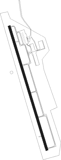
Plattsmouth - Plattsmouth Muni
Airport details
| Country | United States of America |
| State | Nebraska |
| Region | K3 |
| Airspace | Minneapolis Ctr |
| Municipality | Cass County |
| Elevation | 1204ft (367m) |
| Timezone | GMT -6 |
| Coordinates | 40.94837, -95.91736 |
| Magnetic var | |
| Type | land |
| Available since | X-Plane v10.40 |
| ICAO code | KPMV |
| IATA code | n/a |
| FAA code | PMV |
Communication
| Plattsmouth Muni AWOS | 118.975 |
| Plattsmouth Muni CTAF/UNICOM | 122.700 |
| Plattsmouth Muni OMAHA Approach/Departure | 120.100 |
Nearby Points of Interest:
Naomi Institute
-Gottfried Gustav Pitz Barn
-Plattsmouth Main Street Historic District
-Cass County Courthouse
-Zweibel Farmstead
-Todd House
-William Hamilton House
-Hunter School
-William E. Gordon House
-John Sautter Farmhouse
-Fontenelle Forest
-Packer's National Bank Building
-South Omaha Main Street Historic District
-Livestock Exchange Building
-South Omaha Veterans Memorial Bridge
-Jason and Elizabeth Baylor Rector House
-St. Martin of Tours Episcopal Church
-Robbins School
-Otoe County Courthouse
-Grand Army of the Republic Memorial Hall
-Morton-James Public Library
-U.S. Post Office
-Vinton Street Commercial Historic District
-Fremont County Courthouse
-Gallagher Building
Nearby beacons
| code | identifier | dist | bearing | frequency |
|---|---|---|---|---|
| PMV | PLATTSMOUTH NDB | 0.3 | 133° | 329 |
| OFF | OFFUTT (OMAHA) TACAN | 10.1 | 6° | 111.70 |
| OVR | OMAHA VORTAC | 15.4 | 40° | 116.30 |
| AFK | NEBRASKA CITY NDB | 20.7 | 171° | 347 |
| AHQ | WAHOO NDB | 35.4 | 293° | 400 |
| LNK | LINCOLN VORTAC | 37.4 | 268° | 116.10 |
| LN | POTTS (LINCOLN) NDB | 40.2 | 257° | 385 |
| PWE | PAWNEE CITY VORTAC | 46.8 | 201° | 112.40 |
| SCB | SCRIBNER VOR/DME | 50.8 | 313° | 111 |
| BIE | BEATRICE VOR | 54.4 | 232° | 110.60 |
| STJ | SAINT JOSEPH (ST JOSEPH) VORTAC | 74.6 | 135° | 115.50 |
Instrument approach procedures
| runway | airway (heading) | route (dist, bearing) |
|---|---|---|
| RW16 | DAXZU (164°) | DAXZU 2700ft |
| RW16 | MEPWE (131°) | MEPWE DAXZU (5mi, 82°) 2700ft |
| RNAV | DAXZU 2700ft OYEDI (6mi, 164°) 2200ft KPMV (3mi, 164°) 1227ft AVFAL (11mi, 164°) 2800ft AVFAL (turn) | |
| RW34 | AVFAL (344°) | AVFAL 2800ft |
| RW34 | PANNY (61°) | PANNY LEYUF (24mi, 78°) 3000ft AVFAL (5mi, 81°) 2800ft |
| RW34 | VIKKI (297°) | VIKKI JINWU (17mi, 285°) 3000ft AVFAL (5mi, 261°) 2800ft |
| RNAV | AVFAL 2800ft VESZE (6mi, 344°) 2800ft KPMV (5mi, 344°) 1244ft DAXZU (9mi, 344°) 2800ft DAXZU (turn) |
Disclaimer
The information on this website is not for real aviation. Use this data with the X-Plane flight simulator only! Data taken with kind consent from X-Plane 12 source code and data files. Content is subject to change without notice.