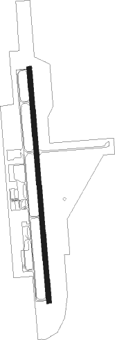
Ponca City - Ponca City Rgnl
Airport details
| Country | United States of America |
| State | Oklahoma |
| Region | K4 |
| Airspace | Kansas City Ctr |
| Municipality | Ponca City |
| Elevation | 1004ft (306m) |
| Timezone | GMT -6 |
| Coordinates | 36.73192, -97.09978 |
| Magnetic var | |
| Type | land |
| Available since | X-Plane v10.40 |
| ICAO code | KPNC |
| IATA code | PNC |
| FAA code | PNC |
Communication
| Ponca City Rgnl ASOS | 134.075 |
| Ponca City Rgnl CTAF/UNICOM | 123.000 |
Approach frequencies
| ILS-cat-I | RW17 | 111.9 | 18.00mi |
| 3° GS | RW17 | 111.9 | 18.00mi |
Nearby Points of Interest:
Poncan Theatre
-Downtown Ponca City Historic District
-Daniel J. Donahoe House
-First Presbyterian Church of Tonkawa
-Tonkawa Lodge No. 157 A.F. & A.M.
-Chilocco Indian Agricultural School
-Pilgrim Congregational Church
-Old Arkansas City High School
-Morrison Baptist Church
-Pawnee Municipal Swimming Pool and Bathhouse
-Arkansas Valley National Bank
-Pawnee County Courthouse
-Pawnee Bill Ranch
-Pawnee Agency and Boarding School Historic District
-Pawnee Armory
-Wolleson–Nicewander Building
-Perry Courthouse Square Historic District
-Noble County Courthouse
-First National Bank and Trust Company Building
-Perry Armory
-Esch's Spur Bridge
-Caldwell Carnegie Library
-Winfield National Bank Building
-Grant County Courthouse
-Wilmer House
Nearby beacons
| code | identifier | dist | bearing | frequency |
|---|---|---|---|---|
| PER | PIONEER (PONCA CITY) VORTAC | 3 | 284° | 113.20 |
| PN | PONCA (PONCA CITY) NDB | 5.5 | 360° | 515 |
| SW | BLAKI (STILLWATER) NDB | 29.7 | 179° | 255 |
| SWO | STILLWATER VOR/DME | 30.5 | 178° | 108.40 |
| ODG | WOODRING (ENID) VOR/DME | 39.5 | 243° | 109 |
| EI | GARFY (ENID) NDB | 43.1 | 237° | 341 |
| END | VANCE (ENID) VORTAC | 45.8 | 245° | 115.40 |
| IC | PICHE (WICHITA) NDB | 53.6 | 337° | 332 |
| IAB | MC CONNELL (WICHITA) TACAN | 54 | 349° | 116.50 |
| IFI | KINGFISHER VORTAC | 70.8 | 224° | 114.70 |
Instrument approach procedures
| runway | airway (heading) | route (dist, bearing) |
|---|---|---|
| RW17 | SEYOR (152°) | SEYOR 2800ft TOMHO (5mi, 90°) 2800ft |
| RW17 | TEDCO (207°) | TEDCO 2800ft TOMHO (5mi, 270°) 2800ft |
| RW17 | TOMHO (180°) | TOMHO 2800ft |
| RNAV | TOMHO 2800ft OKTAE (6mi, 180°) 2700ft KPNC (6mi, 180°) 1042ft ZULOT (12mi, 180°) 2700ft ZULOT (turn) | |
| RW35 | HUPLO (331°) | HUPLO 2700ft ZULOT (5mi, 270°) 2700ft |
| RW35 | JERAG (28°) | JERAG 2700ft ZULOT (5mi, 90°) 2700ft |
| RW35 | ZULOT (360°) | ZULOT 2700ft |
| RNAV | ZULOT 2700ft WURTO (7mi, 360°) 2300ft KPNC (4mi, 360°) 1054ft TOMHO (12mi, 360°) 2800ft TOMHO (turn) |
Disclaimer
The information on this website is not for real aviation. Use this data with the X-Plane flight simulator only! Data taken with kind consent from X-Plane 12 source code and data files. Content is subject to change without notice.