Pensacola - Pensacola Rgnl
Airport details
| Country | United States of America |
| State | Florida |
| Region | K7 |
| Airspace | Jacksonville Ctr |
| Municipality | Pensacola |
| Elevation | 121ft (37m) |
| Timezone | GMT -6 |
| Coordinates | 30.47405, -87.19490 |
| Magnetic var | |
| Type | land |
| Available since | X-Plane v10.40 |
| ICAO code | KPNS |
| IATA code | PNS |
| FAA code | PNS |
Communication
| Pensacola Rgnl ATIS | 121.250 |
| Pensacola Rgnl UNICOM | 122.950 |
| Pensacola Rgnl Clearance DEL | 123.725 |
| Pensacola Rgnl Ground Control | 121.900 |
| Pensacola Rgnl Tower | 119.900 |
| Pensacola Rgnl Approach | 118.600 |
| Pensacola Rgnl Approach | 124.050 |
| Pensacola Rgnl Approach | 119.000 |
| Pensacola Rgnl Departure | 118.600 |
| Pensacola Rgnl Departure | 124.050 |
| Pensacola Rgnl Departure | 119.000 |
Approach frequencies
| LOC | RW26 | 110.95 | 18.00mi |
| ILS-cat-I | RW17 | 111.1 | 18.00mi |
| 3° GS | RW17 | 111.1 | 18.00mi |
Nearby Points of Interest:
Archeological Properties of the Naval Live Oaks Reservation MPS
-Crystal Ice Company Building
-James House
-Pensacola Hospital
-John Edmunds Apartment House
-First Christian Church
-Sacred Heart Catholic Church
-King-Hooton House
-North Hill Preservation District
-Louisville and Nashville Passenger Station and Express Building
-Charles William Jones House
-Winston E. Arnow Federal Building
-Pensacola Historic District
-Palafox Historic District
-Clara Barkley Dorr House
-Thiesen Building
-Lavalle House
-United States Customs House and Post Office
-American National Bank Building
-L & N Marine Terminal Building
-First American Road in Florida
-Naval Live Oaks Reservation
-Pensacola Naval Air Station Historic District
-Arcadia Sawmill and Arcadia Cotton Mill
-Mt. Pilgrim African Baptist Church
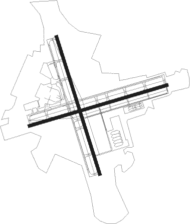
Runway info
Runway 17 / 35  | ||
| length | 2137m (7011ft) | |
| bearing | 165° / 345° | |
| width | 46m (150ft) | |
| surface | concrete | |
| blast zone | 73m (240ft) / 61m (200ft) | |
| Runway 8 / 26 | ||
| length | 2131m (6991ft) | |
| bearing | 80° / 260° | |
| width | 46m (150ft) | |
| surface | asphalt | |
| blast zone | 58m (190ft) / 58m (190ft) | |
Nearby beacons
| code | identifier | dist | bearing | frequency |
|---|---|---|---|---|
| PKZ | PICKENS (PENSACOLA) NDB | 2.3 | 156° | 326 |
| NUN | SAUFLEY (PENSACOLA) VOR | 7.2 | 269° | 108.80 |
| NPA | PENSACOLA TACAN | 9.3 | 226° | 117.20 |
| NGS | SANTA ROSA (MILTON) TACAN | 15.7 | 61° | 133.60 |
| NSE | WHITING (MILTON) TACAN | 17.5 | 35° | 112.30 |
| HRT | HURLBURT (MARY ESTHER) TACAN | 26.2 | 95° | 110.80 |
| CEW | CRESTVIEW VORTAC | 34 | 56° | 115.90 |
| DWG | WARRINGTON (VALPARAISO) TACAN | 34.8 | 90° | 134.50 |
| CE | KOBRA (CRESTVIEW) NDB | 40.9 | 60° | 201 |
| BFM | BROOKLEY (MOBILE) VORTAC | 45.2 | 279° | 112.80 |
| MVC | MONROEVILLE VORTAC | 59.7 | 351° | 116.80 |
| JUY | JUDD (ANDALUSIA) NDB | 64.8 | 44° | 264 |
Instrument approach procedures
| runway | airway (heading) | route (dist, bearing) |
|---|---|---|
| RW08 | HEGOB (79°) | HEGOB 2000ft |
| RNAV | HEGOB 2000ft TIGLE (7mi, 80°) 1700ft MILVE (3mi, 80°) 780ft KPNS (2mi, 76°) 152ft (5260mi, 109°) 600ft LIYER (5249mi, 289°) 2200ft LIYER (turn) | |
| RW17 | PENSI (166°) | PENSI WABEN (8mi, 165°) 2700ft |
| RW17 | WABEN (167°) | WABEN 14000ft WABEN (turn) 2700ft |
| RNAV | WABEN 2700ft BRENT (7mi, 165°) 1700ft ALICO (3mi, 165°) 800ft KPNS (2mi, 174°) 169ft (5260mi, 109°) 321ft OBUFY (5257mi, 289°) 2000ft OBUFY (turn) | |
| RW26 | BAKOS (228°) | BAKOS LIYER (14mi, 220°) 2200ft HOMTU (7mi, 178°) 2200ft |
| RW26 | PENSI (166°) | PENSI LIYER (18mi, 119°) 2200ft HOMTU (7mi, 178°) 2200ft |
| RW26 | VARRE (289°) | VARRE GNIUS (4mi, 306°) 2200ft HOMTU (7mi, 335°) 2200ft |
| RNAV | HOMTU 2200ft HAROT (6mi, 260°) 1700ft FIDUL (3mi, 260°) 860ft KPNS (3mi, 262°) 169ft (5260mi, 109°) 363ft HEGOB (5271mi, 289°) 2000ft HEGOB (turn) | |
| RW35 | PENSI (166°) | PENSI OBUFY (32mi, 165°) 2000ft OBUFY (turn) 2000ft |
| RNAV | OBUFY 2000ft PIGIE (7mi, 345°) 1700ft KPNS (6mi, 341°) 158ft (5260mi, 109°) 303ft WABEN (5263mi, 289°) 2700ft WABEN (turn) |
Disclaimer
The information on this website is not for real aviation. Use this data with the X-Plane flight simulator only! Data taken with kind consent from X-Plane 12 source code and data files. Content is subject to change without notice.