La Verne - Brackett Field
Airport details
| Country | United States of America |
| State | California |
| Region | K2 |
| Airspace | Los Angeles Ctr |
| Municipality | La Verne |
| Elevation | 1011ft (308m) |
| Timezone | GMT -8 |
| Coordinates | 34.09283, -117.77559 |
| Magnetic var | |
| Type | land |
| Available since | X-Plane v10.40 |
| ICAO code | KPOC |
| IATA code | POC |
| FAA code | POC |
Communication
| Brackett Field ATIS | 124.400 |
| Brackett Field UNICOM | 122.950 |
| Brackett Field CTAF | 118.200 |
| Brackett Field Ground Control | 125.000 |
| Brackett Field Tower | 118.200 |
| Brackett Field SOCAL Approach/Departure | 125.500 |
Approach frequencies
| ILS-cat-I | RW26L | 110.5 | 18.00mi |
| 3.9° GS | RW26L | 110.5 | 18.00mi |
Nearby Points of Interest:
La Casa Primera de Rancho San Jose
-La Casa Alvarado
-Ygnacio Palomares Adobe
-Lincoln Park Historic District
-Pomona City Stables
-Phillips Mansion
-Pomona Fox Theater
-Russian Village District
-Rubel Castle
-Old San Antonio Hospital
-Carnegie Library (Upland, California)
-Moyse Building
-Ontario State Bank Block
-Frankish Building
-Sam and Alfreda Maloof Compound
-Cucamonga Service Station
-La Puente Valley Woman's Club
-Hofer Ranch
-The Oaks
-Upton Sinclair House
-George Key Ranch
-A. S. Bradford House
-Queen Anne Cottage and Coach Barn
-National Bank of Whittier Building
-Standard Oil Building
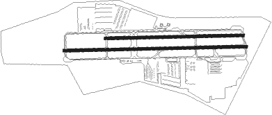
Runway info
Runway 8R / 26L  | ||
| length | 1472m (4829ft) | |
| bearing | 93° / 273° | |
| width | 23m (75ft) | |
| surface | asphalt | |
| displ threshold | 0m (0ft) / 210m (689ft) | |
| Runway 8L / 26R | ||
| length | 1113m (3652ft) | |
| bearing | 93° / 273° | |
| width | 23m (75ft) | |
| surface | asphalt | |
Nearby beacons
| code | identifier | dist | bearing | frequency |
|---|---|---|---|---|
| POM | POMONA VORTAC | 1 | 218° | 110.40 |
| PDZ | PARADISE (ONTARIO) VORTAC | 16.1 | 125° | 112.20 |
| RAL | RIVERSIDE VOR | 18.2 | 113° | 112.40 |
| SB | PETIS (SAN BERNARDINO) NDB | 20.4 | 95° | 397 |
| SLI | SEAL BEACH (LOS ALAMITOS) VORTAC | 23.2 | 222° | 115.70 |
| ELB | EL TORO (SANTA ANA) VOR/DME | 25.1 | 174° | 117.20 |
| RIV | MARCH (RIVERSIDE) TACAN | 27.3 | 110° | 113 |
| LAX | LOS ANGELES VORTAC | 34 | 256° | 113.60 |
| SMO | SANTA MONICA VOR/DME | 34.2 | 263° | 110.80 |
| HDF | HOMELAND (RIVERSIDE) VOR | 35 | 118° | 113.40 |
| PMD | PALMDALE VORTAC | 35.3 | 332° | 114.50 |
| VCV | VICTORVILLE VOR/DME | 35.6 | 38° | 109.05 |
| VNY | VAN NUYS VOR/DME | 36.4 | 280° | 113.10 |
| NFG | CAMP PENDLETON (OCEANSIDE TACAN | 52.8 | 155° | 111.80 |
| LHS | LAKE HUGHES VORTAC | 53.2 | 306° | 114.35 |
| EDW | EDWARDS VORTAC | 53.4 | 3° | 116.40 |
| SXC | SANTA CATALINA VORTAC | 53.7 | 222° | 111.40 |
| OCN | OCEANSIDE VORTAC | 54.2 | 157° | 115.30 |
Departure and arrival routes
| Transition altitude | 18000ft |
| Transition level | 18000ft |
| STAR starting points | distance | inbound heading | |
|---|---|---|---|
| ALL | |||
| ZIGGY7 | 24.2 | 267° | |
| SETER5 | 35.1 | 286° | |
Instrument approach procedures
| runway | airway (heading) | route (dist, bearing) |
|---|---|---|
| RW26L | LIZZE (273°) | LIZZE 6000ft LIZZE (turn) 4000ft |
| RW26L | PDZ (305°) | PDZ LIZZE (10mi, 4°) 4000ft |
| RNAV | LIZZE 4000ft WUDUS (7mi, 273°) 3200ft ZEREK (4mi, 273°) 1840ft KPOC (2mi, 275°) 1063ft (6769mi, 106°) 2100ft PRADO (6772mi, 286°) 4000ft PRADO (turn) |
Holding patterns
| STAR name | hold at | type | turn | heading* | altitude | leg | speed limit |
|---|---|---|---|---|---|---|---|
| SETER5 | JLI | NDB | left | 108 (288)° | 1.5min timed | ICAO rules | |
| ZIGGY7 | PETIS | VHF | right | 76 (256)° | 1.0min timed | ICAO rules | |
| *) magnetic outbound (inbound) holding course | |||||||
Disclaimer
The information on this website is not for real aviation. Use this data with the X-Plane flight simulator only! Data taken with kind consent from X-Plane 12 source code and data files. Content is subject to change without notice.