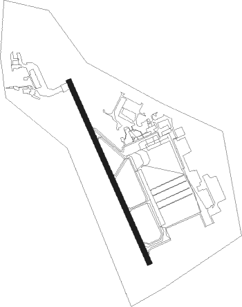
Fort Polk - Polk Aaf
Airport details
| Country | United States of America |
| State | Louisiana |
| Region | K4 |
| Airspace | Houston Oceanic Ctr |
| Municipality | Vernon Parish |
| Elevation | 330ft (101m) |
| Timezone | GMT -6 |
| Coordinates | 31.04478, -93.19164 |
| Magnetic var | |
| Type | land |
| Available since | X-Plane v10.40 |
| ICAO code | KPOE |
| IATA code | POE |
| FAA code | POE |
Communication
| Polk AAF ATIS | 134.850 |
| Polk AAF Ground Control | 121.800 |
| Polk AAF Tower | 119.000 |
| Polk AAF Approach/Departure | 123.700 |
Nearby Points of Interest:
Edmond Ellison Smart House
-Vernon Parish Courthouse
-First United Methodist Church
-Beauregard Parish Jail
-Beauregard Parish Courthouse
-DeRidder Commercial Historic District
-DeRidder USO Building
-Hodges Gardens State Park
-Burks House
-Mayer Hirsch House
-Eden
-Britt Place
-Kate Chopin House
-Allen Parish Courthouse
-Jones House
Nearby beacons
| code | identifier | dist | bearing | frequency |
|---|---|---|---|---|
| FXU | POLK (FORT POLK) VOR | 4.2 | 338° | 108.40 |
| DXB | DE RIDDER NDB | 19 | 206° | 385 |
| OOC | NATCHITOCHES NDB | 37.2 | 11° | 407 |
| AEX | ALEXANDRIA VORTAC | 37.7 | 73° | 116.10 |
| CW | MOSSY (LAKE CHARLES) NDB | 44.3 | 180° | 418 |
| ECY | DURALDE (EUNICE) NDB | 48.1 | 123° | 263 |
| AUR | SULFY (SULPHUR) NDB | 52.1 | 195° | 278 |
| LCH | LAKE CHARLES VORTAC | 54.4 | 175° | 113.40 |
| SWB | SAWMILL (WINNFIELD) VOR/DME | 61.6 | 29° | 113.75 |
| CZJ | AMASON (CENTER) NDB | 68.3 | 309° | 341 |
Instrument approach procedures
| runway | airway (heading) | route (dist, bearing) |
|---|---|---|
| RW16 | CATVO (338°) | CATVO COCOS (23mi, 338°) 2000ft COCOS (turn) 2000ft |
| RW16 | DXB (26°) | DXB COCOS (29mi, 8°) 2000ft COCOS (turn) 2000ft |
| RNAV | COCOS 2000ft BITAY (6mi, 159°) 2000ft KPOE (5mi, 158°) 373ft (5569mi, 108°) 729ft CATVO (5566mi, 288°) 2000ft CATVO (turn) | |
| RW34 | COCOS (158°) | COCOS CATVO (23mi, 158°) 2000ft CATVO (turn) 2000ft |
| RW34 | DXB (26°) | DXB CATVO (13mi, 63°) 2000ft |
| RNAV | CATVO 2000ft BIYAL (6mi, 338°) 2000ft KPOE (6mi, 338°) 323ft (5569mi, 108°) 729ft BITAY (5571mi, 288°) COCOS (6mi, 339°) 2000ft COCOS (turn) |
Disclaimer
The information on this website is not for real aviation. Use this data with the X-Plane flight simulator only! Data taken with kind consent from X-Plane 12 source code and data files. Content is subject to change without notice.
